
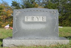


James Alfred Frye
| Birth | : | 6 May 1871 Stokes County, North Carolina, USA |
| Death | : | 17 Jun 1959 Beaver Island, Stokes County, North Carolina, USA |
| Burial | : | Cheshunt Cemetery, Cheshunt, Broxbourne Borough, England |
| Coordinate | : | 51.7009840, -0.0563720 |
| Description | : | James Alfred Frye, born May 06, 1871 in Stokes County, NC to John Henry and Mary Ann Martin Frye. He died Jun 17, 1959 in Stokes County, NC. He married Alice Lucy Wright Jan 30, 1896 in Patrick County, VA. He was a tobacco farmer in Stokes County. |
frequently asked questions (FAQ):
-
Where is James Alfred Frye's memorial?
James Alfred Frye's memorial is located at: Cheshunt Cemetery, Cheshunt, Broxbourne Borough, England.
-
When did James Alfred Frye death?
James Alfred Frye death on 17 Jun 1959 in Beaver Island, Stokes County, North Carolina, USA
-
Where are the coordinates of the James Alfred Frye's memorial?
Latitude: 51.7009840
Longitude: -0.0563720
Family Members:
Parent
Spouse

Siblings

Children

Flowers:


Nearby Cemetories:
1. Cheshunt Cemetery
Cheshunt, Broxbourne Borough, England
Coordinate: 51.7009840, -0.0563720
2. St Mary the Virgin Church
Cheshunt, Broxbourne Borough, England
Coordinate: 51.7042420, -0.0489450
3. Adath Yisroel Cemetery
Cheshunt, Broxbourne Borough, England
Coordinate: 51.7015690, -0.0772910
4. Western Synagogue Cemetery
Cheshunt, Broxbourne Borough, England
Coordinate: 51.6850350, -0.0615410
5. St George Churchyard
Freezywater, London Borough of Enfield, England
Coordinate: 51.6738060, -0.0389670
6. Enfield Crematorium
Enfield, London Borough of Enfield, England
Coordinate: 51.6699829, -0.0544380
7. Waltham Abbey
Waltham Abbey, Epping Forest District, England
Coordinate: 51.6876010, -0.0034070
8. St. Laurence Churchyard
Wormley, Broxbourne Borough, England
Coordinate: 51.7352050, -0.0389350
9. Adath Yisroel Cemetery
Enfield, London Borough of Enfield, England
Coordinate: 51.6634740, -0.0669010
10. Waltham Holy Cross-New Cemetery
Waltham Abbey, Epping Forest District, England
Coordinate: 51.6822880, 0.0024510
11. Waltham Holy Cross Old Cemetery
Waltham Abbey, Epping Forest District, England
Coordinate: 51.6823480, 0.0027610
12. Lavender Hill Cemetery
Enfield, London Borough of Enfield, England
Coordinate: 51.6660423, -0.0944350
13. St. James' Churchyard
Enfield, London Borough of Enfield, England
Coordinate: 51.6558850, -0.0470570
14. Hertford Road Cemetery
Enfield, London Borough of Enfield, England
Coordinate: 51.6554120, -0.0449750
15. St Andrew Churchyard
Enfield, London Borough of Enfield, England
Coordinate: 51.6530210, -0.0821420
16. Saint Augustine's Churchyard
Broxbourne, Broxbourne Borough, England
Coordinate: 51.7445150, -0.0147810
17. Waltham Abbey Jewish Cemetery
Waltham Abbey, Epping Forest District, England
Coordinate: 51.6778780, 0.0389240
18. St. Thomas Churchyard
Upshire, Epping Forest District, England
Coordinate: 51.6898890, 0.0465860
19. Quaker Burial Ground, Hoddesdon, Hertfordshire
Hoddesdon, Broxbourne Borough, England
Coordinate: 51.7610213, -0.0139560
20. St Catherine and St Paul's Churchyard
Hoddesdon, Broxbourne Borough, England
Coordinate: 51.7625830, -0.0120670
21. Saint Mary
Bayford, East Hertfordshire District, England
Coordinate: 51.7629540, -0.1035070
22. Holy Innocents Churchyard
High Beach, Epping Forest District, England
Coordinate: 51.6617140, 0.0343380
23. Woollensbrook Crematorium
Hoddesdon, Broxbourne Borough, England
Coordinate: 51.7681805, -0.0280669
24. St. Andrew's Churchyard
Little Berkhamsted, East Hertfordshire District, England
Coordinate: 51.7547390, -0.1295270