
| Birth | : | 25 May 1845 Tabusintac, Northumberland County, New Brunswick, Canada |
| Death | : | 30 Nov 1930 Watertown, Middlesex County, Massachusetts, USA |
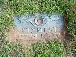
| Burial | : | Saint Andrew's United Church Cemetery, Rexton, Kent County, Canada |
| Coordinate | : | 46.6478700, -64.8724000 |
| Description | : | Parents: STYMIEST, Francis Peabody [email protected] 1816 Tabusintac, Northumberland Co., New Brunswick d.10 May 1894 Rexton, Kent Co, New Brunswick (Age ~ 78 yrs) m. 26 Sept 1839 New Castle New Brunswick URQUHART, Phoebe b.24 Jul 1818 Tabusintac, New Brunswick d.6 Jun 1914 Fairville, St. John, New Brunswick (Age 95 yrs) m. 13 Aug 1876 Rexton, New Brunswick THOMPSON, Margaret Smith b. 26 Jun 1852 Prince Edward Island d. 10 Jan 1901 Mill Creek, Kent Co, New Brunswick (Age 48 yrs) Marriage Contract Aug 1876 by Rev. James Law |
frequently asked questions (FAQ):
-
Where is James Blake Francis Stymiest's memorial?
James Blake Francis Stymiest's memorial is located at: Saint Andrew's United Church Cemetery, Rexton, Kent County, Canada.
-
When did James Blake Francis Stymiest death?
James Blake Francis Stymiest death on 30 Nov 1930 in Watertown, Middlesex County, Massachusetts, USA
-
Where are the coordinates of the James Blake Francis Stymiest's memorial?
Latitude: 46.6478700
Longitude: -64.8724000
Family Members:
Parent

Spouse
Children
Flowers:


Nearby Cemetories:
1. Saint Andrew's United Church Cemetery
Rexton, Kent County, Canada
Coordinate: 46.6478700, -64.8724000
2. Immaculate Conception Roman Catholic Cemetery
Rexton, Kent County, Canada
Coordinate: 46.6400100, -64.8712200
3. Richibucto Protestant Cemetery
Richibucto, Kent County, Canada
Coordinate: 46.6730300, -64.8677700
4. Galloway Cemetery
West Galloway, Kent County, Canada
Coordinate: 46.6124320, -64.8520750
5. Saint Louis de Gonzague
Richibucto, Kent County, Canada
Coordinate: 46.6882680, -64.8624160
6. Methodist Point Cemetery
Rexton, Kent County, Canada
Coordinate: 46.6042300, -64.9165060
7. Chapel Point Cemetery
Richibucto, Kent County, Canada
Coordinate: 46.5966300, -64.9202300
8. Aldouane Roman Catholic Cemetery
Aldouane, Kent County, Canada
Coordinate: 46.7098670, -64.8985700
9. St. Charles Roman Catholic Cemetery
Saint-Charles, Kent County, Canada
Coordinate: 46.6689480, -64.9729100
10. Saint Antoine de Padoue
Richibucto, Kent County, Canada
Coordinate: 46.6568030, -64.7537160
11. Saint Anne's Roman Catholic Cemetery
Big Cove, Kent County, Canada
Coordinate: 46.5854736, -64.9864107
12. Kingdom Hall of Jehovah's Witnesses Cemetery
West Branch, Kent County, Canada
Coordinate: 46.5497546, -64.9345299
13. Saint-Louis-de-Kent Catholic Cemetery
Saint-Louis de Kent, Kent County, Canada
Coordinate: 46.7284860, -64.9799050
14. Saint Anne Roman Catholic Cemetery
Sainte-Anne-de-Kent, Kent County, Canada
Coordinate: 46.5509000, -64.7738340
15. West Branch Presbyterian Cemetery
West Branch, Kent County, Canada
Coordinate: 46.5410340, -64.9480820
16. Saint John's United Church Cemetery
West Branch, Kent County, Canada
Coordinate: 46.5339660, -64.9571180
17. St. Stephens United Church Cemetery
Molus River, Kent County, Canada
Coordinate: 46.5763290, -65.0817130
18. St. Bartholomew's Roman Catholic Cemetery
Molus River, Kent County, Canada
Coordinate: 46.5739550, -65.0830720
19. Old MacIntosh Hill Burial Ground
Kent County, Canada
Coordinate: 46.5031240, -64.7459570
20. St. Mark's Presbyterian Cemetery
Bass River, Kent County, Canada
Coordinate: 46.5424130, -65.0894630
21. Saint Bartholomew Roman Catholic Cemetery
Bass River, Kent County, Canada
Coordinate: 46.5539410, -65.1073140
22. (New) Bouctouche Roman Catholic Cemetery
Bouctouche, Kent County, Canada
Coordinate: 46.5104850, -64.6827398
23. Saint-Norbert Parish Cemetery
Saint-Norbert, Kent County, Canada
Coordinate: 46.4662200, -64.9683100
24. Knox Presbyterian Cemetery
Kouchibouguac, Kent County, Canada
Coordinate: 46.7938700, -65.0578100