
| Birth | : | 1860 Illinois, USA |
| Death | : | 16 Dec 1938 |
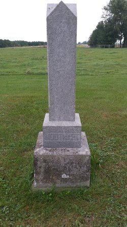
| Burial | : | Palo Verde Cemetery, Blythe, Riverside County, USA |
| Coordinate | : | 33.6307983, -114.5999985 |
| Description | : | Suggested edit: 1938 --- Iowa Death Records 1904-1951 Name: James Franklin Moothart Event Type: Death Event Date: 16 Dec 1938 Event Place: Chester, Poweshiek, Iowa, United States Event Place: West Chester Washington County, Iowa) Gender: Male Age: 78 Birth Year (Estimated): 1860 Father's Name: Levi Moothart Mother's Name: Hannah Miller Certificate Number: 92181 Citing this Record: "Iowa, Death Records, 1904-1951," database with images, FamilySearch (https://familysearch.org/ark:/61903/1:1:Q24D-NT8S : 8 November 2017), Levi Moothart in entry for James Franklin Moothart, 16 Dec 1938, Chester, Poweshiek, Iowa, United States; citing certificate #92181, State Historical Society of Iowa, Des Moines; FamilySearch digital folder 101821074. |
frequently asked questions (FAQ):
-
Where is James Franklin “Frank” Moothart's memorial?
James Franklin “Frank” Moothart's memorial is located at: Palo Verde Cemetery, Blythe, Riverside County, USA.
-
When did James Franklin “Frank” Moothart death?
James Franklin “Frank” Moothart death on 16 Dec 1938 in
-
Where are the coordinates of the James Franklin “Frank” Moothart's memorial?
Latitude: 33.6307983
Longitude: -114.5999985
Family Members:
Parent

Siblings
Flowers:


Nearby Cemetories:
1. Palo Verde Cemetery
Blythe, Riverside County, USA
Coordinate: 33.6307983, -114.5999985
2. Ehrenberg Cemetery
Ehrenberg, La Paz County, USA
Coordinate: 33.6056000, -114.5236000
3. La Paz Cemetery
Ehrenberg, La Paz County, USA
Coordinate: 33.6791670, -114.4263890
4. Hi Jolly Cemetery
Quartzsite, La Paz County, USA
Coordinate: 33.6644470, -114.2363660
5. Cibola Cemetery
Cibola, La Paz County, USA
Coordinate: 33.3153450, -114.6641800
6. Poston War Relocation Center Cemetery
Poston, La Paz County, USA
Coordinate: 33.9875000, -114.4011110
7. Holly Cemetery
Vidal, San Bernardino County, USA
Coordinate: 34.1219406, -114.5058289
8. CRIT Cemetery
Parker, La Paz County, USA
Coordinate: 34.1223106, -114.3164139
9. Parker Community Cemetery
Parker, La Paz County, USA
Coordinate: 34.1411170, -114.2800270
10. Bouse Cemetery
Bouse, La Paz County, USA
Coordinate: 33.9416000, -114.0021000
11. Picacho Cemetery
Imperial County, USA
Coordinate: 33.0207280, -114.6177150
12. Orville William Kyees Gravesite
San Bernardino County, USA
Coordinate: 34.2597360, -114.5435720
13. Aztec Wells Cemetery
Desert Center, Riverside County, USA
Coordinate: 33.6384180, -115.3783320
14. Kofa Cemetery
La Paz County, USA
Coordinate: 33.2652900, -113.9542200
15. Picacho Mine Cemetery
Picacho, Imperial County, USA
Coordinate: 32.9665000, -114.6375500
16. Vicksburg Cemetery
Vicksburg, La Paz County, USA
Coordinate: 33.7115250, -113.7666680
17. John F Pritt Gravesite
Earp, San Bernardino County, USA
Coordinate: 34.2576600, -114.2259500
18. Hovatter Grave Sites
Yuma County, USA
Coordinate: 33.3527170, -113.7757170
19. Hedges Cemetery
Imperial County, USA
Coordinate: 32.8843994, -114.8302994
20. Milligan Cemetery
Milligan, San Bernardino County, USA
Coordinate: 34.2778110, -115.1679930
21. Potholes Cemetery
Bard, Imperial County, USA
Coordinate: 32.8171997, -114.5119019
22. Flowing Wells Cemetery
Imperial County, USA
Coordinate: 33.2135515, -115.4487468
23. Swansea South Cemetery
Swansea, La Paz County, USA
Coordinate: 34.1695720, -113.8473390
24. Swansea North Cemetery
Swansea, La Paz County, USA
Coordinate: 34.1734200, -113.8435600