
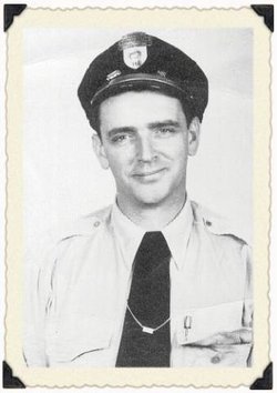
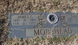
James G. Morehead
| Birth | : | 16 May 1916 |
| Death | : | 20 Feb 1987 |
| Burial | : | Cane Creek Baptist Church Cemetery, Union Mills, Rutherford County, USA |
| Coordinate | : | 35.5222250, -81.8530630 |
frequently asked questions (FAQ):
-
Where is James G. Morehead's memorial?
James G. Morehead's memorial is located at: Cane Creek Baptist Church Cemetery, Union Mills, Rutherford County, USA.
-
When did James G. Morehead death?
James G. Morehead death on 20 Feb 1987 in
-
Where are the coordinates of the James G. Morehead's memorial?
Latitude: 35.5222250
Longitude: -81.8530630
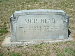
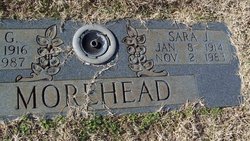
Family Members:
Parent
Spouse
Siblings

Flowers:


Nearby Cemetories:
1. Cane Creek Baptist Church Cemetery
Union Mills, Rutherford County, USA
Coordinate: 35.5222250, -81.8530630
2. Fork Creek Baptist Church Cemetery
Rutherford County, USA
Coordinate: 35.5249710, -81.8802872
3. Weast Cemetery
Sunshine, Rutherford County, USA
Coordinate: 35.5341320, -81.8145960
4. Camp Creek Baptist Church Cemetery
Union Mills, Rutherford County, USA
Coordinate: 35.5141983, -81.9039001
5. Fairview Church Cemetery
Forest City, Rutherford County, USA
Coordinate: 35.5409640, -81.8010940
6. Golden Valley Church of the Brethren Cemetery
Sunshine, Rutherford County, USA
Coordinate: 35.5368800, -81.7974200
7. Mooney-Van Zandt Cemetery
Rutherford County, USA
Coordinate: 35.5335800, -81.7932500
8. Pisgah United Methodist Church Cemetery
Rutherfordton, Rutherford County, USA
Coordinate: 35.4770130, -81.8799750
9. Golden Valley United Methodist Church Cemetery
Bostic, Rutherford County, USA
Coordinate: 35.5203018, -81.7900009
10. Kirksey Family Cemetery
McDowell County, USA
Coordinate: 35.5810600, -81.8431900
11. Sandy Level Baptist Cemetery
Bostic, Rutherford County, USA
Coordinate: 35.4591400, -81.8520440
12. Brackettown Cemetery
McDowell County, USA
Coordinate: 35.5532990, -81.9207993
13. Westminister Baptist Church Cemetery
Rutherfordton, Rutherford County, USA
Coordinate: 35.4647750, -81.8927880
14. Freedom Baptist Church Cemetery
McDowell County, USA
Coordinate: 35.5883900, -81.8445700
15. Epps Family Cemetery
McDowell County, USA
Coordinate: 35.5778020, -81.9016850
16. Cooper Springs Congregational Holiness Church Ceme
Rutherford County, USA
Coordinate: 35.4755700, -81.7844540
17. Fortune Cemetery
Rutherford County, USA
Coordinate: 35.5092010, -81.7647018
18. Poteet Family Cemetery
McDowell County, USA
Coordinate: 35.5774040, -81.9125020
19. Golden Valley Missionary Methodist Church Cemetery
Bostic, Rutherford County, USA
Coordinate: 35.4961700, -81.7678800
20. Brittain Cemetery
Rutherfordton, Rutherford County, USA
Coordinate: 35.4530983, -81.8861008
21. Silver Creek Knob
Burke County, USA
Coordinate: 35.5835000, -81.7970000
22. Pleasant Hill Cemetery
Rutherford County, USA
Coordinate: 35.5022011, -81.9441986
23. Mount Harmony Baptist Church Cemetery
Bostic, Rutherford County, USA
Coordinate: 35.4588380, -81.7996940
24. Trinity United Methodist Church Cemetery
Dysartsville, McDowell County, USA
Coordinate: 35.5995270, -81.8644050