
| Birth | : | 1825 Glasgow, Glasgow City, Scotland |
| Death | : | 16 Jun 1878 Helena, Lewis and Clark County, Montana, USA |
| Burial | : | St. Andrew's Churchyard, Little Steeping, East Lindsey District, England |
| Coordinate | : | 53.1498640, 0.1421090 |
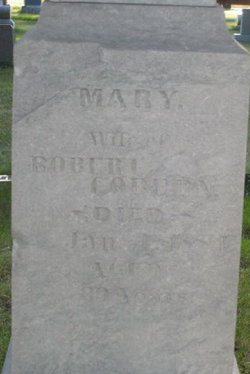
| Description | : | "Native of Scotland" Aged 53 years |
frequently asked questions (FAQ):
-
Where is Jannette Matheson Morrow's memorial?
Jannette Matheson Morrow's memorial is located at: St. Andrew's Churchyard, Little Steeping, East Lindsey District, England.
-
When did Jannette Matheson Morrow death?
Jannette Matheson Morrow death on 16 Jun 1878 in Helena, Lewis and Clark County, Montana, USA
-
Where are the coordinates of the Jannette Matheson Morrow's memorial?
Latitude: 53.1498640
Longitude: 0.1421090
Family Members:
Spouse

Children
Flowers:


Nearby Cemetories:
1. St. Andrew's Churchyard
Little Steeping, East Lindsey District, England
Coordinate: 53.1498640, 0.1421090
2. All Saints Churchyard
Great Steeping, East Lindsey District, England
Coordinate: 53.1533300, 0.1440500
3. St. Andrew's Churchyard
Halton Holegate, East Lindsey District, England
Coordinate: 53.1641800, 0.1196100
4. St. Andrew Churchyard
Firsby, East Lindsey District, England
Coordinate: 53.1409950, 0.1739360
5. All Saints Churchyard
Irby in the Marsh, East Lindsey District, England
Coordinate: 53.1507300, 0.1943700
6. St. Peter and St. Paul's Churchyard
Bratoft, East Lindsey District, England
Coordinate: 53.1618990, 0.2041540
7. St. Benedict's Churchyard
Candlesby, East Lindsey District, England
Coordinate: 53.1832400, 0.1770310
8. Saint Paul's Churchyard
Eastville, East Lindsey District, England
Coordinate: 53.1134100, 0.1012600
9. St. Helen's Churchyard
East Keal, East Lindsey District, England
Coordinate: 53.1546000, 0.0661200
10. St. Mary's Churchyard
Hundleby, East Lindsey District, England
Coordinate: 53.1775600, 0.0771400
11. St. Peter and St. Paul's Churchyard
Burgh le Marsh, East Lindsey District, England
Coordinate: 53.1610370, 0.2433510
12. St. Lawrence & Bishop Edward King Churchyard
Dalby, East Lindsey District, England
Coordinate: 53.2090803, 0.1090854
13. Burgh le Marsh Baptish Churchyard
Burgh le Marsh, East Lindsey District, England
Coordinate: 53.1601544, 0.2463571
14. All Saints Churchyard
Croft, East Lindsey District, England
Coordinate: 53.1325470, 0.2544340
15. SS Peter and Paul Church
Langton, East Lindsey District, England
Coordinate: 53.2124740, 0.0798920
16. St. Peter & St. Paul Churchyard
Langton by Spilsby, East Lindsey District, England
Coordinate: 53.2125100, 0.0798500
17. St Andrew's Church
Claxby, East Lindsey District, England
Coordinate: 53.2205190, 0.1746680
18. All Saints Churchyard
Friskney, East Lindsey District, England
Coordinate: 53.0759000, 0.1789000
19. Friskney Cemetery
Friskney, East Lindsey District, England
Coordinate: 53.0751300, 0.1751590
20. St. Helen and St. Peter Churchyard
Aswardby, East Lindsey District, England
Coordinate: 53.2112300, 0.0594900
21. Birdsong Green Burial Site
Alford, East Lindsey District, England
Coordinate: 53.2184710, 0.2142330
22. St. Nicholas' Churchyard
East Kirkby, East Lindsey District, England
Coordinate: 53.1476632, -0.0086767
23. Saint Hippolyte
Saint-Hippolyte, Lloydminster Census Division, Canada
Coordinate: 53.1184742, 0.0000000
24. Alford Crematorium
Alford, East Lindsey District, England
Coordinate: 53.2549840, 0.1614430