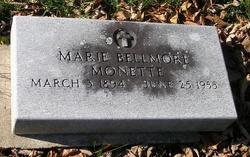
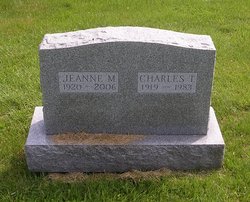
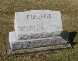
Jeanne Marie Monette Patch
| Birth | : | 19 Oct 1920 West Rutland, Rutland County, Vermont, USA |
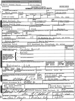
| Death | : | 16 Oct 2006 Rutland, Rutland County, Vermont, USA |
| Burial | : | Scotter Cemetery, Scotter, West Lindsey District, England |
| Coordinate | : | 53.4942000, -0.6665520 |
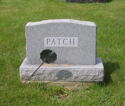
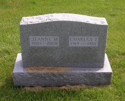
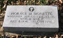
| Description | : | Daughter of Horace Monette and Marie Bellmore. . Wife of Charles T. Patch, whom she married Oct. 21, 1945 in Rutland, Rutland, VT. . Note: Although I have created this memorial using the name on her gravestone - Jeanne M[arie] - her marriage, death records, and obituary all identify her as Marie Jeanne Monette. . OBITUARY Marie Jeanne Patch, 85, of Rutland, died early Monday morning, October 16, 2006, at Haven Health Center in Rutland. She was born in West Rutland on October 19, 1920, the daughter of Horace and Marie [Bellemore] Monette. . Mrs. Patch was a graduate of Rutland High School, class of 1938. She... Read More |
frequently asked questions (FAQ):
-
Where is Jeanne Marie Monette Patch's memorial?
Jeanne Marie Monette Patch's memorial is located at: Scotter Cemetery, Scotter, West Lindsey District, England.
-
When did Jeanne Marie Monette Patch death?
Jeanne Marie Monette Patch death on 16 Oct 2006 in Rutland, Rutland County, Vermont, USA
-
Where are the coordinates of the Jeanne Marie Monette Patch's memorial?
Latitude: 53.4942000
Longitude: -0.6665520
Family Members:
Parent
Spouse
Siblings
Flowers:
Nearby Cemetories:
1. Scotter Cemetery
Scotter, West Lindsey District, England
Coordinate: 53.4942000, -0.6665520
2. St Peter Churchyard
Scotter, West Lindsey District, England
Coordinate: 53.4966600, -0.6636500
3. St Genewys Churchyard
Scotton, West Lindsey District, England
Coordinate: 53.4810900, -0.6597690
4. St. John's Churchyard
Gainsborough, West Lindsey District, England
Coordinate: 53.4635280, -0.6538310
5. Holy Trinity Churchyard
Messingham, North Lincolnshire Unitary Authority, England
Coordinate: 53.5323250, -0.6583030
6. Laughton Cemetery
Laughton, West Lindsey District, England
Coordinate: 53.4681287, -0.7228939
7. All Saints Churchyard
Laughton, West Lindsey District, England
Coordinate: 53.4656600, -0.7224400
8. Kirton-in-Lindsey Cemetery
Kirton in Lindsey, North Lincolnshire Unitary Authority, England
Coordinate: 53.4765050, -0.5963870
9. St Andrews Church
Kirton in Lindsey, North Lincolnshire Unitary Authority, England
Coordinate: 53.4755000, -0.5940000
10. Saint Hybald Churchyard
Manton, North Lincolnshire Unitary Authority, England
Coordinate: 53.5125000, -0.5931000
11. St. Martin de Tours Churchyard
Blyton, West Lindsey District, England
Coordinate: 53.4430280, -0.7169130
12. Saint Radegund Churchyard
Grayingham, West Lindsey District, England
Coordinate: 53.4538900, -0.5924900
13. St Peter Ad Vincula Church
Bottesford, North Lincolnshire Unitary Authority, England
Coordinate: 53.5533120, -0.6448410
14. All Saints Churchyard
Pilham, West Lindsey District, England
Coordinate: 53.4339200, -0.7034700
15. St Mary the Virgin Churchyard
West Butterwick, North Lincolnshire Unitary Authority, England
Coordinate: 53.5426407, -0.7412120
16. Baptist Burial Ground
West Butterwick, North Lincolnshire Unitary Authority, England
Coordinate: 53.5432720, -0.7423210
17. St. Alkmund Churchyard
Blyborough, West Lindsey District, England
Coordinate: 53.4394960, -0.5954560
18. Owston Ferry Cemetery
Owston Ferry, North Lincolnshire Unitary Authority, England
Coordinate: 53.4966300, -0.7827500
19. St Martin's Churchyard
Owston Ferry, North Lincolnshire Unitary Authority, England
Coordinate: 53.4933920, -0.7886380
20. St. Andrews Church Burial Ground
Redbourne, North Lincolnshire Unitary Authority, England
Coordinate: 53.4872680, -0.5342990
21. St Hybald Churchyard
Hibaldstow, North Lincolnshire Unitary Authority, England
Coordinate: 53.5111060, -0.5244550
22. Hibaldstow Cemetery
Hibaldstow, North Lincolnshire Unitary Authority, England
Coordinate: 53.5115220, -0.5244530
23. Brumby Cemetery
Scunthorpe, North Lincolnshire Unitary Authority, England
Coordinate: 53.5799400, -0.6448700
24. Woodlands Cemetery and Crematorium
Scunthorpe, North Lincolnshire Unitary Authority, England
Coordinate: 53.5810900, -0.6744900

