Jeffrey “Ron” Dignan
| Birth | : | 9 Apr 1974 Kenmare, Ward County, North Dakota, USA |
| Death | : | 25 Apr 2006 Bowbells, Burke County, North Dakota, USA |
| Burial | : | Liverpool Necropolis, Everton, Metropolitan Borough of Liverpool, England |
| Coordinate | : | 53.4146670, -2.9621830 |
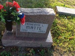
| Description | : | Jeffery R. Dignan, 32, Bowbells ND, died Tuesday, April 25, 2006 in his home. Jeff was born April 9, 1974 in Kenmare, ND, the son of Ron and Cathrine (Matte) Dignan. Jeff attended school in Bowbells and graduated in 1992. At the time of his death he worked for Gerry Knutson as a mechanic at Knutson Auto Repair. Through out the years he also worked at the Pot Ash Plant and as a carpenter. Jeff enjoyed hunting, fishing and camping with family and friends. He once enjoyed bicycling and rode his bike across the United States. Jeff was a member of the Bowbells Fire... Read More |
frequently asked questions (FAQ):
-
Where is Jeffrey “Ron” Dignan's memorial?
Jeffrey “Ron” Dignan's memorial is located at: Liverpool Necropolis, Everton, Metropolitan Borough of Liverpool, England.
-
When did Jeffrey “Ron” Dignan death?
Jeffrey “Ron” Dignan death on 25 Apr 2006 in Bowbells, Burke County, North Dakota, USA
-
Where are the coordinates of the Jeffrey “Ron” Dignan's memorial?
Latitude: 53.4146670
Longitude: -2.9621830
Family Members:
Parent
Flowers:
Nearby Cemetories:
1. Liverpool Necropolis
Everton, Metropolitan Borough of Liverpool, England
Coordinate: 53.4146670, -2.9621830
2. Brunswick Chapel
Liverpool, Metropolitan Borough of Liverpool, England
Coordinate: 53.4111280, -2.9675500
3. Holy Trinity Churchyard
Liverpool, Metropolitan Borough of Liverpool, England
Coordinate: 53.4117490, -2.9759560
4. St. Mary's Churchyard
Edge Hill, Metropolitan Borough of Liverpool, England
Coordinate: 53.4065000, -2.9561600
5. St. Anne's Churchyard
Liverpool, Metropolitan Borough of Liverpool, England
Coordinate: 53.4149050, -2.9782840
6. Metropolitan Cathedral of Christ the King
Liverpool, Metropolitan Borough of Liverpool, England
Coordinate: 53.4052820, -2.9685940
7. Deane Road Cemetery
Liverpool, Metropolitan Borough of Liverpool, England
Coordinate: 53.4114570, -2.9460500
8. Friends Burial Ground (Defunct)
Liverpool, Metropolitan Borough of Liverpool, England
Coordinate: 53.4111670, -2.9795830
9. St. George Churchyard
Everton, Metropolitan Borough of Liverpool, England
Coordinate: 53.4252810, -2.9713940
10. St Mary’s Parochial Cemetery
Liverpool, Metropolitan Borough of Liverpool, England
Coordinate: 53.4024370, -2.9672760
11. St. John's Garden
Liverpool, Metropolitan Borough of Liverpool, England
Coordinate: 53.4087890, -2.9810070
12. Roscoe Memorial Gardens
Liverpool, Metropolitan Borough of Liverpool, England
Coordinate: 53.4044040, -2.9762180
13. St. Andrew’s Churchyard
Liverpool, Metropolitan Borough of Liverpool, England
Coordinate: 53.4029730, -2.9726820
14. St. Anthony's Churchyard
Liverpool, Metropolitan Borough of Liverpool, England
Coordinate: 53.4223190, -2.9815350
15. St Philip Graveyard
Liverpool, Metropolitan Borough of Liverpool, England
Coordinate: 53.4019240, -2.9719920
16. St. Peter's Churchyard
Liverpool, Metropolitan Borough of Liverpool, England
Coordinate: 53.4051290, -2.9844200
17. St Martin-in-the-Fields Churchyard
Liverpool, Metropolitan Borough of Liverpool, England
Coordinate: 53.4210110, -2.9877860
18. St. Paul's Churchyard
Liverpool, Metropolitan Borough of Liverpool, England
Coordinate: 53.4099460, -2.9919370
19. Liverpool Cathedral
Liverpool, Metropolitan Borough of Liverpool, England
Coordinate: 53.3974310, -2.9731610
20. St. George's Churchyard
Liverpool, Metropolitan Borough of Liverpool, England
Coordinate: 53.4049700, -2.9901030
21. St. Mary's Cemetery
Kirkdale, Metropolitan Borough of Liverpool, England
Coordinate: 53.4323690, -2.9752500
22. St James Garden Cemetery
Liverpool, Metropolitan Borough of Liverpool, England
Coordinate: 53.3960744, -2.9715005
23. St. Michaels Churchyard
Liverpool, Metropolitan Borough of Liverpool, England
Coordinate: 53.3976599, -2.9789353
24. St. Thomas Churchyard
Liverpool, Metropolitan Borough of Liverpool, England
Coordinate: 53.4010330, -2.9861190


