
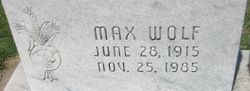
| Birth | : | 28 Oct 1916 Manchester, Dickinson County, Kansas, USA |
| Death | : | 3 Nov 1996 Minneapolis, Ottawa County, Kansas, USA |
| Burial | : | Athelstane Cemetery, Athelstane Township, Clay County, USA |
| Coordinate | : | 39.1768990, -97.1753006 |
| Description | : | THE FOLLOWING OBITUARY IS FROM THE ABILENE REFLECTOR CHRONICLE OF NOVEMBER 4, 1996 - JERALD HENRY WOLF Jerald Henry "Jerry" Wolf, 80, Manchester, died November 3, 1996 at the Ottawa County Hospital in Minneapolis, Kansas. He was born October 28, 1916, in the Manchester Community, the son of Rudolph and Nellie Frazier Wolf. He grew up in the community and was a graduate of Longford High School with the class of 1934. On May 10, 1946, he was married to Eileen Marie Sheedy at the home of her parents, John and Margaret Sheedy in Longford, Clay County, Kansas. They farmed in... Read More |
frequently asked questions (FAQ):
-
Where is Jerald Henry Wolf's memorial?
Jerald Henry Wolf's memorial is located at: Athelstane Cemetery, Athelstane Township, Clay County, USA.
-
When did Jerald Henry Wolf death?
Jerald Henry Wolf death on 3 Nov 1996 in Minneapolis, Ottawa County, Kansas, USA
-
Where are the coordinates of the Jerald Henry Wolf's memorial?
Latitude: 39.1768990
Longitude: -97.1753006
Family Members:
Parent
Spouse

Siblings
Children
Flowers:


Nearby Cemetories:
1. Mizpah Cemetery
Clay County, USA
Coordinate: 39.2057800, -97.1238500
2. Greenridge Cemetery
Dickinson County, USA
Coordinate: 39.1199989, -97.1433029
3. Wesleyan Cemetery
Oak Hill, Clay County, USA
Coordinate: 39.2268982, -97.2572021
4. Saint John's Episcopal Cemetery
Clay County, USA
Coordinate: 39.2193985, -97.0744019
5. Uniondale Cemetery
Wakefield, Clay County, USA
Coordinate: 39.2382800, -97.0918400
6. Henry Cemetery
Buckeye, Dickinson County, USA
Coordinate: 39.0828018, -97.1857986
7. Pleasant Ridge Cemetery
Clay County, USA
Coordinate: 39.2789001, -97.1841965
8. Keystone Cemetery
Manchester, Dickinson County, USA
Coordinate: 39.1185989, -97.2917023
9. Pleasant Valley Cemetery
Oak Hill, Clay County, USA
Coordinate: 39.2468987, -97.2889023
10. Zion Lutheran Cemetery
Clay County, USA
Coordinate: 39.2928009, -97.1557999
11. Madura Cemetery
Wakefield, Clay County, USA
Coordinate: 39.1842003, -97.0117035
12. Jones Cemetery
Dickinson County, USA
Coordinate: 39.0703011, -97.0860977
13. Rose Meron Cemetery
Oak Hill, Clay County, USA
Coordinate: 39.2194700, -97.3338900
14. Buckeye Cemetery
Buckeye, Dickinson County, USA
Coordinate: 39.0463070, -97.1665840
15. Highland Cemetery
Wakefield, Clay County, USA
Coordinate: 39.2190247, -97.0133667
16. Milo Chapman Gravesite
Broughton, Clay County, USA
Coordinate: 39.2888500, -97.0724400
17. Swartwood Cemetery
Longford, Clay County, USA
Coordinate: 39.1323200, -97.3431500
18. Gilbert Cemetery
Clay County, USA
Coordinate: 39.2853012, -97.0625000
19. Liberty Cemetery
Upland, Dickinson County, USA
Coordinate: 39.0896988, -97.0278015
20. Zion Cemetery
Abilene, Dickinson County, USA
Coordinate: 39.0319240, -97.2045850
21. Prairiedale Cemetery
Talmage, Dickinson County, USA
Coordinate: 39.0471992, -97.2652969
22. Union Cemetery
Buckeye, Dickinson County, USA
Coordinate: 39.0243988, -97.1856003
23. Timber Creek Cemetery
Wakefield, Clay County, USA
Coordinate: 39.2182999, -96.9805984
24. Hebron Cemetery
Clay County, USA
Coordinate: 39.3213800, -97.2601400