
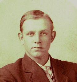
Joel S. Clark
| Birth | : | 13 Nov 1892 Elkader, Clayton County, Iowa, USA |
| Death | : | 21 Feb 1976 Elkader, Clayton County, Iowa, USA |
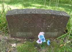
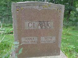
| Burial | : | Clark Family Cemetery, Beulah, Clayton County, USA |
| Coordinate | : | 42.9166505, -91.4751415 |
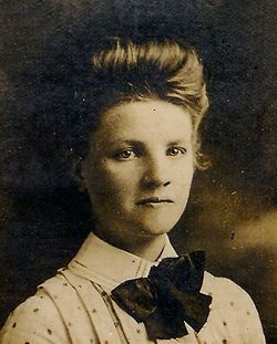
| Description | : | Married Emma Johnsrud 17 May 1915 |
frequently asked questions (FAQ):
-
Where is Joel S. Clark's memorial?
Joel S. Clark's memorial is located at: Clark Family Cemetery, Beulah, Clayton County, USA.
-
When did Joel S. Clark death?
Joel S. Clark death on 21 Feb 1976 in Elkader, Clayton County, Iowa, USA
-
Where are the coordinates of the Joel S. Clark's memorial?
Latitude: 42.9166505
Longitude: -91.4751415
Family Members:
Parent

Spouse
Siblings
Children

Flowers:


Nearby Cemetories:
1. Clark Family Cemetery
Beulah, Clayton County, USA
Coordinate: 42.9166505, -91.4751415
2. Weymouth Cemetery
Saint Olaf, Clayton County, USA
Coordinate: 42.9278799, -91.4583559
3. Patterson Pioneer Cemetery
Saint Olaf, Clayton County, USA
Coordinate: 42.9216000, -91.4489000
4. Cook Family Cemetery
Elkader, Clayton County, USA
Coordinate: 42.9209880, -91.5091230
5. Norway Lutheran Church Cemetery
Saint Olaf, Clayton County, USA
Coordinate: 42.9352798, -91.4302826
6. Wagner Township Cemetery
Saint Olaf, Clayton County, USA
Coordinate: 42.9519386, -91.4513931
7. Highland Lutheran Cemetery
Highland Township, Clayton County, USA
Coordinate: 42.8987000, -91.5330000
8. Marion Lutheran Cemetery
Gunder, Clayton County, USA
Coordinate: 42.9708290, -91.5127792
9. Houg Cemetery
Gunder, Clayton County, USA
Coordinate: 42.9444008, -91.5675964
10. Eno Cemetery
Wagner Township, Clayton County, USA
Coordinate: 42.9930992, -91.4693985
11. Apostolic Cemetery
Marion Township, Clayton County, USA
Coordinate: 42.9347000, -91.5821991
12. Gooding Cemetery
Wagner Township, Clayton County, USA
Coordinate: 42.9869490, -91.4191570
13. Farmersburg-Wagner Cemetery
Farmersburg, Clayton County, USA
Coordinate: 42.9481010, -91.3700027
14. Elkader Cemetery
Elkader, Clayton County, USA
Coordinate: 42.8541718, -91.4000015
15. Saint Josephs Cemetery
Elkader, Clayton County, USA
Coordinate: 42.8488998, -91.4021988
16. Colony Catholic Cemetery (Defunct)
Read Township, Clayton County, USA
Coordinate: 42.8830000, -91.3580000
17. County Home Cemetery
Clayton Center, Clayton County, USA
Coordinate: 42.8916702, -91.3499985
18. Fry Family Cemetery
Farmersburg, Clayton County, USA
Coordinate: 43.0152530, -91.5182350
19. Pioneer Cemetery
Monona, Clayton County, USA
Coordinate: 43.0149994, -91.4274979
20. Dohrer Cemetery
Osborne, Clayton County, USA
Coordinate: 42.8124846, -91.4584734
21. Bismark Cemetery
Farmersburg, Clayton County, USA
Coordinate: 42.9790000, -91.3500000
22. Zion Lutheran Cemetery
Clayton Center, Clayton County, USA
Coordinate: 42.8841705, -91.3249969
23. Clayton Center Cemetery
Clayton Center, Clayton County, USA
Coordinate: 42.8841705, -91.3225021
24. East Clermont Lutheran Church Cemetery
Grand Meadow Township, Clayton County, USA
Coordinate: 42.9969406, -91.5916672