
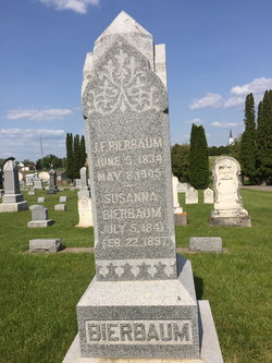

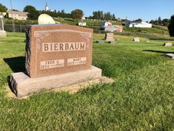
Johann Friederich Bierbaum
| Birth | : | 5 Jun 1834 Wissingen, Landkreis Osnabrück, Lower Saxony (Niedersachsen), Germany |
| Death | : | 8 May 1905 Clayton County, Iowa, USA |
| Burial | : | Woodlawn Memorial Park, Easton, Talbot County, USA |
| Coordinate | : | 38.8610992, -76.0597000 |
| Plot | : | Block 7 Lot 38 Grave 6 |
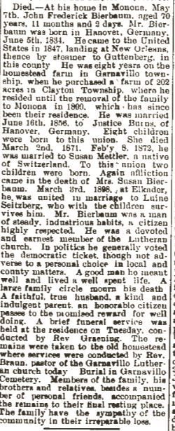
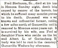
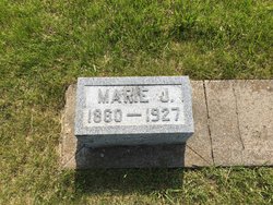
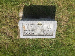
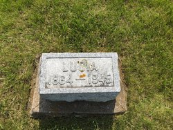
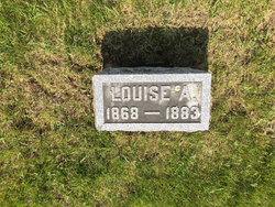
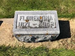
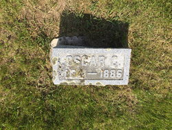
| Description | : | Entry #62, 1834 Births/Baptisms within the parish register at the Evangelical Lutheran Church in Schledehausen, Hanover, documents the birth of Johann Friederich Bierbaum. He was the fourth child of Johann Heinrich and Catharine Elisabeth (Duvendack) Bierbaum. Born June 5, 1834, he was baptized on June 15. Clayton County, Iowa records often document him "J. F. Bierbaum." The parish register at St. Paul Lutheran Church, Garnavillo, Clayton County, Iowa reveals the marriage of Johann and "Magaretha" Bruns on July 16, 1856. One wonders about the use of Margaretha in the 1856 marriage record. Despite being documented Christina in... Read More |
frequently asked questions (FAQ):
-
Where is Johann Friederich Bierbaum's memorial?
Johann Friederich Bierbaum's memorial is located at: Woodlawn Memorial Park, Easton, Talbot County, USA.
-
When did Johann Friederich Bierbaum death?
Johann Friederich Bierbaum death on 8 May 1905 in Clayton County, Iowa, USA
-
Where are the coordinates of the Johann Friederich Bierbaum's memorial?
Latitude: 38.8610992
Longitude: -76.0597000
Family Members:
Parent

Spouse

Siblings
Children
Flowers:


Nearby Cemetories:
1. Woodlawn Memorial Park
Easton, Talbot County, USA
Coordinate: 38.8610992, -76.0597000
2. All Saints Cemetery
Easton, Talbot County, USA
Coordinate: 38.8464012, -76.0817032
3. Hopkins-Stafford Family Cemetery
Skipton, Talbot County, USA
Coordinate: 38.8896488, -76.0609487
4. Saint Pauls Cemetery
Cordova, Talbot County, USA
Coordinate: 38.8802986, -76.0149994
5. Newton Road Cemetery
Cordova, Talbot County, USA
Coordinate: 38.9020538, -76.0510101
6. Chapel Cemetery
Easton, Talbot County, USA
Coordinate: 38.8171997, -76.0211029
7. Saint Joseph's Cemetery
Cordova, Talbot County, USA
Coordinate: 38.9099998, -76.0132980
8. Ashby-Goldsborough Family Cemetery
Easton, Talbot County, USA
Coordinate: 38.8251600, -76.1239840
9. Fairview Church of the Brethren Cemetery
Talbot County, USA
Coordinate: 38.8568993, -75.9757996
10. Lombardy Farm Cemetery
Unionville, Talbot County, USA
Coordinate: 38.8158530, -76.1259852
11. Old Wye Episcopal Church Cemetery
Wye Mills, Talbot County, USA
Coordinate: 38.9366989, -76.0800018
12. Clayton Cemetery
Wye Mills, Talbot County, USA
Coordinate: 38.9297780, -76.1058167
13. Maryland State Police Canine Cemetery Barrack I
Easton, Talbot County, USA
Coordinate: 38.7843938, -76.0753632
14. Saint Stephens Church Cemetery
Easton, Talbot County, USA
Coordinate: 38.8091020, -76.1397660
15. Spring Hill Cemetery
Easton, Talbot County, USA
Coordinate: 38.7775002, -76.0727997
16. Wye House Cemetery
Easton, Talbot County, USA
Coordinate: 38.8545500, -76.1678100
17. Richards Memorial Park
Easton, Talbot County, USA
Coordinate: 38.7761002, -76.0821991
18. Doverbrook Cemetery
Easton, Talbot County, USA
Coordinate: 38.7733002, -76.0643997
19. Tuckahoe Friends Meeting House Burying Ground
Talbot County, USA
Coordinate: 38.8253460, -75.9531270
20. DeShields Cemetery
Talbot County, USA
Coordinate: 38.8278008, -76.1678009
21. Kings Creek Cemetery
Talbot County, USA
Coordinate: 38.8167000, -75.9527969
22. Third Haven Meeting Burial Ground
Easton, Talbot County, USA
Coordinate: 38.7672005, -76.0764008
23. Clover Fields Farm Cemetery
Queenstown, Queen Anne's County, USA
Coordinate: 38.9551960, -76.0896240
24. Wye of Carmichael Cemetery
Queen Anne's County, USA
Coordinate: 38.9411011, -76.1335983