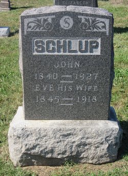
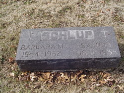
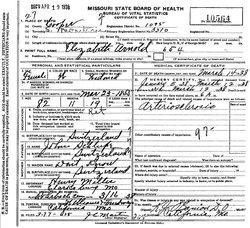
| Birth | : | 20 Aug 1815 Arch, Verwaltungskreis Seeland, Bern, Switzerland |
| Death | : | 21 Jun 1903 California, Moniteau County, Missouri, USA |
| Burial | : | Dutch Ridge Cemetery, Green Township, Mahoning County, USA |
| Coordinate | : | 40.9835130, -80.8145550 |
frequently asked questions (FAQ):
-
Where is Johannes “John” Schlup's memorial?
Johannes “John” Schlup's memorial is located at: Dutch Ridge Cemetery, Green Township, Mahoning County, USA.
-
When did Johannes “John” Schlup death?
Johannes “John” Schlup death on 21 Jun 1903 in California, Moniteau County, Missouri, USA
-
Where are the coordinates of the Johannes “John” Schlup's memorial?
Latitude: 40.9835130
Longitude: -80.8145550
Family Members:
Spouse
Children
Flowers:
Nearby Cemetories:
1. Dutch Ridge Cemetery
Green Township, Mahoning County, USA
Coordinate: 40.9835130, -80.8145550
2. Cool Family Cemetery
Greenford, Mahoning County, USA
Coordinate: 40.9641100, -80.7815880
3. Calla Cemetery
Calla, Mahoning County, USA
Coordinate: 40.9727600, -80.7716800
4. Bethel Methodist Episcopal Cemetery
Goshen Township, Mahoning County, USA
Coordinate: 40.9757800, -80.8655100
5. Christian Cemetery
Greenford, Mahoning County, USA
Coordinate: 40.9438705, -80.8023529
6. Saint Pauls Monastery Cemetery
Canfield, Mahoning County, USA
Coordinate: 41.0228160, -80.8288300
7. Greenford Lutheran Church Cemetery
Mahoning County, USA
Coordinate: 40.9436700, -80.7970200
8. Greenlawn Cemetery
Greenford, Mahoning County, USA
Coordinate: 40.9430000, -80.7970000
9. New Albany Cemetery
New Albany, Mahoning County, USA
Coordinate: 40.9443640, -80.8388010
10. Ellsworth Cemetery
Ellsworth, Mahoning County, USA
Coordinate: 41.0244700, -80.8510760
11. Dean Hill Cemetery
Canfield, Mahoning County, USA
Coordinate: 41.0353012, -80.7957993
12. Locust Grove Cemetery
Mahoning County, USA
Coordinate: 40.9435300, -80.7631500
13. Dressel Farm Cemetery
Greenford, Mahoning County, USA
Coordinate: 40.9363770, -80.7745730
14. Canfield Village Cemetery
Canfield, Mahoning County, USA
Coordinate: 41.0242830, -80.7536270
15. Callahan Family Cemetery
Greenford, Mahoning County, USA
Coordinate: 40.9160550, -80.8083680
16. Geeburg Methodist Church Cemetery
Ellsworth, Mahoning County, USA
Coordinate: 41.0487850, -80.8380010
17. Old North Cemetery
Canfield, Mahoning County, USA
Coordinate: 41.0393982, -80.7600021
18. Infirmary Cemetery
Canfield, Mahoning County, USA
Coordinate: 41.0482500, -80.7792950
19. Paradise Lutheran Cemetery
Canfield, Mahoning County, USA
Coordinate: 40.9872800, -80.7203500
20. Sharon Mennonite Fellowship Cemetery
Green Township, Mahoning County, USA
Coordinate: 40.9286850, -80.7463390
21. Hope Cemetery
Salem, Columbiana County, USA
Coordinate: 40.9096985, -80.8494034
22. Paradise Cemetery
North Lima, Mahoning County, USA
Coordinate: 40.9728369, -80.7061874
23. Washingtonville Cemetery
Washingtonville, Mahoning County, USA
Coordinate: 40.9033012, -80.7846985
24. Covenanter Cemetery
North Jackson, Mahoning County, USA
Coordinate: 41.0687270, -80.8201110


