John C Miller
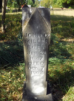
| Birth | : | 28 Jan 1847 |
| Death | : | 7 Oct 1902 |
| Burial | : | Sierra View Memorial Park, Olivehurst, Yuba County, USA |
| Coordinate | : | 39.0872002, -121.5363998 |
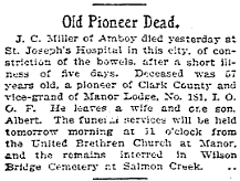
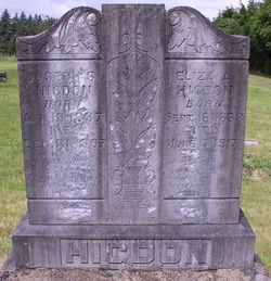
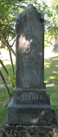
| Description | : | The Confederate War Department determined there was a Strategic reason and dispatched 40,000 troops into Kansas. 1864 the Kansas State Governor Carney acting on higher orders declared by Proclamation Martial Law and ordered all men, ages 18 to 60, White or Black, to report for service. Allen H. HIGDON and Joseph B. HIGDON joined and were sworn in at Leroy, Kansas on September 26 1864 and John C. Miller (under age of 21 years) joined and was sworn in at Leroy on October 10, 1864. They were listed as Privates and they joined with their own horses.... Read More |
frequently asked questions (FAQ):
-
Where is John C Miller's memorial?
John C Miller's memorial is located at: Sierra View Memorial Park, Olivehurst, Yuba County, USA.
-
When did John C Miller death?
John C Miller death on 7 Oct 1902 in
-
Where are the coordinates of the John C Miller's memorial?
Latitude: 39.0872002
Longitude: -121.5363998
Family Members:
Parent
Spouse
Siblings
Children
Flowers:
Nearby Cemetories:
1. Sierra View Memorial Park
Olivehurst, Yuba County, USA
Coordinate: 39.0872002, -121.5363998
2. Yuba City Cemetery
Yuba City, Sutter County, USA
Coordinate: 39.1366010, -121.6128270
3. Sutter-Yuba Memorial Park
Yuba City, Sutter County, USA
Coordinate: 39.1384080, -121.6123760
4. Praise Chapel Mausoleum
Yuba City, Sutter County, USA
Coordinate: 39.1383610, -121.6127890
5. Saint Joseph Catholic Cemetery
Marysville, Yuba County, USA
Coordinate: 39.1591310, -121.5908240
6. Marysville Jewish Cemetery
Marysville, Yuba County, USA
Coordinate: 39.1615300, -121.5879100
7. Marysville Cemetery
Marysville, Yuba County, USA
Coordinate: 39.1621367, -121.5889756
8. Wheatland Cemetery
Wheatland, Yuba County, USA
Coordinate: 39.0083008, -121.4360962
9. Lofton Cemetery
Yuba County, USA
Coordinate: 39.0783005, -121.3696976
10. Fairview Cemetery
Rio Oso, Sutter County, USA
Coordinate: 38.9389000, -121.5250015
11. Camp Far West Cemetery
Wheatland, Yuba County, USA
Coordinate: 39.0395500, -121.3431400
12. Vineyard Cemetery
Yuba County, USA
Coordinate: 39.1557900, -121.3281600
13. Browns Valley Cemetery
Browns Valley, Yuba County, USA
Coordinate: 39.2332100, -121.4079400
14. Sheridan Cemetery
Sheridan, Placer County, USA
Coordinate: 38.9741000, -121.3585300
15. Long Bar Cemetery
Brownsville, Yuba County, USA
Coordinate: 39.2234900, -121.3860400
16. Cabbage Patch Cemetery
Waldo Junction, Yuba County, USA
Coordinate: 39.1117300, -121.3066200
17. Sutter Cemetery
Sutter, Sutter County, USA
Coordinate: 39.1697006, -121.7438965
18. Nicolaus Cemetery
Nicolaus, Sutter County, USA
Coordinate: 38.8958015, -121.5639038
19. Timbuctoo Cemetery
Smartsville, Yuba County, USA
Coordinate: 39.2159925, -121.3175461
20. Androus Family Pioneer Cemetery
Iowa City, Yuba County, USA
Coordinate: 39.2936100, -121.4639800
21. McGanney Cemetery
Smartsville, Yuba County, USA
Coordinate: 39.2018100, -121.2988310
22. Smartsville Cemetery
Smartsville, Yuba County, USA
Coordinate: 39.1973500, -121.2953500
23. Immaculate Conception Cemetery
Smartsville, Yuba County, USA
Coordinate: 39.2023500, -121.2989300
24. Live Oak Cemetery
Live Oak, Sutter County, USA
Coordinate: 39.2768784, -121.6790924

