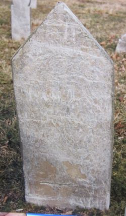
| Birth | : | 1744 Frederick County, Maryland, USA |
| Death | : | Oct 1825 Randolph County, North Carolina, USA |
| Burial | : | Sandy Creek Baptist Church Cemetery, Liberty, Randolph County, USA |
| Coordinate | : | 35.8235550, -79.6429050 |
| Description | : | John Cloud LANE, Sr. is the first child of ten children born to Rev Tidence LANE and his wife Hester VAN BIBBER. John LANE married in 1763 Susannah Clarissa YORK, daughter of Thomas York. John Cloud Lane was a law officer in colonial Orange (now Randolph) County, North Carolina. He is believed to have been a Revolutionary War Soldier. His father Rev Tidence LANE was ordained to the ministry by Rev Shubal Stearns at the Sandy Creek Baptist Church on Sandy Creek in eastern Randolph County, North Carolina. Rev Tidence LANE was sent out on mission as... Read More |
frequently asked questions (FAQ):
-
Where is John Cloud Lane Sr.'s memorial?
John Cloud Lane Sr.'s memorial is located at: Sandy Creek Baptist Church Cemetery, Liberty, Randolph County, USA.
-
When did John Cloud Lane Sr. death?
John Cloud Lane Sr. death on Oct 1825 in Randolph County, North Carolina, USA
-
Where are the coordinates of the John Cloud Lane Sr.'s memorial?
Latitude: 35.8235550
Longitude: -79.6429050
Family Members:
Parent
Spouse
Siblings
Children
Flowers:
Left by Anonymous on 07 Aug 2016

Left by Anonymous on 21 May 2017
Left by Anonymous on 09 Jun 2018

Left by Anonymous on 02 Aug 2018

Left by Anonymous on 07 Feb 2019

Left by Anonymous on 23 Aug 2019

Desendent of dorcas lane and john tripp
Left by Anonymous on 07 Feb 2020
Left by Anonymous on 24 Feb 2021
There was a John Lane who served as a Ranger in Cluggage's Ranger Company at Fort Roberdea then Bedford co. Pa. They protected the lead mines, smelter and settlers sheltering there from Indian and Loyalist war parties. The fort was rebuilt in 1976 .
Left by Anonymous on 07 Mar 2021

We salute you sir!
Left by Anonymous on 31 Jul 2021
John Lane who was in the Rev War in North Carolina was born 1731 in Bertie and died 1796 in Halifax and married Mary Shepherd . Where is the document for names of this John Lane's children and parents ?
Left by Anonymous on 10 Oct 2021
Nearby Cemetories:
1. Sandy Creek Baptist Church Cemetery
Liberty, Randolph County, USA
Coordinate: 35.8235550, -79.6429050
2. Sandy Creek Primitive Baptist Church Cemetery
Liberty, Randolph County, USA
Coordinate: 35.8239020, -79.6406560
3. Melanchthon Lutheran Church Cemetery
Liberty, Randolph County, USA
Coordinate: 35.8451630, -79.6440640
4. Cool Springs Baptist Church Cemetery
Franklinville, Randolph County, USA
Coordinate: 35.8072420, -79.6805660
5. McMasters Cemetery
Randolph County, USA
Coordinate: 35.8072370, -79.6021500
6. Whites Chapel United Methodist Church Cemetery
Liberty, Randolph County, USA
Coordinate: 35.7850520, -79.6422990
7. Bethany United Methodist Church Cemetery #2
Liberty, Randolph County, USA
Coordinate: 35.8430060, -79.5948160
8. Grays Chapel Cemetery
Grays Chapel, Randolph County, USA
Coordinate: 35.8183570, -79.6986060
9. Patterson Grove Christian Church Cemetery
Ramseur, Randolph County, USA
Coordinate: 35.7743940, -79.6536550
10. Hollys Chapel Pentecostal Holiness Church
Ramseur, Randolph County, USA
Coordinate: 35.7825600, -79.6048200
11. Mount Pleasant Baptist Church Cemetery
Staley, Randolph County, USA
Coordinate: 35.8144700, -79.5790000
12. Saint Stephen Memorial Gardens
Liberty, Randolph County, USA
Coordinate: 35.8550750, -79.5877970
13. Amos Grove Cemetery
Liberty, Randolph County, USA
Coordinate: 35.8546982, -79.5871964
14. Fairview Cemetery
Liberty, Randolph County, USA
Coordinate: 35.8516998, -79.5761032
15. Shady Grove Baptist Church Cemetery
Staley, Randolph County, USA
Coordinate: 35.7853800, -79.5821020
16. Margarets Chapel Church Cemetery
Staley, Randolph County, USA
Coordinate: 35.8110940, -79.5648900
17. Whites Memorial Baptist Church Cemetery
Franklinville, Randolph County, USA
Coordinate: 35.7939680, -79.7149760
18. Red Cross Baptist Church Cemetery
Redcross, Randolph County, USA
Coordinate: 35.8715591, -79.6995850
19. Lineberry Family Cemetery
Staley, Randolph County, USA
Coordinate: 35.7878000, -79.5724000
20. Old Shady Grove Cemetery
Staley, Randolph County, USA
Coordinate: 35.7874985, -79.5725021
21. York Family Cemetery
Ramseur, Randolph County, USA
Coordinate: 35.7603000, -79.6108000
22. Olivers Chapel Cemetery
Staley, Randolph County, USA
Coordinate: 35.8060989, -79.5610962
23. Shiloh United Methodist Church Cemetery
Liberty, Randolph County, USA
Coordinate: 35.8915430, -79.6594990
24. Bethel United Methodist Church Cemetery
Randolph County, USA
Coordinate: 35.8779190, -79.7051540


