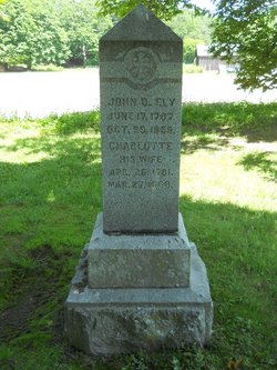
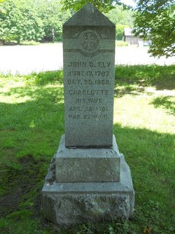
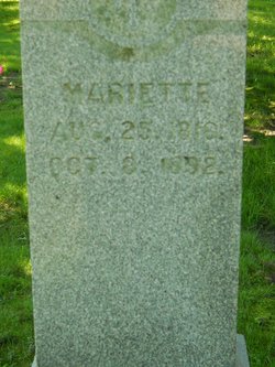
John Day Ely
| Birth | : | 17 Jun 1787 West Springfield, Hampden County, Massachusetts, USA |
| Death | : | 29 Oct 1859 Deerfield, Franklin County, Massachusetts, USA |
| Burial | : | Ward Cemetery, Deerfield, Franklin County, USA |
| Coordinate | : | 42.4806700, -72.5774600 |
| Description | : | Son of Moses Ely (1767-1840) and Chloe (Day) Ely. They were married at West Springfield,MA on Mar 9,1787. He married Charlotte Day on Dec 26,1813 at West Springfield,MA. |
frequently asked questions (FAQ):
-
Where is John Day Ely's memorial?
John Day Ely's memorial is located at: Ward Cemetery, Deerfield, Franklin County, USA.
-
When did John Day Ely death?
John Day Ely death on 29 Oct 1859 in Deerfield, Franklin County, Massachusetts, USA
-
Where are the coordinates of the John Day Ely's memorial?
Latitude: 42.4806700
Longitude: -72.5774600
Family Members:
Parent
Spouse
Siblings
Children
Flowers:
Nearby Cemetories:
1. Ward Cemetery
Deerfield, Franklin County, USA
Coordinate: 42.4806700, -72.5774600
2. Bloody Brook Mass Grave
Deerfield, Franklin County, USA
Coordinate: 42.4819700, -72.6038600
3. Riverside Cemetery
Sunderland, Franklin County, USA
Coordinate: 42.4611015, -72.5864029
4. Sugarloaf Street Cemetery
South Deerfield, Franklin County, USA
Coordinate: 42.4762800, -72.6071500
5. Holy Name of Jesus Cemetery
Deerfield, Franklin County, USA
Coordinate: 42.4706800, -72.6071300
6. Saint Stanislaus Cemetery
Deerfield, Franklin County, USA
Coordinate: 42.4707985, -72.6082993
7. Brookside Cemetery
Deerfield, Franklin County, USA
Coordinate: 42.4707985, -72.6106033
8. North Sunderland Cemetery
Sunderland, Franklin County, USA
Coordinate: 42.4972000, -72.5492020
9. Holy Ghost Ukrainian Catholic Cemetery
Whately, Franklin County, USA
Coordinate: 42.4639015, -72.6097031
10. Pine Nook Cemetery
Deerfield, Franklin County, USA
Coordinate: 42.5086300, -72.5661400
11. East Whately Cemetery
Whately, Franklin County, USA
Coordinate: 42.4446983, -72.5994034
12. Mount Toby Cemetery
Leverett, Franklin County, USA
Coordinate: 42.4894810, -72.5174400
13. Long Plain Cemetery
Leverett, Franklin County, USA
Coordinate: 42.4510994, -72.5250015
14. Mill River Cemetery
Deerfield, Franklin County, USA
Coordinate: 42.5011890, -72.6377770
15. Old South Cemetery
Montague, Franklin County, USA
Coordinate: 42.5232500, -72.5360300
16. Center Cemetery
Whately, Franklin County, USA
Coordinate: 42.4431000, -72.6363983
17. Marvell Cemetery
Leverett, Franklin County, USA
Coordinate: 42.5028000, -72.5042038
18. Jackson Hill Cemetery
Leverett, Franklin County, USA
Coordinate: 42.5028000, -72.5028000
19. North Cemetery
Leverett, Franklin County, USA
Coordinate: 42.4673720, -72.4983230
20. Russellville Cemetery
Hadley, Hampshire County, USA
Coordinate: 42.4199982, -72.5755997
21. David L Scott Gravesite
Whately, Franklin County, USA
Coordinate: 42.4315660, -72.6290920
22. Wiley Cemetery
Leverett, Franklin County, USA
Coordinate: 42.4290200, -72.5304200
23. Laurel Hill Cemetery
Deerfield, Franklin County, USA
Coordinate: 42.5416670, -72.5973020
24. Savage Farm Cemetery
Deerfield, Franklin County, USA
Coordinate: 42.5336700, -72.6245300


