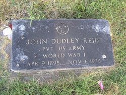
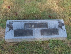
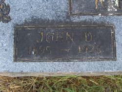
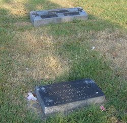
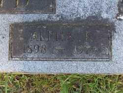
John Dudley Reid
| Birth | : | 9 Apr 1895 Clarendon, Monroe County, Arkansas, USA |
| Death | : | 6 Nov 1976 Muskogee, Muskogee County, Oklahoma, USA |
| Burial | : | Park View Cemetery, Medford, Burlington County, USA |
| Coordinate | : | 39.8983955, -74.8207779 |
| Plot | : | Addition:Rugel #1;Section:10;Plot:5 |
| Description | : | Northwest Arkansas Times Fayetteville, AR 8 Nov 1976 John Reid, 81, of Muskogee, Oklahoma, died Saturday in a Muskogee hospital. Born April 9, 1895, the son of William and Harriet Parson Reid, he was a retired U.S. Deputy Marshal, a Mason and a member of the Methodist Church. He is survived by the widow, Mrs. Alfa Reid of the home; one daughter, Mrs. Fred Flusche of Kansas City, Kan.; a sister-in-law, Mrs. Hal Brogdon of Springdale; one sister, Miss Bertha Reid of Conway; two grandchildren; and one great-grandchild. Funeral service was today at 2 p.m. at the Bluff Cemetery in Springdale. |
frequently asked questions (FAQ):
-
Where is John Dudley Reid's memorial?
John Dudley Reid's memorial is located at: Park View Cemetery, Medford, Burlington County, USA.
-
When did John Dudley Reid death?
John Dudley Reid death on 6 Nov 1976 in Muskogee, Muskogee County, Oklahoma, USA
-
Where are the coordinates of the John Dudley Reid's memorial?
Latitude: 39.8983955
Longitude: -74.8207779
Family Members:
Spouse
Flowers:
Nearby Cemetories:
1. Park View Cemetery
Medford, Burlington County, USA
Coordinate: 39.8983955, -74.8207779
2. Medford Friends Hicksite Burial Ground
Medford, Burlington County, USA
Coordinate: 39.8978940, -74.8219260
3. Medford Baptist Cemetery
Medford, Burlington County, USA
Coordinate: 39.8997536, -74.8187943
4. Medford Methodist Cemetery
Medford, Burlington County, USA
Coordinate: 39.9008408, -74.8200302
5. Medford Friends Meeting Cemetery
Medford, Burlington County, USA
Coordinate: 39.8992081, -74.8255463
6. Stratton Burying Ground
Medford, Burlington County, USA
Coordinate: 39.8839836, -74.8203583
7. Saint Peters Episcopal Church Garden
Medford, Burlington County, USA
Coordinate: 39.8849360, -74.8337860
8. Peacock Cemetery
Chairville, Burlington County, USA
Coordinate: 39.8988991, -74.7889023
9. Park View Cemetery at Kirbys Mill
Medford, Burlington County, USA
Coordinate: 39.9222300, -74.8076800
10. Haines Family Farm Cemetery
Medford, Burlington County, USA
Coordinate: 39.9235020, -74.8079980
11. Mount Laurel Friends Burying Ground
Mount Laurel, Burlington County, USA
Coordinate: 39.9286000, -74.8853920
12. Jacob's Chapel Cemetery
Mount Laurel, Burlington County, USA
Coordinate: 39.9297670, -74.8852350
13. Evergreen Cemetery
Lumberton, Burlington County, USA
Coordinate: 39.9562988, -74.8094025
14. Saint Martin in the Fields Memorial Garden
Lumberton, Burlington County, USA
Coordinate: 39.9581480, -74.8081230
15. Vincentown Baptist Cemetery
Vincentown, Burlington County, USA
Coordinate: 39.9395400, -74.7609690
16. Old Lumberton Cemetery
Lumberton, Burlington County, USA
Coordinate: 39.9590988, -74.8058014
17. Eldridge Cemetery
Mount Laurel, Burlington County, USA
Coordinate: 39.9268837, -74.8968887
18. Evesham Friends Cemetery
Mount Laurel, Burlington County, USA
Coordinate: 39.9351130, -74.8915510
19. Mount Laurel Cemetery
Mount Laurel, Burlington County, USA
Coordinate: 39.9272003, -74.8977966
20. Vincentown Friends Cemetery
Vincentown, Burlington County, USA
Coordinate: 39.9352400, -74.7495500
21. Lord of Life Memorial Garden
Tabernacle, Burlington County, USA
Coordinate: 39.8510860, -74.7590690
22. Vincentown Methodist Cemetery
Vincentown, Burlington County, USA
Coordinate: 39.9370900, -74.7488600
23. Marlton Cemetery
Marlton, Burlington County, USA
Coordinate: 39.8767320, -74.9039320
24. Darnell Family Cemetery
Mount Laurel, Burlington County, USA
Coordinate: 39.9535520, -74.8728800

