John Dunlap
| Birth | : | 6 Aug 1810 Pennsylvania, USA |
| Death | : | 2 Dec 1884 Carroll County, Ohio, USA |
| Burial | : | Scotts Cemetery, Carroll County, USA |
| Coordinate | : | 40.5386009, -81.1556015 |
| Plot | : | Row 6, grave 7 |
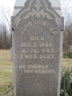
| Inscription | : | JOHN DUNLAP Died Dec. 2, 1884 Aged 74y 3m 26d 'We Cherish Thy Memory' |
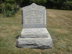
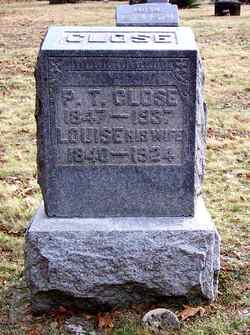
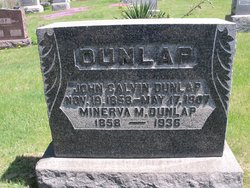
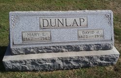
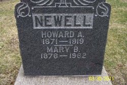
| Description | : | Contributor: janicet (47361005) made the followintg suggestions in Sept. 2020: Married, all in Carroll Co., OH, (1) 5 Mar 1839 Sarah Catherine Booth 1817–bef 1854; parents of: Louise Dunlap 1840–1924 [m. Grffin, Close] Elizabeth DUNLAP 1847–? Nancy DUNLAP 1851–1882 (2) on 16 Nov 1854, Nancy Booth 1825–1885; parents of: John Calvin DUNLAP 1858–1907 James Vincent DUNLAP 1863–1928 Hannah E DUNLAP 1865–? (30 on 30 Dec 1867 •Nancy Agnes (McQueen, Dunlap) Busby 1833–1905; parents of; Anna Lillian Dunlap1868–1912 Laura Delphine Dunlap 1870–1928 [m. McQueen] David Jackson Dunlap 1872–1931 Mary Belle DUNLAP 1876–1962 [m. Newell] |
frequently asked questions (FAQ):
-
Where is John Dunlap's memorial?
John Dunlap's memorial is located at: Scotts Cemetery, Carroll County, USA.
-
When did John Dunlap death?
John Dunlap death on 2 Dec 1884 in Carroll County, Ohio, USA
-
Where are the coordinates of the John Dunlap's memorial?
Latitude: 40.5386009
Longitude: -81.1556015
Family Members:
Spouse
Children
Flowers:
Nearby Cemetories:
1. Scotts Cemetery
Carroll County, USA
Coordinate: 40.5386009, -81.1556015
2. Farnsworth Cemetery
Carroll County, USA
Coordinate: 40.5385017, -81.1567001
3. Old Scott Cemetery
Carroll County, USA
Coordinate: 40.5483017, -81.1541977
4. Seceders Cemetery
Carroll County, USA
Coordinate: 40.5332985, -81.1446991
5. McGuire Cemetery
Tabor, Carroll County, USA
Coordinate: 40.5518990, -81.1564026
6. Saint Luke Cemetery
Carroll County, USA
Coordinate: 40.5303001, -81.1810989
7. Piecynski Farm Cemetery
Carrollton, Carroll County, USA
Coordinate: 40.5658690, -81.1224020
8. Pleasant Valley Cemetery
Carroll County, USA
Coordinate: 40.5764008, -81.1493988
9. Champers Cemetery
Carrollton, Carroll County, USA
Coordinate: 40.5667610, -81.1178540
10. Leavittsville Cemetery
Leavittsville, Carroll County, USA
Coordinate: 40.5133018, -81.1967010
11. Price-Rollins Cemetery
Carroll County, USA
Coordinate: 40.5088997, -81.1956024
12. Mount Pleasant Cemetery
Carrollton, Carroll County, USA
Coordinate: 40.5238991, -81.1003036
13. Palermo Cemetery
Carroll County, USA
Coordinate: 40.4894444, -81.1522220
14. Bethel Cemetery
Leavittsville, Carroll County, USA
Coordinate: 40.4921989, -81.1841965
15. Veteran's Grave
Orange Township, Carroll County, USA
Coordinate: 40.4931470, -81.2003677
16. Mount Tabor Cemetery
Carroll County, USA
Coordinate: 40.4817009, -81.1483002
17. Immaculate Heart of Mary Cemetery
Carrollton, Carroll County, USA
Coordinate: 40.5758010, -81.0955510
18. Westview Cemetery
Carrollton, Carroll County, USA
Coordinate: 40.5663986, -81.0852966
19. Grandview Cemetery
Carrollton, Carroll County, USA
Coordinate: 40.5694008, -81.0828018
20. Baxters Ridge Cemetery
Carroll County, USA
Coordinate: 40.6068993, -81.1686020
21. Union Valley Cemetery
Carroll County, USA
Coordinate: 40.5758018, -81.2332993
22. Roby Cemetery
Sherrodsville, Carroll County, USA
Coordinate: 40.5028000, -81.2382965
23. Saint Francis Catholic Cemetery
Sherrodsville, Carroll County, USA
Coordinate: 40.4951920, -81.2349170
24. Zion Cemetery
Sherrodsville, Carroll County, USA
Coordinate: 40.5208015, -81.2518997

