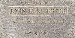
John Earl Beere
| Birth | : | 26 Nov 1938 Jerome, Yavapai County, Arizona, USA |
| Death | : | 6 Feb 2002 Merced County, California, USA |
| Burial | : | Dos Palos Cemetery, Dos Palos, Merced County, USA |
| Coordinate | : | 36.9831009, -120.6357651 |
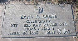
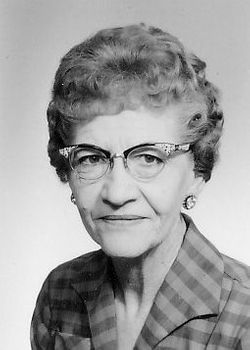
| Description | : | The following story is courtesy of Richard Crowe, a neighbor to the Beeres. Mr. Crowe is writing a memoir of his years growing up in Dos Palos, and he kindly shared the following excerpt of his work. *********************************** "While I knew who Earl and Melba Beere were, it was their son, John Earl Beere (1938-2002), who I best knew. The Beere's lived west of the hospital between the Burgess and Jacobsen homes. We lived one block north of the Hospital…so pretty close to the Beeres. All through the early 50s John Earl was one of my regular bicycle pals. He... Read More |
frequently asked questions (FAQ):
-
Where is John Earl Beere's memorial?
John Earl Beere's memorial is located at: Dos Palos Cemetery, Dos Palos, Merced County, USA.
-
When did John Earl Beere death?
John Earl Beere death on 6 Feb 2002 in Merced County, California, USA
-
Where are the coordinates of the John Earl Beere's memorial?
Latitude: 36.9831009
Longitude: -120.6357651
Family Members:
Parent
Flowers:
Nearby Cemetories:
1. Dos Palos Cemetery
Dos Palos, Merced County, USA
Coordinate: 36.9831009, -120.6357651
2. Los Banos Cemetery
Los Banos, Merced County, USA
Coordinate: 37.0470200, -120.8547000
3. Calvary Cemetery
Los Banos, Merced County, USA
Coordinate: 37.0486800, -120.8547000
4. Las Juntas Cemetery
Firebaugh, Fresno County, USA
Coordinate: 36.7793800, -120.3720300
5. Chowchilla Cemetery
Chowchilla, Madera County, USA
Coordinate: 37.0880318, -120.2834854
6. Calvary Cemetery
Merced, Merced County, USA
Coordinate: 37.2868996, -120.4860992
7. Evergreen Memorial Park
Merced, Merced County, USA
Coordinate: 37.2907982, -120.4689026
8. Merced Cemetery
Merced, Merced County, USA
Coordinate: 37.2925835, -120.4701004
9. Franklin Pet Cemetery
Merced, Merced County, USA
Coordinate: 37.3228970, -120.5425370
10. Plainsburg Cemetery
Plainsburg, Merced County, USA
Coordinate: 37.2350960, -120.3303757
11. Fancher Memorial
Tuttle, Merced County, USA
Coordinate: 37.2949400, -120.3778300
12. San Joaquin Valley National Cemetery
Santa Nella, Merced County, USA
Coordinate: 37.1198170, -121.0738000
13. Cottonwood Cemetery
Gustine, Merced County, USA
Coordinate: 37.1878128, -121.0403900
14. Helm-Turner Cemetery
Le Grand, Merced County, USA
Coordinate: 37.2421989, -120.2830963
15. New Hope Cemetery
Madera County, USA
Coordinate: 36.9089737, -120.1552200
16. Harper Family Cemetery
Los Banos, Merced County, USA
Coordinate: 37.0215379, -121.1236853
17. Winton Cemetery
Winton, Merced County, USA
Coordinate: 37.3820267, -120.6260223
18. Stevinson Sunnyside Cemetery
Stevinson, Merced County, USA
Coordinate: 37.3292007, -120.9231033
19. Colonel James J Stevinson Cemetery
Stevinson, Merced County, USA
Coordinate: 37.3572044, -120.9112320
20. South Hilmar Cemetery
Hilmar, Merced County, USA
Coordinate: 37.3802681, -120.8868408
21. Cherry Hill Cemetery
Panoche, San Benito County, USA
Coordinate: 36.6150017, -120.9586029
22. Arbor Vitae Cemetery
Madera, Madera County, USA
Coordinate: 36.9660988, -120.0717010
23. Madera Islamic Cemetery
Madera County, USA
Coordinate: 37.0370774, -120.0744976
24. Gwin Ghost Town Cemetery
Le Grand, Merced County, USA
Coordinate: 37.2696890, -120.1820670


