
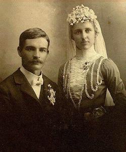

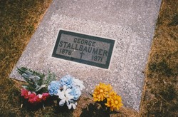
John George “George” Stallbaumer
| Birth | : | 24 Nov 1876 Saint Benedict, Nemaha County, Kansas, USA |
| Death | : | 29 Jun 1971 Axtell, Marshall County, Kansas, USA |
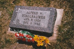
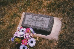
| Burial | : | Saint Marys Cemetery, Saint Benedict, Nemaha County, USA |
| Coordinate | : | 39.8866997, -96.0982971 |
| Plot | : | Row 20, Sp 9 |
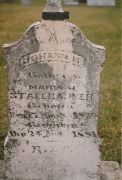
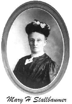
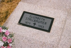
| Description | : | George Stallbaumer, a member of one of the pioneering families of the St. Benedict area, passed away on June 29, 1971, at the Axtell hospital where he had been a patient for one day. He was 94 years old. Mr. Stallbaumer was born November 24, 1876, on a farm north of Seneca, the youngest child of Johann Martin and Mary von Bruck Stallbaumer. On August 28, 1900, he was married to Mary Elizabeth Engelken. They farmed northwest of Seneca in the St. Benedict community. She died February 8, 1963. They celebrated their golden wedding anniversary in... Read More |
frequently asked questions (FAQ):
-
Where is John George “George” Stallbaumer's memorial?
John George “George” Stallbaumer's memorial is located at: Saint Marys Cemetery, Saint Benedict, Nemaha County, USA.
-
When did John George “George” Stallbaumer death?
John George “George” Stallbaumer death on 29 Jun 1971 in Axtell, Marshall County, Kansas, USA
-
Where are the coordinates of the John George “George” Stallbaumer's memorial?
Latitude: 39.8866997
Longitude: -96.0982971
Family Members:
Parent
Spouse
Siblings
Children


Flowers:


Nearby Cemetories:
1. Saint Marys Cemetery
Saint Benedict, Nemaha County, USA
Coordinate: 39.8866997, -96.0982971
2. Seneca City Cemetery
Seneca, Nemaha County, USA
Coordinate: 39.8499603, -96.0712128
3. Saints Peter and Paul Cemetery
Seneca, Nemaha County, USA
Coordinate: 39.8488998, -96.0702972
4. Bloss Cemetery
Seneca, Nemaha County, USA
Coordinate: 39.9053900, -96.0318600
5. Coal City Cemetery
Seneca, Nemaha County, USA
Coordinate: 39.9498500, -96.0689600
6. Scotch Valley Cemetery
Nemaha County, USA
Coordinate: 39.9578018, -96.0699997
7. Dennis Cemetery
Nemaha County, USA
Coordinate: 39.8181400, -96.0585100
8. Sacred Heart Cemetery
Baileyville, Nemaha County, USA
Coordinate: 39.8485985, -96.1832962
9. Ash Point Cemetery
Baileyville, Nemaha County, USA
Coordinate: 39.8962380, -96.2051080
10. Baileyville Cemetery
Baileyville, Nemaha County, USA
Coordinate: 39.8418900, -96.1976300
11. Brewer Cemetery
Baileyville, Nemaha County, USA
Coordinate: 39.9556900, -96.1736500
12. Williams Cemetery
Bern, Nemaha County, USA
Coordinate: 39.9219017, -95.9741974
13. Saint John Lutheran Cemetery
Bern, Nemaha County, USA
Coordinate: 39.9538900, -95.9977700
14. McCaffrey Cemetery
Nemaha County, USA
Coordinate: 39.9827100, -96.1474500
15. German Lutheran Cemetery
Bern, Nemaha County, USA
Coordinate: 39.9794500, -96.0234300
16. Friedens United Church of Christ Cemetery
Bern, Nemaha County, USA
Coordinate: 39.9929008, -96.0529480
17. Saint Peters Evangelican Cemetery
Du Bois, Pawnee County, USA
Coordinate: 40.0010000, -96.1095000
18. Oneida Cemetery
Oneida, Nemaha County, USA
Coordinate: 39.8638500, -95.9482200
19. Bern Cemetery
Bern, Nemaha County, USA
Coordinate: 39.9637299, -95.9781494
20. Ford Cemetery
Seneca, Nemaha County, USA
Coordinate: 39.8011017, -95.9858017
21. Saint Michaels Cemetery
Axtell, Marshall County, USA
Coordinate: 39.8922005, -96.2577972
22. Rose Hill Cemetery
Axtell, Marshall County, USA
Coordinate: 39.8793983, -96.2667007
23. Cincinnati Cemetery
Du Bois, Pawnee County, USA
Coordinate: 40.0042000, -96.0274963
24. Pleasant Ridge Cemetery
Du Bois, Pawnee County, USA
Coordinate: 40.0156000, -96.1494000