
| Birth | : | 1790 New Jersey, USA |
| Death | : | unknown |
| Burial | : | Aura Methodist Cemetery, Aura, Gloucester County, USA |
| Coordinate | : | 39.6725006, -75.1374969 |
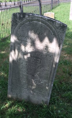
| Description | : | John married Mary Jackson, probably before 1820. He was a laborer and perhaps farmer in Aura, Franklin/Clayton Twp., Gloucester Co., NJ. He died between Apr. 1851, when his wife purchased property in Franklin Twp., and Apr. 1857, when he is referred to as "the late John Groff" in a land record. |
frequently asked questions (FAQ):
-
Where is John Groff's memorial?
John Groff's memorial is located at: Aura Methodist Cemetery, Aura, Gloucester County, USA.
-
When did John Groff death?
John Groff death on unknown in
-
Where are the coordinates of the John Groff's memorial?
Latitude: 39.6725006
Longitude: -75.1374969
Family Members:
Spouse
Children

Flowers:


Nearby Cemetories:
1. Land Of Canaan Cemetery
Glassboro, Gloucester County, USA
Coordinate: 39.6741982, -75.1085968
2. Gloucester County Veterans Memorial Cemetery
Williamstown, Gloucester County, USA
Coordinate: 39.6521279, -75.1163586
3. Hardingville Cemetery
Hardingville, Gloucester County, USA
Coordinate: 39.6632100, -75.1790400
4. Trinity Bible Cemetery
Glassboro, Gloucester County, USA
Coordinate: 39.7003610, -75.1133800
5. Saint Bridgets Cemetery
Glassboro, Gloucester County, USA
Coordinate: 39.7023300, -75.1159000
6. First United Methodist Church Cemetery
Glassboro, Gloucester County, USA
Coordinate: 39.7068900, -75.1081300
7. Saint Thomas Episcopal Church Cemetery
Glassboro, Gloucester County, USA
Coordinate: 39.7079200, -75.1101500
8. Cedar Green Cemetery
Clayton, Gloucester County, USA
Coordinate: 39.6613998, -75.0852966
9. Manahath Cemetery
Glassboro, Gloucester County, USA
Coordinate: 39.7154236, -75.1141129
10. Chickory Chapel Cemetery
Gloucester County, USA
Coordinate: 39.6244011, -75.1318970
11. Richwood United Methodist Church Cemetery
Richwood, Gloucester County, USA
Coordinate: 39.7211100, -75.1667700
12. Cost Family Cemetery
Pitman, Gloucester County, USA
Coordinate: 39.7307100, -75.1332310
13. Friendship Methodist Cemetery
Monroeville, Salem County, USA
Coordinate: 39.6219101, -75.1827240
14. Downer United Methodist Church Cemetery
Williamstown, Gloucester County, USA
Coordinate: 39.6929700, -75.0523200
15. Chestnut Grove Cemetery
Elmer, Salem County, USA
Coordinate: 39.6049995, -75.1766968
16. Hillcrest Memorial Park
Hurffville, Gloucester County, USA
Coordinate: 39.7491989, -75.1110992
17. Franklinville African Methodist Episcopal Cemetery
Gloucester County, USA
Coordinate: 39.6138500, -75.0666600
18. Bunker Hill Presbyterian Church Cemetery
Gloucester County, USA
Coordinate: 39.7451600, -75.0849200
19. Mount Zion Methodist Church Cemetery
Barnsboro, Gloucester County, USA
Coordinate: 39.7547540, -75.1629530
20. Bethel Methodist Church Cemetery
Hurffville, Gloucester County, USA
Coordinate: 39.7571983, -75.1110992
21. Mullica Hill Friends Cemetery
Mullica Hill, Gloucester County, USA
Coordinate: 39.7315712, -75.2244415
22. Trinity United Methodist Church Cemetery
Mullica Hill, Gloucester County, USA
Coordinate: 39.7320251, -75.2273941
23. Mullica Hill Baptist Cemetery
Mullica Hill, Gloucester County, USA
Coordinate: 39.7337837, -75.2258377
24. Driver Cemetery
Barnsboro, Gloucester County, USA
Coordinate: 39.7631000, -75.1554900