| Birth | : | 7 Apr 1791 Davidson County, North Carolina, USA |
| Death | : | 10 May 1856 Washington County, Indiana, USA |
| Burial | : | Wright Cemetery, Carroll County, USA |
| Coordinate | : | 38.6699500, -85.2586200 |
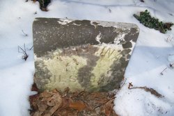
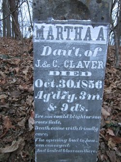
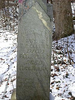
| Inscription | : | John Consort of Christenah Claver Died May 10, 1856 Ag'd 65y.1m.3d. A loving husband a father dear, A faithful friend is buried here. |
| Description | : | John was born in what was Rowan County at the time of his birth, but is now in Davidson County, NC. He was the son of John Claver/Clafer (who was the son of George Baltas Claver, AKA Jerrik/Yearik Baltas Kleber) and Maria Magaretha Moser, daughter of Anthony Moser and Margaret Beck. Married first: Polly Rough on 28 July 1813 in North Carolina. Polly (b 15 Oct 1795; d btween 1836 and 1847 in Washington Co., Indiana) was the daughter of John Rough and Suzannah Smithers. Children of John and Polly: William Hernry Claver, John Lewis Claver, Camelia Franklin Claver, Charles August Claver,... Read More |
frequently asked questions (FAQ):
-
Where is John M. Claver's memorial?
John M. Claver's memorial is located at: Wright Cemetery, Carroll County, USA.
-
When did John M. Claver death?
John M. Claver death on 10 May 1856 in Washington County, Indiana, USA
-
Where are the coordinates of the John M. Claver's memorial?
Latitude: 38.6699500
Longitude: -85.2586200
Family Members:
Parent
Spouse
Children
Flowers:
Nearby Cemetories:
1. Wright Cemetery
Carroll County, USA
Coordinate: 38.6699500, -85.2586200
2. Spillman Cemetery
Carroll County, USA
Coordinate: 38.6701200, -85.2582700
3. Taylor Cemetery
Carroll County, USA
Coordinate: 38.6778900, -85.2533500
4. Kings Ridge Cemetery
Carroll County, USA
Coordinate: 38.6738740, -85.2324670
5. Coghill Cemetery
Carrollton, Carroll County, USA
Coordinate: 38.6604500, -85.2280130
6. King-Bradley Cemetery
Carroll County, USA
Coordinate: 38.6953570, -85.2833410
7. Cull Cemetery
Carrollton, Carroll County, USA
Coordinate: 38.6953700, -85.2893260
8. Mound Hill Cemetery
Carrollton, Carroll County, USA
Coordinate: 38.6570600, -85.2028500
9. May Cemetery
Carroll County, USA
Coordinate: 38.6461560, -85.2047790
10. Gale Cemetery
Brooksburg, Jefferson County, USA
Coordinate: 38.7104170, -85.2236390
11. McKay Cemetery #1
Brooksburg, Jefferson County, USA
Coordinate: 38.7065800, -85.2120790
12. Armstrong Cemetery
Brooksburg, Jefferson County, USA
Coordinate: 38.7172650, -85.2298910
13. Vaughn Cemetery
Jefferson County, USA
Coordinate: 38.7191944, -85.2338889
14. Young Cemetery
Carroll County, USA
Coordinate: 38.7232870, -85.2594270
15. Hunters Bottom Cemetery
Locust, Carroll County, USA
Coordinate: 38.7262700, -85.2802930
16. Morris Chapel Cemetery
Brooksburg, Jefferson County, USA
Coordinate: 38.7253720, -85.2328910
17. Ash Cemetery
Lamb, Switzerland County, USA
Coordinate: 38.6939180, -85.1891040
18. Methodist Church Cemetery
Carrollton, Carroll County, USA
Coordinate: 38.6805190, -85.1821880
19. City Cemetery
Carrollton, Carroll County, USA
Coordinate: 38.6781600, -85.1815260
20. Sample Family Farm Cemetery
Lamb, Switzerland County, USA
Coordinate: 38.7050180, -85.1936290
21. Saint Johns Cemetery
Carrollton, Carroll County, USA
Coordinate: 38.6769000, -85.1786900
22. Hunters Bottom Cemetery (Defunct)
Carrollton, Carroll County, USA
Coordinate: 38.7332360, -85.2800640
23. Cain Cemetery
Lamb, Switzerland County, USA
Coordinate: 38.6918280, -85.1764990
24. Giltner Cemetery (Defunct)
Carrollton, Carroll County, USA
Coordinate: 38.7261300, -85.3079500


