
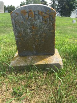

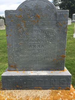
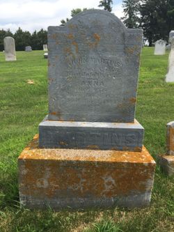
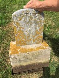
John Martins or Martens
| Birth | : | 8 Apr 1833 Germany |
| Death | : | 16 Jul 1875 Farmersburg, Clayton County, Iowa, USA |
| Burial | : | Garnavillo Cemetery, Garnavillo, Clayton County, USA |
| Coordinate | : | 42.8660300, -91.2390100 |
| Plot | : | 256 ft 6 in from N, 165 ft from E |
| Description | : | Born in Hanover, Germany and immigrated early 1850's. All eight children of John and Anna Martins were born in Clayton County, Iowa and baptized at St. Paul's Lutheran Church in Garnavillo, Iowa. John was injured or became ill in October 1874 and was under medical care until his death. He died durng the time of the Long Depressions from 1873-1879. The property was to be sold through a sheriff's sale by the end of 1876. There were no buyers, so the farm transferred to the mortgager. Records of the estate are at the Elkador Courthouse. The family name in... Read More |
frequently asked questions (FAQ):
-
Where is John Martins or Martens's memorial?
John Martins or Martens's memorial is located at: Garnavillo Cemetery, Garnavillo, Clayton County, USA.
-
When did John Martins or Martens death?
John Martins or Martens death on 16 Jul 1875 in Farmersburg, Clayton County, Iowa, USA
-
Where are the coordinates of the John Martins or Martens's memorial?
Latitude: 42.8660300
Longitude: -91.2390100
Family Members:
Spouse
Children

Flowers:


Nearby Cemetories:
1. Garnavillo Cemetery
Garnavillo, Clayton County, USA
Coordinate: 42.8660300, -91.2390100
2. Garnavillo Community Cemetery
Garnavillo, Clayton County, USA
Coordinate: 42.8656000, -91.2422100
3. Saint Joseph Cemetery
Garnavillo, Clayton County, USA
Coordinate: 42.8628006, -91.2502975
4. McClelland Cemetery
Garnavillo, Clayton County, USA
Coordinate: 42.8249879, -91.2084641
5. Pioneer Rock Cemetery
Ceres, Clayton County, USA
Coordinate: 42.8230591, -91.1863937
6. Clayton Center Cemetery
Clayton Center, Clayton County, USA
Coordinate: 42.8841705, -91.3225021
7. Zion Lutheran Cemetery
Clayton Center, Clayton County, USA
Coordinate: 42.8841705, -91.3249969
8. Clayton Cemetery
Clayton, Clayton County, USA
Coordinate: 42.9043999, -91.1641998
9. Tangeman Family Cemetery
Garnavillo, Clayton County, USA
Coordinate: 42.8580000, -91.1420000
10. Saint Michael Cemetery
Clayton County, USA
Coordinate: 42.8055992, -91.1802979
11. County Home Cemetery
Clayton Center, Clayton County, USA
Coordinate: 42.8916702, -91.3499985
12. Borcherding Cemetery
Jefferson Township, Clayton County, USA
Coordinate: 42.8182983, -91.1414032
13. Krumm Cemetery
Garber, Clayton County, USA
Coordinate: 42.7913760, -91.3023559
14. Colony Catholic Cemetery (Defunct)
Read Township, Clayton County, USA
Coordinate: 42.8830000, -91.3580000
15. National Cemetery
National, Clayton County, USA
Coordinate: 42.9536018, -91.2902985
16. Harford Cemetery
Wyalusing, Grant County, USA
Coordinate: 42.9401000, -91.1401800
17. Storck Cemetery
Guttenberg, Clayton County, USA
Coordinate: 42.7694335, -91.1834638
18. Saint Paula Cemetery
Osterdock, Clayton County, USA
Coordinate: 42.7635994, -91.1992035
19. Norwegian Church Cemetery
McGregor, Clayton County, USA
Coordinate: 42.9644400, -91.1764100
20. Meenan Cemetery
Communia, Clayton County, USA
Coordinate: 42.7999862, -91.3584693
21. Old Garber Cemetery
Garber, Clayton County, USA
Coordinate: 42.7560005, -91.2580032
22. Bagley Cemetery
Bagley, Grant County, USA
Coordinate: 42.9019012, -91.0907974
23. First Evangelical Lutheran Church Cemetery
McGregor, Clayton County, USA
Coordinate: 42.9718000, -91.1760000
24. Elkader Cemetery
Elkader, Clayton County, USA
Coordinate: 42.8541718, -91.4000015