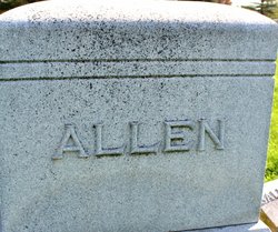
| Birth | : | 1827 |
| Death | : | 24 Apr 1872 Barnard, Nodaway County, Missouri, USA |
| Burial | : | Barnard American Legion Cemetery, Barnard, Nodaway County, USA |
| Coordinate | : | 40.1839600, -94.8173828 |
| Plot | : | Row 10 |
| Inscription | : | Father |
| Description | : | 3/4/2021 - Contributor: Julia Johnson (47176433) added the following information: Suggested edit: "Maryville Republican (Maryville, Missouri), Tuesday, April 30, 1872 --On Thursday last a large delegation of Odd Fellows went from this place to Barnard to attend the funeral of one of their order, Mr. John McFarland, who died in that place on Wednesday, April 24. Mr. McFarland was a well-known resident of this county, being a brother of Samuel McFarland, Esq., of Hopkins." |
frequently asked questions (FAQ):
-
Where is John McFarland's memorial?
John McFarland's memorial is located at: Barnard American Legion Cemetery, Barnard, Nodaway County, USA.
-
When did John McFarland death?
John McFarland death on 24 Apr 1872 in Barnard, Nodaway County, Missouri, USA
-
Where are the coordinates of the John McFarland's memorial?
Latitude: 40.1839600
Longitude: -94.8173828
Family Members:
Spouse
Children
Flowers:
Nearby Cemetories:
1. Barnard American Legion Cemetery
Barnard, Nodaway County, USA
Coordinate: 40.1839600, -94.8173828
2. Barnard Masonic-IOOF Cemetery
Barnard, Nodaway County, USA
Coordinate: 40.1845818, -94.8176727
3. Alumbaugh Cemetery
Barnard, Nodaway County, USA
Coordinate: 40.1843987, -94.8383026
4. Jackson Cemetery
Barnard, Nodaway County, USA
Coordinate: 40.1561012, -94.7842026
5. Baker Cemetery
Barnard, Nodaway County, USA
Coordinate: 40.1660800, -94.8636600
6. Salem Cemetery
Pumpkin Center, Nodaway County, USA
Coordinate: 40.2076721, -94.8683167
7. Sharp Cemetery
Barnard, Nodaway County, USA
Coordinate: 40.2176190, -94.7630450
8. Platte Valley Cemetery
Barnard, Nodaway County, USA
Coordinate: 40.1413994, -94.7692032
9. Litts Cemetery
Whitecloud, Nodaway County, USA
Coordinate: 40.1377983, -94.8756027
10. Pleasant Grove Cemetery
Pumpkin Center, Nodaway County, USA
Coordinate: 40.2188110, -94.8918610
11. Graves Cemetery
Guilford, Nodaway County, USA
Coordinate: 40.1730995, -94.7276764
12. Bolckow Cemetery
Bolckow, Andrew County, USA
Coordinate: 40.1131210, -94.8142929
13. Weathermon Cemetery
Guilford, Nodaway County, USA
Coordinate: 40.1683998, -94.7240829
14. Upper Neely Grove Cemetery
Bolckow, Andrew County, USA
Coordinate: 40.1083488, -94.7961807
15. Groves Cemetery
Guilford, Nodaway County, USA
Coordinate: 40.1567001, -94.7221985
16. Talbott Family Cemetery
Arkoe, Nodaway County, USA
Coordinate: 40.2639084, -94.8416748
17. Swinford Cemetery
Barnard, Nodaway County, USA
Coordinate: 40.2570190, -94.7569427
18. White Cloud Cemetery
Arkoe, Nodaway County, USA
Coordinate: 40.2656700, -94.8940500
19. Walnut Grove Methodist Cemetery
Andrew County, USA
Coordinate: 40.0967598, -94.7518311
20. Bethany Christian Church Cemetery
Graham, Nodaway County, USA
Coordinate: 40.1585388, -94.9461365
21. Swan Chapel Cemetery
Graham, Nodaway County, USA
Coordinate: 40.2449417, -94.9421692
22. Cox Cemetery
Maryville, Nodaway County, USA
Coordinate: 40.2833390, -94.8923790
23. Saint Columba Cemetery
Conception, Nodaway County, USA
Coordinate: 40.2431107, -94.6842957
24. Centenary Cemetery
Graham, Nodaway County, USA
Coordinate: 40.1293907, -94.9546204


