
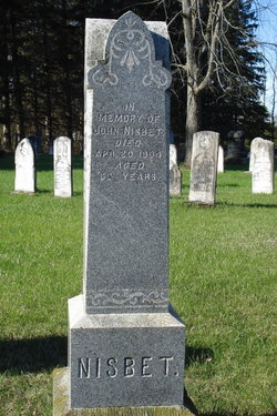

John Nisbet
| Birth | : | 1834 |
| Death | : | 20 Apr 1904 |
| Burial | : | Hucknall Cemetery, Hucknall, Ashfield District, England |
| Coordinate | : | 53.0293427, -1.1988190 |
| Plot | : | 33 |
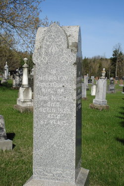
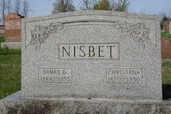
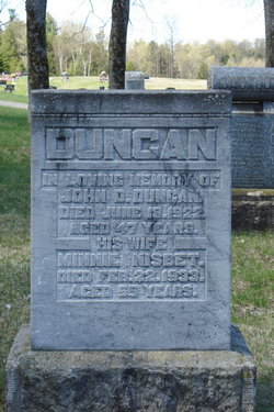
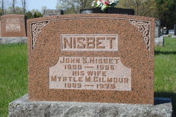
| Description | : | Son of William Nisbet & Christina Lindsay. Husband of Agnes Duncan. ----------------------------------- Plot 33 : (side 1 of stone) - In memory of Agnes Duncan, wife of John Nisbet, died Oct.5,1927, aged 87 years (side 2 of stone) - In memory of John Nisbet, died Apr.20,1904, aged 69 years. ----------------------------------- Death - Lanark Era - May 18, 1904 - At McDonald's Corners, Wednesday, April 20th, John Nisbet, aged 69 years. |
frequently asked questions (FAQ):
-
Where is John Nisbet's memorial?
John Nisbet's memorial is located at: Hucknall Cemetery, Hucknall, Ashfield District, England.
-
When did John Nisbet death?
John Nisbet death on 20 Apr 1904 in
-
Where are the coordinates of the John Nisbet's memorial?
Latitude: 53.0293427
Longitude: -1.1988190
Family Members:
Spouse
Children


Flowers:


Nearby Cemetories:
1. Hucknall Cemetery
Hucknall, Ashfield District, England
Coordinate: 53.0293427, -1.1988190
2. St. Mary Magdalene Churchyard
Hucknall, Ashfield District, England
Coordinate: 53.0390630, -1.2058330
3. St. James Churchyard
Papplewick, Gedling Borough, England
Coordinate: 53.0582060, -1.1872990
4. Northern Cemetery
Bulwell, Nottingham Unitary Authority, England
Coordinate: 52.9979840, -1.2077900
5. Newstead Hucknall Road Cemetery
Newstead, Gedling Borough, England
Coordinate: 53.0651470, -1.2298350
6. Redhill Cemetery
Arnold, Nottingham Unitary Authority, England
Coordinate: 53.0066910, -1.1382950
7. St. Mary the Virgin Churchyard
Newstead, Gedling Borough, England
Coordinate: 53.0688200, -1.2273000
8. St. Mary's Churchyard
Greasley, Broxtowe Borough, England
Coordinate: 53.0201100, -1.2720500
9. All Saints Churchyard
Annesley, Ashfield District, England
Coordinate: 53.0662300, -1.2501190
10. Newstead Abbey
Newstead, Gedling Borough, England
Coordinate: 53.0783450, -1.1931120
11. St. Leodegarius Churchyard
Old Basford, Nottingham Unitary Authority, England
Coordinate: 52.9794240, -1.1778650
12. Basford Cemetery
Old Basford, Nottingham Unitary Authority, England
Coordinate: 52.9799700, -1.1725900
13. Annesley and Felley
Annesley, Ashfield District, England
Coordinate: 53.0771910, -1.2407140
14. St. John's Carrington Churchyard
Nottingham, Nottingham Unitary Authority, England
Coordinate: 52.9755350, -1.1506790
15. All Saints Church
Strelley, Broxtowe Borough, England
Coordinate: 52.9737900, -1.2470340
16. St. Mary's Churchyard
Eastwood, Broxtowe Borough, England
Coordinate: 53.0166227, -1.3084371
17. Kingsway New Cemetery
Kirkby-in-Ashfield, Ashfield District, England
Coordinate: 53.0917070, -1.2422500
18. Eastwood Cemetery
Eastwood, Broxtowe Borough, England
Coordinate: 53.0115814, -1.3073300
19. Nottingham Church Cemetery
Nottingham, Nottingham Unitary Authority, England
Coordinate: 52.9649830, -1.1558070
20. Kingsway Old Cemetery
Kirkby-in-Ashfield, Ashfield District, England
Coordinate: 53.0936690, -1.2427970
21. Hardy Street Jewish Cemetery
Nottingham, Nottingham Unitary Authority, England
Coordinate: 52.9619500, -1.1665900
22. St. Peter Churchyard Old Radford
Nottingham, Nottingham Unitary Authority, England
Coordinate: 52.9601830, -1.1789620
23. Tithe Green Burial Ground
Calverton, Gedling Borough, England
Coordinate: 53.0672540, -1.0949290
24. Nottingham General Cemetery
Nottingham, Nottingham Unitary Authority, England
Coordinate: 52.9575370, -1.1594236