
| Memorials | : | 0 |
| Location | : | Eastwood, Broxtowe Borough, England |
| Coordinate | : | 53.0166227, -1.3084371 |
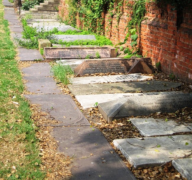
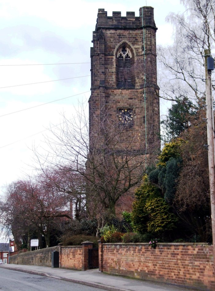
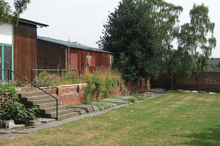
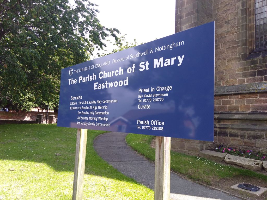
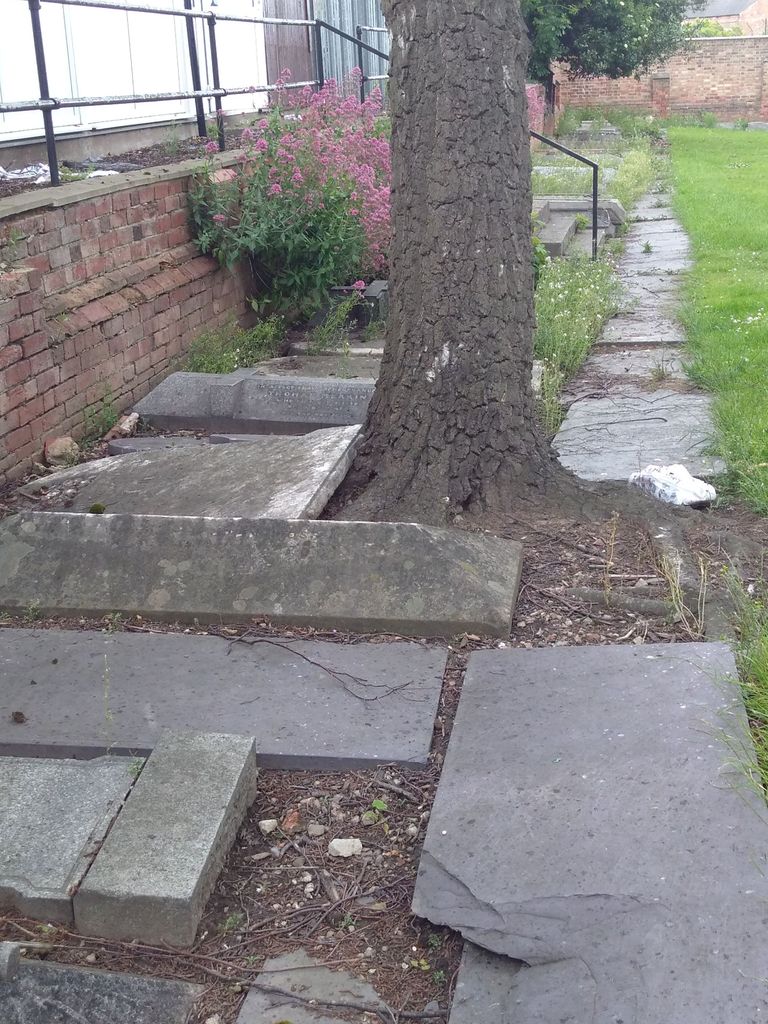
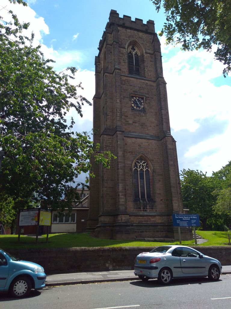
| Description | : | The L-shaped Churchyard covers an area of approximately one acre and is mostly covered with grass and trees. The boundaries to the North, South and East are marked by brick walls approximately four feet high. The boundary to the West is marked by a stone wall of similar height. There are entrances to the churchyard via wrought iron gates in the North, East and West walls. There are tarmac footpaths leading to the Church entrance doors from these gates and around the exterior of the building. After the fire of 1963 and prior to the building of the current Church all... Read More |
frequently asked questions (FAQ):
-
Where is St. Mary's Churchyard?
St. Mary's Churchyard is located at Church Street Eastwood, Broxtowe Borough ,Nottinghamshire , NG316 3 BPEngland.
-
St. Mary's Churchyard cemetery's updated grave count on graveviews.com?
0 memorials
-
Where are the coordinates of the St. Mary's Churchyard?
Latitude: 53.0166227
Longitude: -1.3084371
Nearby Cemetories:
1. Eastwood Cemetery
Eastwood, Broxtowe Borough, England
Coordinate: 53.0115814, -1.3073300
2. St John's Church, Aldercar
Amber Valley Borough, England
Coordinate: 53.0266800, -1.3360000
3. St. Mary's Churchyard
Greasley, Broxtowe Borough, England
Coordinate: 53.0201100, -1.2720500
4. Marlpool Municipal Cemetery
Heanor, Amber Valley Borough, England
Coordinate: 53.0082110, -1.3490550
5. St. Mary's Churchyard
Jacksdale, Ashfield District, England
Coordinate: 53.0577660, -1.3326300
6. Crosshill Cemetery
Codnor, Amber Valley Borough, England
Coordinate: 53.0329710, -1.3764590
7. Holy Trinity Churchyard
Mapperley, Amber Valley Borough, England
Coordinate: 52.9818800, -1.3536800
8. St. James' Churchyard
Codnor, Amber Valley Borough, England
Coordinate: 53.0343350, -1.3772720
9. Park Cemetery
Ilkeston, Erewash Borough, England
Coordinate: 52.9714000, -1.3006350
10. Ilkeston Stanton Road
Ilkeston, Erewash Borough, England
Coordinate: 52.9645800, -1.3077120
11. Christ Church Churchyard
Ironville, Amber Valley Borough, England
Coordinate: 53.0628250, -1.3508600
12. Smalley Baptist Churchyard
Smalley, Amber Valley Borough, England
Coordinate: 52.9968520, -1.3947580
13. All Saints Church
Strelley, Broxtowe Borough, England
Coordinate: 52.9737900, -1.2470340
14. All Saints
Kirk Hallam, Erewash Borough, England
Coordinate: 52.9602950, -1.3188150
15. St. John the Baptist Churchyard
Smalley, Amber Valley Borough, England
Coordinate: 52.9930300, -1.3961360
16. St. Wilfrid Churchyard
West Hallam, Erewash Borough, England
Coordinate: 52.9656640, -1.3579720
17. St Mary the Virgin Churchyard
Denby, Amber Valley Borough, England
Coordinate: 53.0142300, -1.4065600
18. All Saints Churchyard
Stanley Common, Erewash Borough, England
Coordinate: 52.9770772, -1.3834721
19. All Saints Churchyard
Annesley, Ashfield District, England
Coordinate: 53.0662300, -1.2501190
20. St. James's Churchyard
Riddings, Amber Valley Borough, England
Coordinate: 53.0702500, -1.3618710
21. Northern Cemetery
Bulwell, Nottingham Unitary Authority, England
Coordinate: 52.9979840, -1.2077900
22. Ripley Cemetery
Ripley, Amber Valley Borough, England
Coordinate: 53.0457260, -1.4038020
23. St. Mary Magdalene Churchyard
Hucknall, Ashfield District, England
Coordinate: 53.0390630, -1.2058330
24. St. Helen's Churchyard
Trowell, Broxtowe Borough, England
Coordinate: 52.9528120, -1.2815590