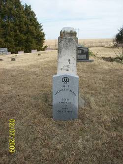
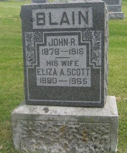
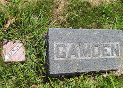
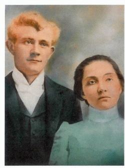
| Birth | : | 8 Jun 1878 Ray County, Missouri, USA |
| Death | : | 10 Jul 1918 Johnson County, Missouri, USA |
| Burial | : | Westview Cemetery, Carrollton, Carroll County, USA |
| Coordinate | : | 40.5663986, -81.0852966 |
| Description | : | son of T. H. Blain & Sarah Role? |
frequently asked questions (FAQ):
-
Where is John Rice Blain's memorial?
John Rice Blain's memorial is located at: Westview Cemetery, Carrollton, Carroll County, USA.
-
When did John Rice Blain death?
John Rice Blain death on 10 Jul 1918 in Johnson County, Missouri, USA
-
Where are the coordinates of the John Rice Blain's memorial?
Latitude: 40.5663986
Longitude: -81.0852966
Family Members:
Parent
Spouse
Siblings
Children
Flowers:
Nearby Cemetories:
1. Westview Cemetery
Carrollton, Carroll County, USA
Coordinate: 40.5663986, -81.0852966
2. Grandview Cemetery
Carrollton, Carroll County, USA
Coordinate: 40.5694008, -81.0828018
3. Immaculate Heart of Mary Cemetery
Carrollton, Carroll County, USA
Coordinate: 40.5758010, -81.0955510
4. Aller Family Cemetery
Carrollton, Carroll County, USA
Coordinate: 40.5879760, -81.0771540
5. Champers Cemetery
Carrollton, Carroll County, USA
Coordinate: 40.5667610, -81.1178540
6. Piecynski Farm Cemetery
Carrollton, Carroll County, USA
Coordinate: 40.5658690, -81.1224020
7. Mount Pleasant Cemetery
Carrollton, Carroll County, USA
Coordinate: 40.5238991, -81.1003036
8. Lee Cemetery
Carroll County, USA
Coordinate: 40.5391998, -81.0314026
9. Pleasant Valley Cemetery
Carroll County, USA
Coordinate: 40.5764008, -81.1493988
10. Wherry Cemetery
Stemple, Carroll County, USA
Coordinate: 40.6156006, -81.1063995
11. Denver George Haddock Family Cemetery
Carrollton, Carroll County, USA
Coordinate: 40.5443880, -81.0227370
12. County Home Cemetery
Carroll County, USA
Coordinate: 40.6175003, -81.0674973
13. Old Scott Cemetery
Carroll County, USA
Coordinate: 40.5483017, -81.1541977
14. McGuire Cemetery
Tabor, Carroll County, USA
Coordinate: 40.5518990, -81.1564026
15. Seceders Cemetery
Carroll County, USA
Coordinate: 40.5332985, -81.1446991
16. Downing Cemetery
Carroll County, USA
Coordinate: 40.5567017, -81.0117035
17. Green Hill Cemetery
Carroll County, USA
Coordinate: 40.5303001, -81.0246964
18. Scotts Cemetery
Carroll County, USA
Coordinate: 40.5386009, -81.1556015
19. Farnsworth Cemetery
Carroll County, USA
Coordinate: 40.5385017, -81.1567001
20. Mount Olivet Cemetery
Carroll County, USA
Coordinate: 40.5905991, -81.0081024
21. Moorehead Cemetery
Carroll County, USA
Coordinate: 40.5449982, -81.0033035
22. Stuller Cemetery
Carroll County, USA
Coordinate: 40.6302986, -81.0513992
23. New Harrisburg Cemetery
New Harrisburg, Carroll County, USA
Coordinate: 40.6208000, -81.1483002
24. Harsh-Swamp Cemetery
Carroll County, USA
Coordinate: 40.6413994, -81.0892029


