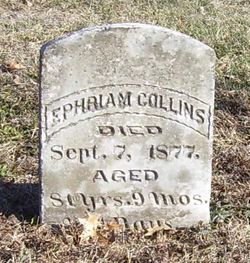
| Birth | : | 1 May 1799 Abbeville County, South Carolina, USA |
| Death | : | 8 Sep 1864 Mount Comfort, Hancock County, Indiana, USA |
| Burial | : | St. Thomas the Apostle Churchyard, Lymington, New Forest District, England |
| Coordinate | : | 50.7576410, -1.5451200 |
| Description | : | John Collins was married two times, his first wife being Elizabeth Seawright (1805-1834). John and Elizabeth had three children, William Franklin M.D. (Doc), Margaret Rebecca and Dunn. After Elizabeth died circa 1834 and John emigrated from near Donalds, South Carolina to Indiana with his motherless children, he met Clarissa Evans, daughter of his friend James Evans, who had just come from the adjoining state of Tennessee. She soon became his wife. They were married August 31, 1837 In Marion County, Indiana. Together they “entered” the land a short distance north of Mt. Comfort and in... Read More |
frequently asked questions (FAQ):
-
Where is John Smith Collins's memorial?
John Smith Collins's memorial is located at: St. Thomas the Apostle Churchyard, Lymington, New Forest District, England.
-
When did John Smith Collins death?
John Smith Collins death on 8 Sep 1864 in Mount Comfort, Hancock County, Indiana, USA
-
Where are the coordinates of the John Smith Collins's memorial?
Latitude: 50.7576410
Longitude: -1.5451200
Family Members:
Parent
Spouse
Siblings
Children
Flowers:
Nearby Cemetories:
1. St. Thomas the Apostle Churchyard
Lymington, New Forest District, England
Coordinate: 50.7576410, -1.5451200
2. Lymington Cemetery
Lymington, New Forest District, England
Coordinate: 50.7576200, -1.5576200
3. St. Mark's Churchyard
Pennington, New Forest District, England
Coordinate: 50.7545700, -1.5631100
4. St Mary Churchyard
South Baddesley, New Forest District, England
Coordinate: 50.7691430, -1.5026160
5. St. John The Baptist Churchyard
Boldre, New Forest District, England
Coordinate: 50.7924070, -1.5422530
6. All Saints Churchyard
Milford-on-Sea, New Forest District, England
Coordinate: 50.7278170, -1.5897770
7. All Saints Churchyard
Hordle, New Forest District, England
Coordinate: 50.7549400, -1.6136200
8. St Luke Churchyard
Sway, New Forest District, England
Coordinate: 50.7839000, -1.6058800
9. Sway Cemetery
Sway, New Forest District, England
Coordinate: 50.7930690, -1.6131930
10. Ashley Baptist Cemetery
New Milton, New Forest District, England
Coordinate: 50.7529200, -1.6336400
11. St Nicholas Churchyard
Brockenhurst, New Forest District, England
Coordinate: 50.8146060, -1.5681240
12. St James Churchyard
Yarmouth, Isle of Wight Unitary Authority, England
Coordinate: 50.7055370, -1.4991890
13. St Paul Churchyard
East Boldre, New Forest District, England
Coordinate: 50.8011710, -1.4693300
14. East Boldre Baptist Chapelyard
East Boldre, New Forest District, England
Coordinate: 50.8044770, -1.4707650
15. Milford Road Cemetery
New Milton, New Forest District, England
Coordinate: 50.7472700, -1.6502700
16. East Boldre Old Chapelyard
East Boldre, New Forest District, England
Coordinate: 50.8100600, -1.4756000
17. St. Swithin's Old Churchyard
Thorley, Isle of Wight Unitary Authority, England
Coordinate: 50.7007450, -1.4815300
18. Beaulieu Cemetery
Beaulieu, New Forest District, England
Coordinate: 50.8046600, -1.4594000
19. St Mary Magdalene Churchyard
New Milton, New Forest District, England
Coordinate: 50.7481200, -1.6645700
20. New Milton Cemetery
New Milton, New Forest District, England
Coordinate: 50.7507690, -1.6650340
21. All Saints Churchyard
Freshwater, Isle of Wight Unitary Authority, England
Coordinate: 50.6843570, -1.5102280
22. St Saviour Roman Catholic Churchyard
Totland, Isle of Wight Unitary Authority, England
Coordinate: 50.6762700, -1.5410390
23. Christ Church Totland Bay
Totland, Isle of Wight Unitary Authority, England
Coordinate: 50.6760770, -1.5448160
24. St Agnes Churchyard
Freshwater, Isle of Wight Unitary Authority, England
Coordinate: 50.6731050, -1.5173550


