
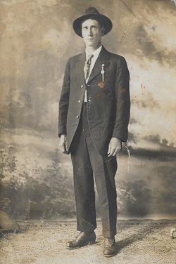
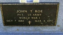

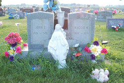
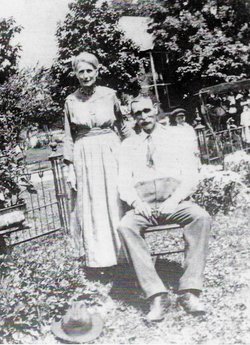
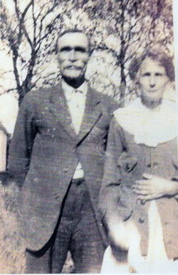
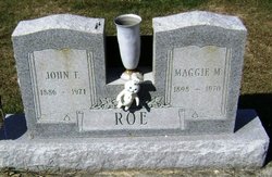
John T. Roe
| Birth | : | 7 Oct 1886 USA |
| Death | : | 4 Mar 1971 USA |
| Burial | : | Bunhill Fields Burial Ground, London Borough of Islington, England |
| Coordinate | : | 51.5236015, -0.0888900 |
| Plot | : | Section G Lot 37 Grave 6 |
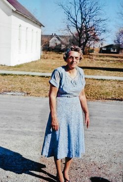
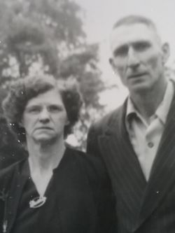
| Description | : | husband of marie, father of ellen, sarah g., helen, lois, john, phillip, rose, jim, jerry, mary, and charles |
frequently asked questions (FAQ):
-
Where is John T. Roe's memorial?
John T. Roe's memorial is located at: Bunhill Fields Burial Ground, London Borough of Islington, England.
-
When did John T. Roe death?
John T. Roe death on 4 Mar 1971 in USA
-
Where are the coordinates of the John T. Roe's memorial?
Latitude: 51.5236015
Longitude: -0.0888900
Family Members:
Parent
Spouse
Siblings
Children

Flowers:


Nearby Cemetories:
1. Bunhill Fields Burial Ground
London Borough of Islington, England
Coordinate: 51.5236015, -0.0888900
2. Wesleys Chapel
London Borough of Islington, England
Coordinate: 51.5237140, -0.0865760
3. Quaker Gardens
London, City of London, England
Coordinate: 51.5239250, -0.0911890
4. Bunhill Fields Quaker Burying Ground
Islington, London Borough of Islington, England
Coordinate: 51.5239250, -0.0911890
5. St Luke Churchyard
St Luke's, London Borough of Islington, England
Coordinate: 51.5251312, -0.0941940
6. Old Church of St. Mary Moorfields (Defunct)
London, City of London, England
Coordinate: 51.5187890, -0.0857140
7. St. Giles Cripplegate Churchyard
London, City of London, England
Coordinate: 51.5187100, -0.0939510
8. St Mary's Moorfields Churchyard
London, City of London, England
Coordinate: 51.5177280, -0.0858980
9. Holywell Priory
Shoreditch, London Borough of Hackney, England
Coordinate: 51.5238050, -0.0785300
10. Plague Grave At Seward Street And Mount Mills
Clerkenwell, London Borough of Islington, England
Coordinate: 51.5259780, -0.0985880
11. Liverpool Street Station
London, City of London, England
Coordinate: 51.5187870, -0.0814920
12. Charthouse Chapel and Churchyard
City of London, England
Coordinate: 51.5209310, -0.0987080
13. Priory of St. Mary of Bethlehem Cemetery
Bishopsgate, City of London, England
Coordinate: 51.5183640, -0.0818180
14. St Clement with St Barnabas and St Matthew
Finsbury, London Borough of Islington, England
Coordinate: 51.5277700, -0.0977600
15. Charterhouse
London Borough of Islington, England
Coordinate: 51.5213890, -0.0997220
16. All Hallows on the Wall Churchyard
London, City of London, England
Coordinate: 51.5165990, -0.0843330
17. St Mary Aldermanbury Churchyard
London, City of London, England
Coordinate: 51.5164830, -0.0930720
18. St Albans Churchyard (Defunct)
London, City of London, England
Coordinate: 51.5166460, -0.0940880
19. St. Leonard Churchyard
Shoreditch, London Borough of Hackney, England
Coordinate: 51.5268230, -0.0773640
20. Guildhall
London, City of London, England
Coordinate: 51.5158200, -0.0911380
21. St Bartholomew the Great Churchyard
London, City of London, England
Coordinate: 51.5189300, -0.0995360
22. St Botolph Church
Bishopsgate, City of London, England
Coordinate: 51.5167080, -0.0816560
23. St. Botholph without Bishopsgate
Finsbury, London Borough of Islington, England
Coordinate: 51.5166840, -0.0815590
24. Austin Friars Churchyard
Broad Street, City of London, England
Coordinate: 51.5155030, -0.0854620