
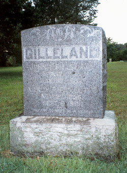
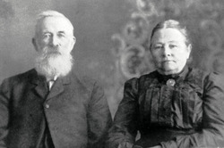
John Thomas Gilleland
| Birth | : | 17 Apr 1832 Olean, Miller County, Missouri, USA |
| Death | : | 30 Jan 1920 Olean, Miller County, Missouri, USA |
| Burial | : | Fruitvale Memorial Cemetery, Fruitvale, Kootenay Boundary Regional District, Canada |
| Coordinate | : | 49.1063200, -117.5487500 |
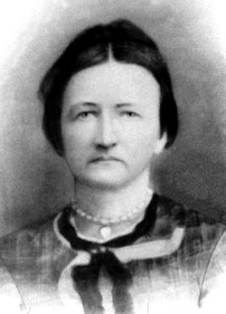
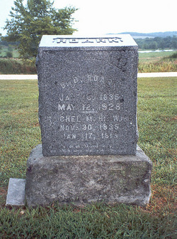
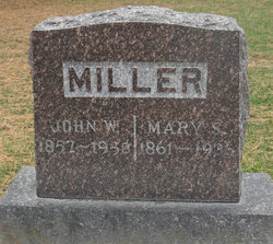
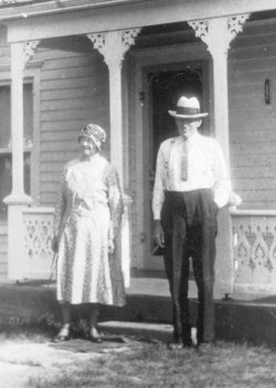
| Description | : | Son of Samuel S. and Mary B. (Welborn) Gilleland, married Nancy Pauline Atkinson, September 17, 1857, Miller County, Missouri. -------------------------------- Unknown Newspaper February 4, 1920 John Thompson Gilleland was born April 17, 1832 and departed this life January 30, 1920 being at the time of his death past 87 years of age. He was born and raised on the farm now owned by Henry Strother near Olean. He entered the land, now owned by Sam Russell and Monroe Gilliland, and built a home there and farmed until 1994 when he sold it to John W. Miller. He had formerly... Read More |
frequently asked questions (FAQ):
-
Where is John Thomas Gilleland's memorial?
John Thomas Gilleland's memorial is located at: Fruitvale Memorial Cemetery, Fruitvale, Kootenay Boundary Regional District, Canada.
-
When did John Thomas Gilleland death?
John Thomas Gilleland death on 30 Jan 1920 in Olean, Miller County, Missouri, USA
-
Where are the coordinates of the John Thomas Gilleland's memorial?
Latitude: 49.1063200
Longitude: -117.5487500
Family Members:
Parent
Spouse

Siblings
Children


Nearby Cemetories:
1. Fruitvale Memorial Cemetery
Fruitvale, Kootenay Boundary Regional District, Canada
Coordinate: 49.1063200, -117.5487500
2. Columbia Riverview Cemetery
Trail, Kootenay Boundary Regional District, Canada
Coordinate: 49.0976200, -117.6678700
3. Pend'Oreille Cemetery
Trail, Kootenay Boundary Regional District, Canada
Coordinate: 49.0064500, -117.6037500
4. Boundary Cemetery
Northport, Stevens County, USA
Coordinate: 48.9974900, -117.6293200
5. Old Trail Cemetery
Trail, Kootenay Boundary Regional District, Canada
Coordinate: 49.0773200, -117.7761000
6. Mountain View Cemetery
Trail, Kootenay Boundary Regional District, Canada
Coordinate: 49.0756500, -117.7818900
7. Columbia Cemetery
Rossland, Kootenay Boundary Regional District, Canada
Coordinate: 49.0798540, -117.7841230
8. Calvary Catholic Cemetery
Rossland, Kootenay Boundary Regional District, Canada
Coordinate: 49.0715700, -117.7931900
9. Ootischenia Cemetery
Ootischenia, Central Kootenay Regional District, Canada
Coordinate: 49.2785350, -117.6401060
10. Salmo Cemetery
Salmo, Central Kootenay Regional District, Canada
Coordinate: 49.1942000, -117.3007400
11. Kinnaird Park Memorial Cemetery
Castlegar, Central Kootenay Regional District, Canada
Coordinate: 49.2874908, -117.6594009
12. Hearn's Hill Mitsunaga Gravesite
Salmo, Central Kootenay Regional District, Canada
Coordinate: 49.1979900, -117.2808600
13. Harvey Gravesite
Pend Oreille County, USA
Coordinate: 48.9555100, -117.3152300
14. Champion Creek Blagodatnoye Cemetery
Castlegar, Central Kootenay Regional District, Canada
Coordinate: 49.3042000, -117.4041900
15. Verigin's Memorial Park
Brilliant, Central Kootenay Regional District, Canada
Coordinate: 49.3193800, -117.6314800
16. Zuckerberg Island
Castlegar, Central Kootenay Regional District, Canada
Coordinate: 49.3157650, -117.6558490
17. Brilliant USCC Cemetery
Castlegar, Central Kootenay Regional District, Canada
Coordinate: 49.3200600, -117.6457710
18. Salmo Doukhobor Cemetery
Salmo, Central Kootenay Regional District, Canada
Coordinate: 49.2307400, -117.2521700
19. Forest Home Cemetery
Northport, Stevens County, USA
Coordinate: 48.8955994, -117.7388992
20. Robson Community Memorial Cemetery
Robson, Central Kootenay Regional District, Canada
Coordinate: 49.3331610, -117.6920910
21. Thrums Doukhobor Cemetery
Castlegar, Central Kootenay Regional District, Canada
Coordinate: 49.3684700, -117.5671860
22. Riverview Cemetery
Northport, Stevens County, USA
Coordinate: 48.8958015, -117.8031006
23. Metaline Cemetery
Metaline, Pend Oreille County, USA
Coordinate: 48.8546295, -117.3930435
24. Ymir Cemetery
Ymir, Central Kootenay Regional District, Canada
Coordinate: 49.2815230, -117.2055080