| Birth | : | 12 Apr 1879 Coffey County, Kansas, USA |
| Death | : | 19 Jul 1953 Burlington, Coffey County, Kansas, USA |
| Burial | : | St Mary's Churchyard, Long Stratton, South Norfolk District, England |
| Coordinate | : | 52.4840800, 1.2339000 |
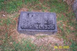
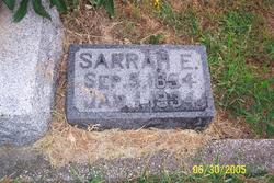
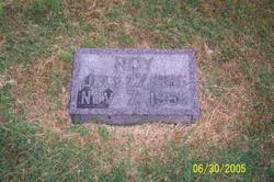
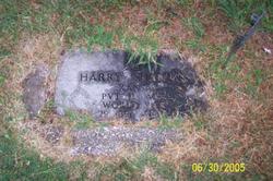
| Description | : | John Thomas Shannon, oldest son of Harvey and Sarah Shannon was born near Burlington, Kansas, April 12, 1879 and passed away at his home in the west part of Burlington July 19, 1953 at 6 a.m., after an illness of more than a year. He was 74 years, three months and seven days at the time of his death. In October, 1952 he underwent a serious operation in St. Elizabeth hospital in Hutchinson and never fully recovered. He was a patient sufferer and never complained. John with his two brothers, Roy and Harry, farmed the Shannon farm four... Read More |
frequently asked questions (FAQ):
-
Where is John Thomas Shannon's memorial?
John Thomas Shannon's memorial is located at: St Mary's Churchyard, Long Stratton, South Norfolk District, England.
-
When did John Thomas Shannon death?
John Thomas Shannon death on 19 Jul 1953 in Burlington, Coffey County, Kansas, USA
-
Where are the coordinates of the John Thomas Shannon's memorial?
Latitude: 52.4840800
Longitude: 1.2339000
Family Members:
Parent
Siblings
Flowers:
Nearby Cemetories:
1. St Mary's Churchyard
Long Stratton, South Norfolk District, England
Coordinate: 52.4840800, 1.2339000
2. Long Stratton Congregational Churchyard
Long Stratton, South Norfolk District, England
Coordinate: 52.4818890, 1.2324460
3. Saint John the Baptist Churchyard
Morningthorpe, South Norfolk District, England
Coordinate: 52.4859170, 1.2654150
4. St. Mary's Churchyard
Shelton, South Norfolk District, England
Coordinate: 52.4720940, 1.2686120
5. St Catherine Churchyard
Fritton, Great Yarmouth Borough, England
Coordinate: 52.4919750, 1.2796600
6. St Peter Churchyard
Forncett, South Norfolk District, England
Coordinate: 52.4906450, 1.1862950
7. Saint Margaret's Churchyard
Hardwick, South Norfolk District, England
Coordinate: 52.4632800, 1.2712440
8. St Mary Churchyard
Forncett, South Norfolk District, England
Coordinate: 52.4994380, 1.1897810
9. St. Michael's Churchyard
Great Moulton, South Norfolk District, England
Coordinate: 52.4718860, 1.1868760
10. St Michael Churchyard
Aslacton, South Norfolk District, England
Coordinate: 52.4750490, 1.1737040
11. St. Margaret Churchyard
Hapton, South Norfolk District, England
Coordinate: 52.5244110, 1.2066410
12. St Margaret Churchyard
Hempnall, South Norfolk District, England
Coordinate: 52.5018500, 1.3004810
13. St Michael And All Saint's
Flordon, South Norfolk District, England
Coordinate: 52.5294700, 1.2261400
14. Methodist Churchyard
Forncett End, South Norfolk District, England
Coordinate: 52.4993440, 1.1545110
15. St. Mary's Churchyard
Saxlingham Nethergate, South Norfolk District, England
Coordinate: 52.5268910, 1.2880390
16. Saint Mary Magdalene Churchyard
Pulham Market, South Norfolk District, England
Coordinate: 52.4285200, 1.2301100
17. Pulham Market Cemetery
Pulham Market, South Norfolk District, England
Coordinate: 52.4281900, 1.2297700
18. Saint Nicholas Churchyard
Fundenhall, South Norfolk District, England
Coordinate: 52.5275430, 1.1717020
19. St Mary's Churchyard
Newton Flotman, South Norfolk District, England
Coordinate: 52.5393520, 1.2617220
20. St. Michael and All Angels Churchyard
Bunwell, South Norfolk District, England
Coordinate: 52.4914460, 1.1296800
21. St Mary the Virgin Churchyard
Pulham St Mary, South Norfolk District, England
Coordinate: 52.4205290, 1.2520380
22. All Saints Churchyard
Ashwellthorpe, South Norfolk District, England
Coordinate: 52.5346560, 1.1638810
23. St Mary Churchyard
Shotesham, South Norfolk District, England
Coordinate: 52.5411110, 1.2985880
24. Carleton Rode Baptist Churchyard
Carleton Rode, South Norfolk District, England
Coordinate: 52.4937320, 1.1185210

