
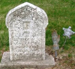
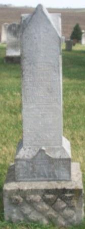
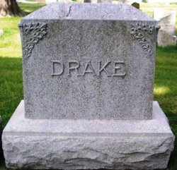
John Tupper Drake
| Birth | : | 1838 Wood County, Ohio, USA |
| Death | : | 14 Jan 1863 Arkansas, USA |
| Burial | : | Ōpōtiki Lawn Cemetery, Ōpōtiki, Ōpōtiki District, New Zealand |
| Coordinate | : | -38.0180870, 177.2882760 |
| Description | : | WPA Iowa Grave Transcriptions: DRAKE, John T. Born: 24 YRS Died: 14 JAN 1863 Cemetery: I.O.O.F. Location: BROOKLYN County: POWESHIEK CO. - IOWA Record Notes: CO. H 28 IA. INF. WIFE-A.M. SUNNING BROOKLYN CHRONICLE 12 DEC 1899 History Poweshiek County, Iowa page 467. John T. the eldest(Isaac Drake & Nancy Swaney)enlisted on the 11th of August 1862, as a member of Company H, 28th Iowa Volunteer Infantry, and on the 24th of August, that year, was united in marriage to Miss A. M. Cunning. He then accompanied his regiment to Helena, Arkansas, where he passed away January 14, 1863. Prior to the Civil War... Read More |
frequently asked questions (FAQ):
-
Where is John Tupper Drake's memorial?
John Tupper Drake's memorial is located at: Ōpōtiki Lawn Cemetery, Ōpōtiki, Ōpōtiki District, New Zealand.
-
When did John Tupper Drake death?
John Tupper Drake death on 14 Jan 1863 in Arkansas, USA
-
Where are the coordinates of the John Tupper Drake's memorial?
Latitude: -38.0180870
Longitude: 177.2882760
Family Members:
Parent

Spouse
Siblings
Flowers:


Nearby Cemetories:
1. Ōpōtiki Lawn Cemetery
Ōpōtiki, Ōpōtiki District, New Zealand
Coordinate: -38.0180870, 177.2882760
2. Old Military Cemetery
Ōpōtiki, Ōpōtiki District, New Zealand
Coordinate: -38.0025964, 177.2851815
3. Woodlands Cemetery
Ōpōtiki, Ōpōtiki District, New Zealand
Coordinate: -38.0305569, 177.2635720
4. Opape Urupā
Ōpōtiki, Ōpōtiki District, New Zealand
Coordinate: -37.9746540, 177.4244230
5. Hillcrest Cemetery
Whakatāne, Whakatāne District, New Zealand
Coordinate: -37.9673630, 177.0136840
6. Ōpihi Whanaunga Kore Urupā
Whakatāne, Whakatāne District, New Zealand
Coordinate: -37.9436107, 177.0046426
7. Domain Road Cemetery
Whakatāne, Whakatāne District, New Zealand
Coordinate: -37.9583600, 176.9840800
8. Ruatoki North Māori Cemetery
Ruatoki North, Whakatāne District, New Zealand
Coordinate: -38.1501100, 177.0073300
9. Pupuaruhe Urupā
Whakatāne, Whakatāne District, New Zealand
Coordinate: -37.9555600, 176.9624100
10. Maraenui Māori Cemetery
Houpoto, Ōpōtiki District, New Zealand
Coordinate: -37.8694900, 177.5849900
11. Ngahina Māori Cemetery
Ruatoki North, Whakatāne District, New Zealand
Coordinate: -38.1736200, 176.9892600
12. Motu Cemetery
Motu, Gisborne District, New Zealand
Coordinate: -38.2477500, 177.5385700
13. Matariu Urupā
Te Teko, Whakatāne District, New Zealand
Coordinate: -38.0390400, 176.8016400
14. Rangiaohia Māori Cemetery
Matatā, Whakatāne District, New Zealand
Coordinate: -37.8905100, 176.7639600
15. Te Kaha Māori Cemetery
Te Kaha, Ōpōtiki District, New Zealand
Coordinate: -37.7262100, 177.6930600
16. Awakaponga Cemetery
Matatā, Whakatāne District, New Zealand
Coordinate: -37.9308200, 176.7465100
17. Howie Family Cemetery
Te Kaha, Ōpōtiki District, New Zealand
Coordinate: -37.7171680, 177.7103060
18. Rakauroa Cemetery
Matawai, Gisborne District, New Zealand
Coordinate: -38.4358900, 177.5711400
19. Kawerau Cemetery
Kawerau, Kawerau District, New Zealand
Coordinate: -38.0990990, 176.6762150
20. White Island Burial Site
Whakatāne District, New Zealand
Coordinate: -37.5241910, 177.1863520
21. Tapuae o te Rangi Urupā
Whatatutu, Gisborne District, New Zealand
Coordinate: -38.3791200, 177.8134180
22. Raukokore Anglican Church Cemetery
Raukokore, Ōpōtiki District, New Zealand
Coordinate: -37.6389240, 177.8785240
23. Murupara-Galatea Cemetery
Galatea, Whakatāne District, New Zealand
Coordinate: -38.4411700, 176.7164800
24. Te Papa Marae Māori Cemetery
Murupara, Whakatāne District, New Zealand
Coordinate: -38.4499600, 176.6989500