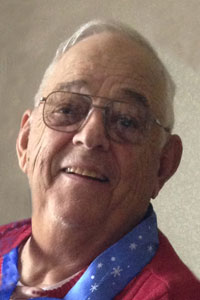
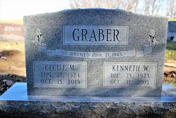
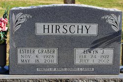
John W Graber
| Birth | : | 8 Apr 1938 |
| Death | : | 15 Mar 2016 |
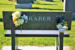
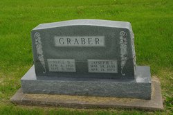
| Burial | : | Green Mound Cemetery, Henry County, USA |
| Coordinate | : | 41.0696983, -91.6652985 |
| Description | : | ohn W. Graber, 76, of the Trenton, Iowa, community, died unexpectedly Tuesday, March 15, 2016, at his home. Born April 8, 1938, in rural Trenton, Iowa, he was a son of the late Joseph Lloyd and Alice Brannon Graber. He also was preceded in death by a brother, Kenneth Graber; and a sister, Esther Hirschy. On Dec. 21, 1995, he married the former Sherry Myers Moser, formerly of Logan County, at the Trenton Missionary Church and she survives, along with four stepchildren, Randy Moser, Ryan (Melissa) Moser and their son, Jayvin, Rodney Moser and Jennifer (Matthew) Harvey, all of Colorado Springs, Colo.;... Read More |
frequently asked questions (FAQ):
-
Where is John W Graber's memorial?
John W Graber's memorial is located at: Green Mound Cemetery, Henry County, USA.
-
When did John W Graber death?
John W Graber death on 15 Mar 2016 in
-
Where are the coordinates of the John W Graber's memorial?
Latitude: 41.0696983
Longitude: -91.6652985
Family Members:
Parent
Siblings
Flowers:
Nearby Cemetories:
1. Green Mound Cemetery
Henry County, USA
Coordinate: 41.0696983, -91.6652985
2. Roth Cemetery
Trenton, Henry County, USA
Coordinate: 41.0515000, -91.6772000
3. Scheffel Family Cemetery
Trenton, Henry County, USA
Coordinate: 41.0539030, -91.6921730
4. Messer Cemetery
Henry County, USA
Coordinate: 41.0419006, -91.6885986
5. Finley Cemetery
Henry County, USA
Coordinate: 41.0913800, -91.6202800
6. White Oak Cemetery
Trenton, Henry County, USA
Coordinate: 41.0293999, -91.6793976
7. Old Baptist Cemetery
Wayland, Henry County, USA
Coordinate: 41.1045000, -91.6209000
8. Alfred Warner Family Burial Ground
Trenton, Henry County, USA
Coordinate: 41.0180520, -91.6909500
9. New Richwoods Cemetery
Trenton, Henry County, USA
Coordinate: 41.0270000, -91.6118000
10. Vorhies Cemetery
Rome, Henry County, USA
Coordinate: 41.0213230, -91.7134810
11. Traxler Cemetery
Mount Pleasant, Henry County, USA
Coordinate: 41.0413500, -91.5922000
12. Richwoods South Cemetery
Henry County, USA
Coordinate: 41.0177000, -91.6115000
13. Nelson Plot
Jefferson County, USA
Coordinate: 41.1243890, -91.7185420
14. Sugar Creek Cemetery
Wayland, Henry County, USA
Coordinate: 41.1347008, -91.6343994
15. Dallner Cemetery
Jefferson County, USA
Coordinate: 41.1047000, -91.7458000
16. Oak Grove Cemetery
Mount Pleasant, Henry County, USA
Coordinate: 41.0323982, -91.5813522
17. Hope Lutheran Cemetery
Germanville, Jefferson County, USA
Coordinate: 41.0943985, -91.7593994
18. Union Free Cemetery
Germanville, Jefferson County, USA
Coordinate: 41.0971000, -91.7585000
19. Pioneer Shively-Neff Cemetery
Wayland, Henry County, USA
Coordinate: 41.1420950, -91.7027100
20. Wayland Methodist Church Cemetery
Wayland, Henry County, USA
Coordinate: 41.1480000, -91.6585000
21. Haynes Cemetery
Wayland, Henry County, USA
Coordinate: 41.1441000, -91.7074000
22. Kurtz Cemetery
Wayland, Henry County, USA
Coordinate: 41.1470000, -91.7071000
23. Cottonwood Cemetery
Coppock, Henry County, USA
Coordinate: 41.1488991, -91.7024994
24. Four Corners German Lutheran Cemetery
Lockridge, Jefferson County, USA
Coordinate: 41.0247002, -91.7605972

