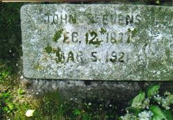
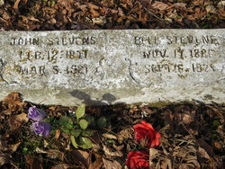
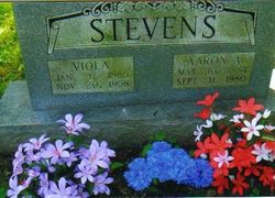
John W. Stevens
| Birth | : | 12 Feb 1877 Onia, Stone County, Arkansas, USA |
| Death | : | 5 Mar 1921 Onia, Stone County, Arkansas, USA |
| Burial | : | Frenchs Forest Cemetery, Davidson, Northern Beaches Council, Australia |
| Coordinate | : | -33.7392360, 151.2020750 |
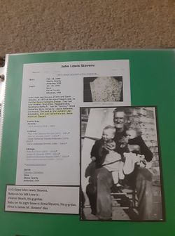
| Description | : | Johnny Stevens was the son of John Lewis Stevens and Nancy Catherine Brewer. At the age of 18, September 19, 1895, he married Martha Louisa Ward. They had five children: Reffie, Nora, George Wilburn, Jewell, and Roy. The 3rd of August 1902, he married Martha's cousin, C. Belle Rorie. They had three children: Arlis, Garland, and Stella. Johnny was fatally shot by Floyd J. Avey. The story is covered in the Batesville Guard (Arkansas), March 12, 1921. |
frequently asked questions (FAQ):
-
Where is John W. Stevens's memorial?
John W. Stevens's memorial is located at: Frenchs Forest Cemetery, Davidson, Northern Beaches Council, Australia.
-
When did John W. Stevens death?
John W. Stevens death on 5 Mar 1921 in Onia, Stone County, Arkansas, USA
-
Where are the coordinates of the John W. Stevens's memorial?
Latitude: -33.7392360
Longitude: 151.2020750
Family Members:
Parent
Spouse
Siblings
Children
Flowers:
Nearby Cemetories:
1. Frenchs Forest Cemetery
Davidson, Northern Beaches Council, Australia
Coordinate: -33.7392360, 151.2020750
2. Church of St. Francis and St. Alban
Gordon, Ku-ring-gai Council, Australia
Coordinate: -33.7563700, 151.1522220
3. St. John's Anglican Church Cemetery
Gordon, Ku-ring-gai Council, Australia
Coordinate: -33.7571060, 151.1519580
4. Northern Suburbs Memorial Gardens and Crematorium
North Ryde, Ryde City, Australia
Coordinate: -33.7954460, 151.1511550
5. Macquarie Park Cemetery and Crematorium
North Ryde, Ryde City, Australia
Coordinate: -33.7937180, 151.1420060
6. Manly Cemetery
Manly, Northern Beaches Council, Australia
Coordinate: -33.7922700, 151.2715000
7. Gore Hill Cemetery
St Leonards, North Sydney Council, Australia
Coordinate: -33.8229500, 151.1887590
8. St. Thomas Rest Park
Crows Nest, North Sydney Council, Australia
Coordinate: -33.8244490, 151.2063050
9. St Aidan's Anglican Church
Longueville, Lane Cove Municipality, Australia
Coordinate: -33.8281510, 151.1709560
10. Mona Vale Cemetery
Mona Vale, Northern Beaches Council, Australia
Coordinate: -33.6752140, 151.2879720
11. Field of Mars Cemetery
East Ryde, Ryde City, Australia
Coordinate: -33.8120030, 151.1246480
12. The Old Man's Valley Cemetery
Hornsby, Hornsby Shire, Australia
Coordinate: -33.6994480, 151.0923970
13. Mary MacKillop Memorial Chapel
North Sydney, North Sydney Council, Australia
Coordinate: -33.8388250, 151.2049160
14. Ryde Baptist Graveyard
Ryde, Ryde City, Australia
Coordinate: -33.8062930, 151.1119180
15. Rawson Park
Mosman, Mosman Municipality, Australia
Coordinate: -33.8350640, 151.2504980
16. Mona Vale Anglican Church
Mona Vale, Northern Beaches Council, Australia
Coordinate: -33.6745924, 151.3031547
17. St Charles Borromeo Cemetery
Ryde, Ryde City, Australia
Coordinate: -33.8188360, 151.1146200
18. Sydney North Head Quarantine Cemetery
Manly, Northern Beaches Council, Australia
Coordinate: -33.8177130, 151.2947000
19. Saint Annes Church Cemetery
Ryde, Ryde City, Australia
Coordinate: -33.8156960, 151.1042650
20. Gladesville Asylum Cemetery
Gladesville, Hunter's Hill Municipality, Australia
Coordinate: -33.8393010, 151.1342490
21. Church Point Historic Cemetery
Church Point, Northern Beaches Council, Australia
Coordinate: -33.6450120, 151.2841090
22. Garden Island
Potts Point, City of Sydney, Australia
Coordinate: -33.8613635, 151.2280308
23. Royal Botanic Gardens
Sydney, City of Sydney, Australia
Coordinate: -33.8647440, 151.2170610
24. Carlingford Anglican Cemetery
Carlingford, City of Parramatta Council, Australia
Coordinate: -33.7833430, 151.0598510

