
| Birth | : | 4 Oct 1796 Virginia, USA |
| Death | : | 11 Sep 1860 Calhoun County, West Virginia, USA |
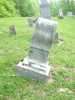
| Burial | : | Bethlehem Cemetery, Grantsville, Calhoun County, USA |
| Coordinate | : | 38.9124985, -81.0841980 |
| Description | : | John and Rachel (Barr) Ball lived in a log house in Calhoun County, (WV) on the site of the Calhoun School. The house was still standing in 1919. In 1847, John's brother McFarland Ball and his wife, Elizabeth, died of typhoid fever, so their four young children came to live with John & Rachel. The [four] children were Martha (Ball) Williamson, born about 1838, Emery Madison Ball 1841–1918, Drusilla Ball 1843 1909 and Sally (Ball) Gainer, born about 1844. --(provided by #48299626) |
frequently asked questions (FAQ):
-
Where is John Wesley Ball's memorial?
John Wesley Ball's memorial is located at: Bethlehem Cemetery, Grantsville, Calhoun County, USA.
-
When did John Wesley Ball death?
John Wesley Ball death on 11 Sep 1860 in Calhoun County, West Virginia, USA
-
Where are the coordinates of the John Wesley Ball's memorial?
Latitude: 38.9124985
Longitude: -81.0841980
Family Members:
Parent
Spouse

Siblings
Children
Flowers:


Nearby Cemetories:
1. Bethlehem Cemetery
Grantsville, Calhoun County, USA
Coordinate: 38.9124985, -81.0841980
2. Betts Cemetery
Calhoun County, USA
Coordinate: 38.9303017, -81.1153030
3. Pleasant Hill Cemetery
Grantsville, Calhoun County, USA
Coordinate: 38.9508018, -81.0627975
4. Saint Paul Cemetery
Grantsville, Calhoun County, USA
Coordinate: 38.8770000, -81.1275000
5. Saint Paul Cemetery
Mount Zion, Calhoun County, USA
Coordinate: 38.8768997, -81.1278000
6. Hunt Cemetery
Bigbend, Calhoun County, USA
Coordinate: 38.9573700, -81.1239100
7. Bethel-Bennett-Burns Cemetery
Grantsville, Calhoun County, USA
Coordinate: 38.9022000, -81.0153000
8. Broomstick Cemetery
Calhoun County, USA
Coordinate: 38.9668999, -81.0911026
9. Mount Zion Cemetery
Grantsville, Calhoun County, USA
Coordinate: 38.8605995, -81.1256027
10. Roling Cemetery
Calhoun County, USA
Coordinate: 38.8521996, -81.0702972
11. Norman Ridge United Methodist Church Cemetery
Calhoun County, USA
Coordinate: 38.9687900, -81.1175100
12. Yoak Cemetery
Five Forks, Calhoun County, USA
Coordinate: 38.9703865, -81.1154938
13. Bennett Cemetery
Calhoun County, USA
Coordinate: 38.8636017, -81.0314026
14. Bryners Chapel Cemetery
Joker, Calhoun County, USA
Coordinate: 38.9033012, -81.1703033
15. Ayers Cemetery
Latonia, Gilmer County, USA
Coordinate: 38.9422222, -81.0058333
16. Taylor Cemetery
Bigbend, Calhoun County, USA
Coordinate: 38.9801760, -81.1199320
17. Big Springs Cemetery
Big Springs, Calhoun County, USA
Coordinate: 38.9850006, -81.0708008
18. Hur Cemetery
Calhoun County, USA
Coordinate: 38.8741989, -81.1686020
19. Knight Cemetery
Big Springs, Calhoun County, USA
Coordinate: 38.9894000, -81.0800000
20. Chestnut Grove Baptist Church Cemetery
Gilmer County, USA
Coordinate: 38.9340420, -80.9885860
21. Nobe Cemetery
Nobe, Calhoun County, USA
Coordinate: 38.9813000, -81.0380300
22. Barr Cemetery
Calhoun County, USA
Coordinate: 38.8274994, -81.0924988
23. Stump Cemetery
Stumptown, Gilmer County, USA
Coordinate: 38.8495000, -81.0030000
24. Trace Fork United Methodist Church Cemetery
Gilmer County, USA
Coordinate: 38.9743580, -81.0005560