
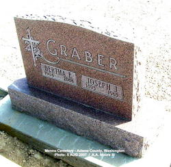
Joseph J. Graber
| Birth | : | 18 Sep 1893 Oregon, USA |
| Death | : | 12 Apr 1965 Grant County, Washington, USA |
| Burial | : | Glasco Cemetery, Glasco, Cloud County, USA |
| Coordinate | : | 39.3574000, -97.8265000 |
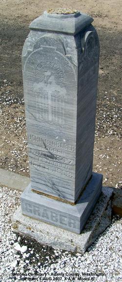
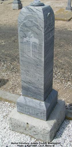
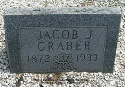
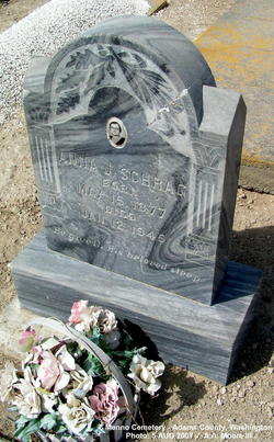
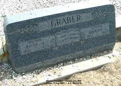
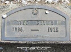
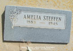
| Description | : | Father: JOHANN C GRABER b: 2 JAN 1848 Mother: MARIA GERING b: 27 MAY 1853 _________________________ 1900 United States Federal Census Name: Joseph J. Graber Home in 1900: Low, Adams Co., Washington Age: 6 Born: Sep 1893 Birthplace: Oregon Relationship to head-of-house: Son Father's name: John S. Mother's name: Mary Race: White Household Members: Name Age John S Graber 53 Mary Graber 48 Jacob J. Graber 28 Adolph J. Graber 15 Theophiles J. Graber 13 Amelia J. Graber 11 Christian J. Graber 9 Joseph J. Graber 6 ___________________ Washington Death Index, 1940-1996 Name: Joseph... Read More |
frequently asked questions (FAQ):
-
Where is Joseph J. Graber's memorial?
Joseph J. Graber's memorial is located at: Glasco Cemetery, Glasco, Cloud County, USA.
-
When did Joseph J. Graber death?
Joseph J. Graber death on 12 Apr 1965 in Grant County, Washington, USA
-
Where are the coordinates of the Joseph J. Graber's memorial?
Latitude: 39.3574000
Longitude: -97.8265000
Family Members:
Parent
Spouse

Siblings
Flowers:


Nearby Cemetories:
1. Glasco Cemetery
Glasco, Cloud County, USA
Coordinate: 39.3574000, -97.8265000
2. Saint Marys Catholic Cemetery
Glasco, Cloud County, USA
Coordinate: 39.3574000, -97.8245000
3. Simpson Cemetery
Simpson, Mitchell County, USA
Coordinate: 39.3633003, -97.9471970
4. Bethel Cemetery
Meredith Township, Cloud County, USA
Coordinate: 39.3506000, -97.7029000
5. Delphos Cemetery
Delphos, Ottawa County, USA
Coordinate: 39.2778015, -97.7416992
6. Saint Paul Cemetery
Delphos, Ottawa County, USA
Coordinate: 39.2677994, -97.7518997
7. Asherville Cemetery
Asherville, Mitchell County, USA
Coordinate: 39.4205000, -97.9672900
8. Morrison Cemetery
Center Township, Cloud County, USA
Coordinate: 39.4817009, -97.7975006
9. Summit Cemetery
Jamestown, Cloud County, USA
Coordinate: 39.4813200, -97.8628800
10. Green Mound Cemetery
Asherville, Mitchell County, USA
Coordinate: 39.3203011, -97.9858017
11. Coursen Grove Cemetery
Simpson, Mitchell County, USA
Coordinate: 39.3060989, -97.9792023
12. Hall Cemetery
Cloud County, USA
Coordinate: 39.4455986, -97.7033005
13. Saint Peters Cemetery
Miltonvale, Cloud County, USA
Coordinate: 39.3652350, -97.6483570
14. Bell-Bogardus Cemetery
Asherville, Mitchell County, USA
Coordinate: 39.4242410, -97.9919970
15. Bohemian National Cemetery
Ada, Ottawa County, USA
Coordinate: 39.2193870, -97.9054030
16. Wilcox Cemetery
Cloud County, USA
Coordinate: 39.4925003, -97.7313995
17. West Asher Cemetery
Scottsville, Mitchell County, USA
Coordinate: 39.4815000, -97.9661600
18. Baldwin Cemetery
Ottawa County, USA
Coordinate: 39.2061005, -97.9111023
19. Kindel Cemetery
Center Township, Cloud County, USA
Coordinate: 39.4519005, -97.6464005
20. Smith Cemetery
Asherville, Mitchell County, USA
Coordinate: 39.4516690, -98.0098850
21. McBride Cemetery
Beloit, Mitchell County, USA
Coordinate: 39.4808006, -97.9907990
22. Enterprise Cemetery
Cloud County, USA
Coordinate: 39.4230995, -97.6106033
23. Shiloh Cemetery
Beloit, Mitchell County, USA
Coordinate: 39.3574982, -98.0594025
24. Summit Cemetery #3
Macyville, Cloud County, USA
Coordinate: 39.5258330, -97.9194440