
| Birth | : | 9 Sep 1880 Calhoun County, West Virginia, USA |
| Death | : | 23 Feb 1963 Calhoun County, West Virginia, USA |
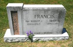
| Burial | : | Bethlehem Cemetery, Grantsville, Calhoun County, USA |
| Coordinate | : | 38.9124985, -81.0841980 |
| Description | : | Joseph was the son of Thomas Austin and Emma Onile Hall Francis. On June 10, 1907 he married Clara Dell Burrows. They were the parents of Glen O., Clay Lee, Ole J., Hall Vance and Gladys Francis. |
frequently asked questions (FAQ):
-
Where is Joseph Lee “Joe” Francis's memorial?
Joseph Lee “Joe” Francis's memorial is located at: Bethlehem Cemetery, Grantsville, Calhoun County, USA.
-
When did Joseph Lee “Joe” Francis death?
Joseph Lee “Joe” Francis death on 23 Feb 1963 in Calhoun County, West Virginia, USA
-
Where are the coordinates of the Joseph Lee “Joe” Francis's memorial?
Latitude: 38.9124985
Longitude: -81.0841980
Family Members:
Parent

Spouse
Siblings
Children
Flowers:


Nearby Cemetories:
1. Bethlehem Cemetery
Grantsville, Calhoun County, USA
Coordinate: 38.9124985, -81.0841980
2. Betts Cemetery
Calhoun County, USA
Coordinate: 38.9303017, -81.1153030
3. Pleasant Hill Cemetery
Grantsville, Calhoun County, USA
Coordinate: 38.9508018, -81.0627975
4. Saint Paul Cemetery
Grantsville, Calhoun County, USA
Coordinate: 38.8770000, -81.1275000
5. Saint Paul Cemetery
Mount Zion, Calhoun County, USA
Coordinate: 38.8768997, -81.1278000
6. Hunt Cemetery
Bigbend, Calhoun County, USA
Coordinate: 38.9573700, -81.1239100
7. Bethel-Bennett-Burns Cemetery
Grantsville, Calhoun County, USA
Coordinate: 38.9022000, -81.0153000
8. Broomstick Cemetery
Calhoun County, USA
Coordinate: 38.9668999, -81.0911026
9. Mount Zion Cemetery
Grantsville, Calhoun County, USA
Coordinate: 38.8605995, -81.1256027
10. Roling Cemetery
Calhoun County, USA
Coordinate: 38.8521996, -81.0702972
11. Norman Ridge United Methodist Church Cemetery
Calhoun County, USA
Coordinate: 38.9687900, -81.1175100
12. Yoak Cemetery
Five Forks, Calhoun County, USA
Coordinate: 38.9703865, -81.1154938
13. Bennett Cemetery
Calhoun County, USA
Coordinate: 38.8636017, -81.0314026
14. Bryners Chapel Cemetery
Joker, Calhoun County, USA
Coordinate: 38.9033012, -81.1703033
15. Ayers Cemetery
Latonia, Gilmer County, USA
Coordinate: 38.9422222, -81.0058333
16. Taylor Cemetery
Bigbend, Calhoun County, USA
Coordinate: 38.9801760, -81.1199320
17. Big Springs Cemetery
Big Springs, Calhoun County, USA
Coordinate: 38.9850006, -81.0708008
18. Hur Cemetery
Calhoun County, USA
Coordinate: 38.8741989, -81.1686020
19. Knight Cemetery
Big Springs, Calhoun County, USA
Coordinate: 38.9894000, -81.0800000
20. Chestnut Grove Baptist Church Cemetery
Gilmer County, USA
Coordinate: 38.9340420, -80.9885860
21. Nobe Cemetery
Nobe, Calhoun County, USA
Coordinate: 38.9813000, -81.0380300
22. Barr Cemetery
Calhoun County, USA
Coordinate: 38.8274994, -81.0924988
23. Stump Cemetery
Stumptown, Gilmer County, USA
Coordinate: 38.8495000, -81.0030000
24. Trace Fork United Methodist Church Cemetery
Gilmer County, USA
Coordinate: 38.9743580, -81.0005560