| Description |
: |
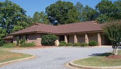
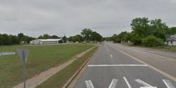
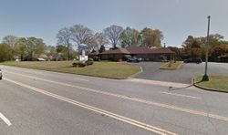
Old Mt. Tabor graveyard was located at 1901 S. Murray Ave., Anderson, S.C., now site of the Saluda Baptist Association office. The Church was moved to 5901 Highway 187 and the new cemetery is there but the old graves were not moved, are still on the hill and under the highway and the old grave markers destroyed.
Born in Virginia in 1724, according to some early biographical accounts, though perhaps confusing him with his father. Apparently there was an old bible at one time in the family giving a 1724 birthdate for Joshua Burris...
Read More
|
Old Mt. Tabor graveyard was located at 1901 S. Murray Ave., Anderson, S.C., now site of the Saluda Baptist Association office. The Church was moved to 5901 Highway 187 and the new cemetery is there but the old graves were not moved, are still on the hill and under the highway and the old grave markers destroyed.
Born in Virginia in 1724, according to some early biographical accounts, though perhaps confusing him with his father. Apparently there was an old bible at one time in the family giving a 1724 birthdate for Joshua Burris (Sr). Many descendants incorrectly give 1724 as the birthdate of Joshua Burriss Jr.
Joshua Burriss married Sarah Chamblee in N.C. and was born circa 1755 according to Ethel Updike's book, The Chamblee, Shirley, Speers Families of the South. If one of their sons was born in 1774 as has been stated, then likely Joshua was born before 1753 at the latest. But if he was 21 in 1768, he was born before 1747.
Other descendants have claimed descent from Anthony Burrows/Burrus (1579-1600), one of the original settlers of Jamestowne. Unsourced family trees show Joshua Burris Sr. (b.1724) was the son of James Jacob Burriss/Burress/Burrus/Burrows/Boroughs (d.1768), son of John Burris (1646-1703), son of John Burrus Sr. (1590-1628), son of Anthony, and maternal ancestors named Woodward, Buck, Beckingham, Travers, Glascocke, Langley, Daughtry, McIlroy, Furr, Collinge, Bebb (Bibb?), Woodbridge, Palifriman. Among others.
Some family historians have claimed that Joshua Burris Sr. was born in Germany and married Elizabeth Brookshire in England. However, this is another mistaken assumption in the Burris(s) family history, of which there have been many.
One Joshua Burras, age 21, "clog maker," was transported from London Oct. 1720, arriving at Annapolis, MD. in May 1721 (ref., "Emigrants in Bondage, 1614-1775") but there is nothing to indicate that the poor immigrant to Annapolis born in 1699 was in any way related to the wealthy planter and slave owner born c1755 in N.C.
Some descendants have stated there were three brothers: James Burris, Joshua Burris, and Solomon Burris (1752-1845).
According to Solomon Burris' affidavit made years later, his family lived in Anson County but about 1776 his father moved to Bertie County. Hertford County was formed from Bertie, Chowan, and Northampton counties in 1759.
James Burress died 1768 in Hertford Co., N.C., and Joshua Burress was the estate administrator. This Joshua Burris (Sr.?) is said by researchers to have died in 1787 (source not stated). The 1768 record is probably the basis for the story of the three brothers, though whether the estate record provides further evidence is unknown. Solomon Burris married Judith Taylor and signed an affidavit on Oct. 3, 1832, in his pension file, stating that he was born in 1752 in Anson Co., N.C., that he was still living there in Anson Co. in 1776 when he enlisted in service, and that his father (not named in the affidavit) moved to Bertie County, taking a family bible with him that contained his birth record. The James Burress who died in Hertford County, 30 miles north of Bertie, may have been Solomon's father rather than brother. Newspaper articles around the turn of the 20th century mention Solomon's grandchildren from N.C. attending the Joshua Burriss family reunion in Anderson, S.C.
A descendant of Solomon Burris who joined the D.A.R. was Eliza L. Efird Whitley(NSDAR 151226), and another descendant had NSDAR number 141517. A book entitled The Whitley families of North Carolina by Walter C. Whitley (1978), p. 78, stated incorrectly: "Solomon Burris … was the first Burris to settle in North Carolina, came here from Germany and England, settled close to Red Cross, 10 miles west of Albemarle Stanly County, N.C. He fought in the Revolutionary War."
Stanly County (NC) Heritage by Stanly Co. Heritage Book Committee, #720: "Solomon Burris was born 12/10/1752, perhaps in Germany [wrong: he clearly stated himself he was born in Anson Co., N.C.], and died 5/21/1845. It is believed he came over with two other brothers from England. Some say it was his father (John Burris, 1735-1783) that came (sic) from Germany with 4 brothers, and that Solomon was born in the U.S."
Sept. 26, 1772, Bertie Co., N.C., Deed Book M: Joshua Burrass and wife Sarah of Bertie deeded to Josiah Mathis (or Matthews) of Hertford 100 acres joining Flatt Swamp, John Perry's (Berry's?) corner, and Joshua Burras' corner. Witnesses: John Speight, Robert Sumner, Thomas Smith. Proven November Court 1775.
November 1775, Bertie Court: Deed of Sale from Joshua Burras and Sarah Burrass to Josia Mathis, by oath of Thomas Smith, one of the subscribing witnesses.
14 Feb 1776
Joshua Burress of Martin Co NC, a planter sold 420 acres called "Pellmell" adj George Mitchell and Jonathan Miller. Wit: Walter William Wynn, Thomas West Whitnall
29 Nov 1779
Joshua Burress of Anson Co NC sold 100 acres on Pee Dee River and Jones Cr adj William Ratcliff and Daniel Murphy. (Order Book 1 p. Bertie Co Deek Bk M, p 255, 277, Book 4 p 22)
1788, Edgecomb Co NC
Sarah Burros was wife of Joshua Burros Nov 28, 1788. (Deed Bk 5, 302)
1797, Anderson County, South Carolina
Joshua Burris "planter" purchased 450 acres of land on waters of Big Generostee Creek; 150 pounds sterling paid for this property.
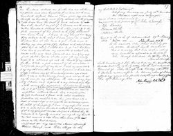
1804 - Anderson Co., S.C.: Will of Joshua Burris dated 3 Jan 1804, probated 4 Feb 1804 (pg 43-44) To Sarah Burress, plantation and lands as long as kept in good repair. When out of repair, John Burress and another good man to be chosen and lands to be sold, if not during her widowhood, his daughters Elizabeth Casselbury (Castleberry) and Nancy Burress to have lands at their mother's decease. Sarah Burress to have stock and furniture. Nancy to have feather bed and furniture. Mary Shamly (Chamblee) to have cow and calf. All property not mentioned to be sold and divided between children. Dated 3 Jan 1804. Witnesses: Elisha Herring, Wm. Herring, John Burress. Executor, John Irving.
The January 3rd will appears to have been a deathbed will, if the family waited the customary thirty days before filing it in court on February 4, 1804. He died Jan. 3 or a couple of days thereafter.
History of the Saluda Baptist Association by T.H. Garrett (1896): Reverend James Burriss, son of the first Joshua Burriss in Pendleton, S.C., descended from the English Boroughs family and thru the Burrisses from eleven (11) maternal English ancestral lines, and these from other English families of numerous names.
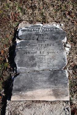
Traditions and History of Anderson County (1928), by Louise Ayer Vandiver, page 146: One of the oldest and most numerous families in the county is that of Burriss, spelled in several different ways, but all of the same blood. The first of the name to come to Anderson county was Joshua, born in Virginia in 1724. He moved to South Carolina in 1776. His wife was Sarah Chamblee, and they lived not far from where Gluck Mill is now located. They were the parents of seven children, all of whom settled on land given them by their father on Generostee Creek. The names of Joshua Burriss' children with the names of the men and women they married are: Elisha married Margaret Greelee; Elizabeth, born 1768, married Asa Castleberry in 1796; James, born 1776, married Susan Cain in 1794; John, born 1776, married Elizabeth Davis in 1796; Mary, born 1778, married Lewis Chamblee in 1798; Thomas, born 1782, married Jane Davis in 1800; Nancy, born 1794, married Silas Massey in 1812. All of these couples left descendants who have intermarried with most of the old families of the community. Many of them have moved away, and in 1906 records had been collected of living people at that time of 1,313 descendants of the original Burriss family; they were then scattered over eleven states, and the work had been only begun. Since that year much has been added to the family history.
Joshua Burriss became a man of wealth. On his arrival in what is now Anderson County, he bought land from James McCarley, and the deed bears the date October 4th, 1795. At one time Joshua Burriss owned as much land as constitutes a township now. His possessions embrace parts of what is now Centerville, Rock Mills, Savannah and Varennes townships. In settling his sons, Mr. Burriss had a method all his own. He placed them up and down Generostee Creek according to their ages. Elisha, the oldest, was placed farthest north, on what was long known as the "Old Byrum Place," now the Anderson Country Club. The next was James, whose home stood near where the Orr Mill is now. He and his wife are buried in the old Mt. Tabor grave yard. John's land was about where the "Old Watson home" is now, the place which belonged to the late Manley Watson. Thomas's land was near Old Rock Mills, and he is buried in an ancient grave yard at that place. His daughters were differently placed. One of them, Mary Chamblee, owned the old Whitner place, which Judge Whitner bought from Moses Chamblee, probably her son.
The original Burriss in this community spelled his name Boroughs, but his sons spelled it Burriss, and in the next generation there were three brothers who spelled it in three different ways. Burriss has, however, come to be the general way of writing the name. [Reprinted in Volume I page 2 of the "Burriss Family Genealogy.]
The Burriss family soon began to own slaves as well as real estate. Among those belonging to Mr. Jacob Burriss was a native African who always insisted upon using a rock for a pillow.
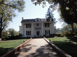
Among the many who have borne the name, William Burriss stands high. He was a son of the pioneer Baptist preacher, Jacob Burriss, who must have been a grandson of the original Joshua. Modest, quiet, unassuming, he yet rose to a prominent and dignified position solely by his sterling character. In a eulogy of him at the time of his death, the late W. W. Keys, editor of The Baptist Courier, whose wife was a relative of Mr. Burriss, said of him in the words of Byron: "Though modest, on his unembarrassed brow nature had written gentleman." His home was not on the public road; it stood about half a mile back on the farm, shut from view by woods sequestered and quiet, a stately building surrounded by luxuriant vegetation, and a plantation well managed and thoroughly worked.
Mr. Burriss married Sarah Moorhead. His family were loyal and prominent members of Salem Church for many years. Mr Burriss served that church as deacon and treasurer for an ordinary lifetime.
While William Burriss attended strictly to his own affairs, he was not indifferent to the just demands of his community, always ready to cooperate in any enterprise that was for the public good. He never sought office of any kind, but was well informed on public affairs. A fine type of citizen, and one who has left an impression on the community in which he passed his life.
Three of his sons became citizens of the town of Anderson, and each showed many of his father's characteristics---gentleness, modesty and kindness being very pronounced in all of them. They were the three brothers, all dead now—Marcus, Rufus and Boyce Burriss.
Ed Hillhouse Jr. wrote the following: "Later in life, Joshua and Sarah Burriss moved to Mount Tabor to be near their son James. Joshua died there in 1804 and was buried in the cemetery there beside his wife, Sarah. (NOTE: Joshua Burriss/Boroughs predeceased his wife.) This cemetery was moved to the First Baptist Church cemetery when the Saluda Association office was built. Their graves are not marked in any way."
NOTE: The old (original) Mt. Tabor graveyard is/was located at 1901 S. Murray Ave., Anderson, S.C., but then called Orr Mills, now the site of the Saluda Baptist Association.
Mt. Tabor Church moved to 5901 Highway 187, Anderson, and the NEW Mt. Tabor cemetery located there.
First Baptist Church, founded by Rev. James Burriss, moved to 307 S Manning Street, Anderson, and his grave marker was moved.there when several of the other markers from the original Old Mt. Tabor Church (Orr Mills) were moved there.
Ed Hillhouse also believed they were among the charter members of Mountain Creek Baptist Church, organized in 1789, although the early records are incomplete. Burriss descendants have been members since 1789 to today, as is Mr. Hillhouse, also a descendant as well as church historian. (Anderson Record, vol. 8, no. 2 (July 1995), (Anderson County Chapter, S.C. Genealogical Society), p. 3: Burriss Family by Ed Hillhouse.)
Maude Burriss Johnston and Lois Watson (d.1947), another early family historian, had written that they were buried in a family cemetery on Joshua's plantation, in graves now lost.
Penne Magnusson Hannum posted online: "He is said to be buried in the Garrison Col. Indep, of Anderson County, SC."
See also BURRISS FAMILY GENEALOGY by Maude Burriss Johnston (1893-1986), et. al., Burriss Family history Committee, 7 volumes (900+ pages). |