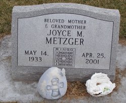
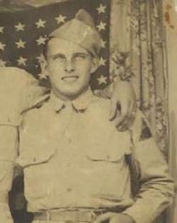
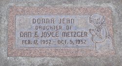
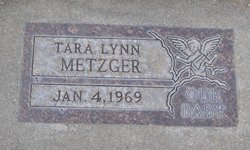
Joyce Mae Hoyt Metzger
| Birth | : | 14 May 1933 Milbank, Grant County, South Dakota, USA |
| Death | : | 25 Apr 2001 Cozad, Dawson County, Nebraska, USA |
| Burial | : | Saint Mary Cemetery, Holden, Worcester County, USA |
| Coordinate | : | 42.3522400, -71.8684200 |
| Description | : | Joyce Hoyt Metzger was born to Lynn and Doris Sauter Hoyt during the Great Depression. She travelled around South Dakota with her parents and younger siblings as they worked the harvests in South Dakota, mainly staying close to Milbank where she, her father, and his mother were born. In the fall of 1941 she and her family came to Cozad to help her aunt and uncle work the harvest for a local farmer that lived north of town. Her parents decided to stay and she attended school in Cozad. She married Daniel Metzger in 1950 and... Read More |
frequently asked questions (FAQ):
-
Where is Joyce Mae Hoyt Metzger's memorial?
Joyce Mae Hoyt Metzger's memorial is located at: Saint Mary Cemetery, Holden, Worcester County, USA.
-
When did Joyce Mae Hoyt Metzger death?
Joyce Mae Hoyt Metzger death on 25 Apr 2001 in Cozad, Dawson County, Nebraska, USA
-
Where are the coordinates of the Joyce Mae Hoyt Metzger's memorial?
Latitude: 42.3522400
Longitude: -71.8684200
Family Members:
Spouse
Children
Flowers:
Nearby Cemetories:
1. Saint Mary Cemetery
Holden, Worcester County, USA
Coordinate: 42.3522400, -71.8684200
2. Grove Cemetery
Holden, Worcester County, USA
Coordinate: 42.3520400, -71.8672700
3. Park Avenue Cemetery
Holden, Worcester County, USA
Coordinate: 42.3514200, -71.8656900
4. Old Burying Ground
Holden, Worcester County, USA
Coordinate: 42.3505800, -71.8626000
5. Saint Francis Episcopal Church Memorial Garden
Holden, Worcester County, USA
Coordinate: 42.3522800, -71.8588700
6. Mooreland Cemetery
Paxton, Worcester County, USA
Coordinate: 42.3280800, -71.9321000
7. Worcester County Memorial Park
Paxton, Worcester County, USA
Coordinate: 42.3245697, -71.9308777
8. Smith Family Cemetery
Rutland, Worcester County, USA
Coordinate: 42.3946064, -71.9231169
9. Paxton Center Cemetery
Paxton, Worcester County, USA
Coordinate: 42.3128900, -71.9277700
10. Rutland Rural Cemetery
Rutland, Worcester County, USA
Coordinate: 42.3790100, -71.9447500
11. High Plains Cemetery
West Boylston, Worcester County, USA
Coordinate: 42.3889008, -71.7972031
12. Mount Vernon Cemetery
West Boylston, Worcester County, USA
Coordinate: 42.3634650, -71.7804030
13. Beaman Cemetery
West Boylston, Worcester County, USA
Coordinate: 42.3649590, -71.7803600
14. South Burying Ground
Princeton, Worcester County, USA
Coordinate: 42.4192009, -71.8957977
15. Old Burial Ground
Rutland, Worcester County, USA
Coordinate: 42.3756000, -71.9578000
16. Legg Cemetery
Sterling, Worcester County, USA
Coordinate: 42.4070020, -71.7986150
17. Elliot Hill Burial Ground
Leicester, Worcester County, USA
Coordinate: 42.2802200, -71.9145500
18. Putnam Farm Cemetery
Rutland, Worcester County, USA
Coordinate: 42.3484010, -71.9771420
19. Worcester Rural Cemetery
Worcester, Worcester County, USA
Coordinate: 42.2803001, -71.8035965
20. Saint Lukes Cemetery
West Boylston, Worcester County, USA
Coordinate: 42.3833008, -71.7568970
21. Adam El-Khishin Meditation Area
Worcester, Worcester County, USA
Coordinate: 42.2755600, -71.8090900
22. West Rutland Cemetery
Rutland, Worcester County, USA
Coordinate: 42.3561970, -71.9897170
23. Quaker Cemetery
Leicester, Worcester County, USA
Coordinate: 42.2635600, -71.8960300
24. Cookshire Cemetery
Sterling, Worcester County, USA
Coordinate: 42.4108500, -71.7734800


