
| Birth | : | 16 Nov 1921 Stockton, Cedar County, Missouri, USA |
| Death | : | 4 Apr 2008 Webb City, Jasper County, Missouri, USA |
| Burial | : | Rosebank Cemetery, Mulberry, Crawford County, USA |
| Coordinate | : | 37.5518990, -94.6194000 |
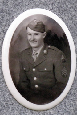
| Description | : | Juanita Mays Rohnke, 86, of Mulberry died at 3:25 a.m. Friday, April 4, 2008 at the Webb City Health and Rehabilitation Center, Webb City, Missouri. Mrs. Rohnke was born November 16, 1921 at Stockton, Missouri the daughter of David Curtis Sayre and Myrtie May (Toliver) Sayre. Mrs. Rohnke was a homemaker who lived in Mulberry most of her life. She was raised at Mulberry and graduated from Mulberry High School in 1940. She worked at Crain Grocery for many years. She married Walter Raymond Mays on March 29, 1941 at Lamar, Missouri. Mr. Mays preceded her in death July 12,... Read More |
frequently asked questions (FAQ):
-
Where is Juanita Sayre Mays Rohnke's memorial?
Juanita Sayre Mays Rohnke's memorial is located at: Rosebank Cemetery, Mulberry, Crawford County, USA.
-
When did Juanita Sayre Mays Rohnke death?
Juanita Sayre Mays Rohnke death on 4 Apr 2008 in Webb City, Jasper County, Missouri, USA
-
Where are the coordinates of the Juanita Sayre Mays Rohnke's memorial?
Latitude: 37.5518990
Longitude: -94.6194000
Family Members:
Parent

Spouse
Siblings
Children
Flowers:


Nearby Cemetories:
1. Rosebank Cemetery
Mulberry, Crawford County, USA
Coordinate: 37.5518990, -94.6194000
2. Smilie Cemetery
Mulberry, Crawford County, USA
Coordinate: 37.5503006, -94.6492004
3. Yale Cemetery
Mindenmines, Barton County, USA
Coordinate: 37.4836900, -94.6155000
4. Franklin Cemetery
Franklin, Crawford County, USA
Coordinate: 37.5135200, -94.7066500
5. Leroy Cemetery
Barton County, USA
Coordinate: 37.6246986, -94.5753021
6. Pleasant Valley Cemetery
Arcadia, Crawford County, USA
Coordinate: 37.6302480, -94.6481540
7. Garden of Memories Cemetery
Washington Township, Crawford County, USA
Coordinate: 37.5078011, -94.7063980
8. Liberal City Cemetery
Liberal, Barton County, USA
Coordinate: 37.5621986, -94.5057983
9. Mindenmines Cemetery
Mindenmines, Barton County, USA
Coordinate: 37.4639381, -94.5913460
10. Arcadia Catholic Cemetery
Arcadia, Crawford County, USA
Coordinate: 37.6441100, -94.6391100
11. Englevale Cemetery
Englevale, Crawford County, USA
Coordinate: 37.5861015, -94.7322006
12. Lone Star Cemetery
Frontenac, Crawford County, USA
Coordinate: 37.4768982, -94.7043991
13. Shirley Cemetery
Frontenac, Crawford County, USA
Coordinate: 37.4768930, -94.7047340
14. Old Arcadia Cemetery
Arcadia, Crawford County, USA
Coordinate: 37.6539001, -94.6271973
15. Shiloh Cemetery
Liberal, Barton County, USA
Coordinate: 37.6455994, -94.5563965
16. Mount Carmel Cemetery
Frontenac, Crawford County, USA
Coordinate: 37.4552994, -94.6789017
17. Frontenac Cemetery
Frontenac, Crawford County, USA
Coordinate: 37.4542007, -94.6766968
18. McGonigle Cemetery
Cato, Crawford County, USA
Coordinate: 37.6264000, -94.7305984
19. Barton City Cemetery
Liberal, Barton County, USA
Coordinate: 37.5774994, -94.4721985
20. Brown Cemetery
Crawford County, USA
Coordinate: 37.6571999, -94.6996994
21. Union Center Cemetery
Crawford County, USA
Coordinate: 37.5292015, -94.7778015
22. Fowler Cemetery
Crawford County, USA
Coordinate: 37.6636009, -94.7011032
23. Trogdon Cemetery
Dry Wood, Crawford County, USA
Coordinate: 37.6618090, -94.7115040
24. Nance Cemetery
Crawford County, USA
Coordinate: 37.6576300, -94.7270400