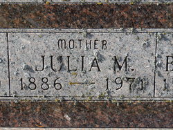
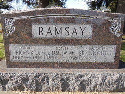
Julia M Trail Anderson
| Birth | : | 4 Oct 1886 Jefferson County, Iowa, USA |
| Death | : | 16 Jun 1971 Fairfield, Jefferson County, Iowa, USA |
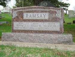
| Burial | : | Evergreen Cemetery, Fairfield, Jefferson County, USA |
| Coordinate | : | 41.0138600, -91.9562100 |
| Plot | : | 2nd.030 |
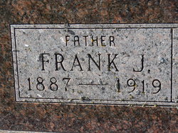
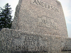
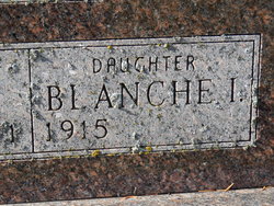
| Description | : | Daughter of William Edward Trail and Amanda Bray Trail/Staats. Married Frank Ramsay on September 10, 1913. They had a daughter, Blanche Irene Ramsay (her obituary uses "Ramsey"). Married to Otis Raymond Anderson in March 1921. The marriage date can be found as March 20 or 30, depending on sources. ------------ Fairfield Ledger Thursday June 17, 1971 Anderson Rites Will Be Friday Mrs. Julia Anderson, 84, long time resident of Jefferson County, died at 2:40 p.m. Wednesday at the Jefferson County Hospital. She had been in failing health the past year. Mrs. Anderson made her home at 50 E. Madison. Services will be Friday at... Read More |
frequently asked questions (FAQ):
-
Where is Julia M Trail Anderson's memorial?
Julia M Trail Anderson's memorial is located at: Evergreen Cemetery, Fairfield, Jefferson County, USA.
-
When did Julia M Trail Anderson death?
Julia M Trail Anderson death on 16 Jun 1971 in Fairfield, Jefferson County, Iowa, USA
-
Where are the coordinates of the Julia M Trail Anderson's memorial?
Latitude: 41.0138600
Longitude: -91.9562100
Family Members:
Parent
Spouse
Siblings
Children
Flowers:
Nearby Cemetories:
1. Evergreen Cemetery
Fairfield, Jefferson County, USA
Coordinate: 41.0138600, -91.9562100
2. Old Fairfield Cemetery
Fairfield, Jefferson County, USA
Coordinate: 41.0148000, -91.9598000
3. Memorial Lawn Cemetery
Fairfield, Jefferson County, USA
Coordinate: 41.0068000, -91.9805000
4. Switzer Cemetery
Fairfield, Jefferson County, USA
Coordinate: 41.0368996, -91.9096985
5. Bradshaw Cemetery
Jefferson County, USA
Coordinate: 40.9766998, -91.9032974
6. Roth Cemetery
Fairfield, Jefferson County, USA
Coordinate: 40.9589005, -91.9574966
7. Bethesda Cemetery
Fairfield, Jefferson County, USA
Coordinate: 41.0019000, -91.8796000
8. Smith Family Cemetery
Libertyville, Jefferson County, USA
Coordinate: 40.9972416, -92.0362857
9. Wheeler Cemetery
Jefferson County, USA
Coordinate: 41.0797000, -91.9185500
10. Galliher Cemetery
Glasgow, Jefferson County, USA
Coordinate: 40.9666892, -91.8835038
11. Upper Richwoods Cemetery
Salina, Jefferson County, USA
Coordinate: 41.0602989, -91.8807983
12. Jefferson County Poor Farm Cemetery
Libertyville, Jefferson County, USA
Coordinate: 40.9416900, -91.9996200
13. Perlee Cemetery
Perlee, Jefferson County, USA
Coordinate: 41.0805750, -91.8993380
14. Pattison Cemetery
Fairfield, Jefferson County, USA
Coordinate: 40.9444008, -91.9049988
15. Moorman Cemetery
Fairfield, Jefferson County, USA
Coordinate: 41.0452995, -92.0622025
16. Wright Cemetery
Fairfield, Jefferson County, USA
Coordinate: 40.9524000, -91.8728000
17. Antioch Cemetery
Fairfield, Jefferson County, USA
Coordinate: 41.1002998, -91.9147034
18. Moyer Cemetery
Fairfield, Jefferson County, USA
Coordinate: 41.1046982, -91.9330978
19. Cumberland Cemetery
Jefferson County, USA
Coordinate: 40.9248000, -91.9903000
20. Gregg Cemetery
Jefferson County, USA
Coordinate: 41.0078011, -92.0811005
21. Salina Cemetery
Salina, Jefferson County, USA
Coordinate: 41.0419006, -91.8330994
22. McCleary Cemetery
Jefferson County, USA
Coordinate: 40.9892006, -92.0805969
23. Brooks Cemetery
Jefferson County, USA
Coordinate: 41.0635986, -92.0693970
24. Thompson Cemetery
Jefferson County, USA
Coordinate: 40.9155998, -91.9772034

