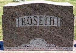
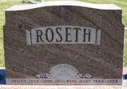
Julius K. Roseth
| Birth | : | 16 Mar 1882 Norway |
| Death | : | 2 May 1955 Pierre, Hughes County, South Dakota, USA |
| Burial | : | Crystal Cemetery, Crystal, Montcalm County, USA |
| Coordinate | : | 43.2347470, -84.9158600 |
| Description | : | Julius K. Roseth, a pioneer resident and prominent rancher of Haakon County, died Monday May 2, 1955, at the St. Mary's Hospital in Pierre after a short illness. Death came suddenly whle he was consulting a doctor at the hospital. On Sunday he and a nephew, John Ostlien, had returned from a fishing trip to the Hills as he was not feeling well. On Monday noon when his condition did not improve, his son, Clarence took him to Pierre where he entered the hospital but was not considered an emergency case. It was during the consultation... Read More |
frequently asked questions (FAQ):
-
Where is Julius K. Roseth's memorial?
Julius K. Roseth's memorial is located at: Crystal Cemetery, Crystal, Montcalm County, USA.
-
When did Julius K. Roseth death?
Julius K. Roseth death on 2 May 1955 in Pierre, Hughes County, South Dakota, USA
-
Where are the coordinates of the Julius K. Roseth's memorial?
Latitude: 43.2347470
Longitude: -84.9158600
Family Members:
Spouse
Children
Flowers:
Nearby Cemetories:
1. Crystal Cemetery
Crystal, Montcalm County, USA
Coordinate: 43.2347470, -84.9158600
2. Burke Cemetery
Carson City, Montcalm County, USA
Coordinate: 43.2196999, -84.8852997
3. Vickeryville Cemetery
Vickeryville, Montcalm County, USA
Coordinate: 43.1917000, -84.9760971
4. Vickeryville Old Order Mennonite Church Cemetery
Vickeryville, Montcalm County, USA
Coordinate: 43.1734880, -84.9342820
5. Carson City Cemetery
Carson City, Montcalm County, USA
Coordinate: 43.1850300, -84.8508400
6. Saint Marys Cemetery
Carson City, Montcalm County, USA
Coordinate: 43.1847600, -84.8508400
7. Spencer Cemetery
Crystal, Montcalm County, USA
Coordinate: 43.2883700, -84.8555700
8. Mount Calm Mennonite Church Cemetery
Carson City, Montcalm County, USA
Coordinate: 43.1801800, -84.8372300
9. Klees Cemetery
Montcalm County, USA
Coordinate: 43.3066340, -84.8607230
10. Bloomer Township Cemetery
Carson City, Montcalm County, USA
Coordinate: 43.1516991, -84.8949966
11. Evergreen Township Cemetery
Sheridan, Montcalm County, USA
Coordinate: 43.2200600, -85.0472300
12. New Haven Township Cemetery
New Haven Center, Gratiot County, USA
Coordinate: 43.2487230, -84.7828580
13. Sumner Cemetery
Sumner, Gratiot County, USA
Coordinate: 43.3139000, -84.8242035
14. Ferris Center Cemetery
Vestaburg, Montcalm County, USA
Coordinate: 43.3438988, -84.9060974
15. Sheridan Cemetery
Sheridan, Montcalm County, USA
Coordinate: 43.2061920, -85.0653030
16. Dalton Cemetery
Carson City, Montcalm County, USA
Coordinate: 43.1202400, -84.9157500
17. Sunny Hill Cemetery
Fenwick, Montcalm County, USA
Coordinate: 43.1319008, -85.0002975
18. Palo Cemetery
Palo, Ionia County, USA
Coordinate: 43.1100000, -84.9380000
19. Roosa Farm Cemetery
Sumner Township, Gratiot County, USA
Coordinate: 43.2922139, -84.7477728
20. Forest Hill Cemetery
Stanton, Montcalm County, USA
Coordinate: 43.2910995, -85.0883026
21. McBride Cemetery
McBride, Montcalm County, USA
Coordinate: 43.3493996, -85.0382996
22. Woodward Cemetery
Hubbardston, Ionia County, USA
Coordinate: 43.0893300, -84.8913600
23. Hubbardston Old Catholic Cemetery
Hubbardston, Ionia County, USA
Coordinate: 43.0908960, -84.8590590
24. Westside Cemetery
Hubbardston, Ionia County, USA
Coordinate: 43.0928001, -84.8506012

