
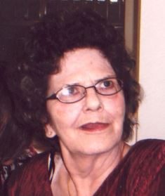
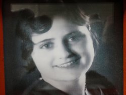
Karen Kay Vetos Eisenbraun
| Birth | : | 12 Apr 1942 Cripple Creek, Teller County, Colorado, USA |
| Death | : | 3 Oct 2013 Rapid City, Pennington County, South Dakota, USA |
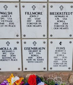
| Burial | : | Scotty Philip Cemetery, Fort Pierre, Stanley County, USA |
| Coordinate | : | 44.4019012, -100.4036026 |
| Description | : | Karen Kay Eisenbraun, 71, died Thursday, Oct. 3, 2013, at Rapid City Regional Hospital. Karen was born April 12, 1942, in Cripple Creek, CO, to Lloyd and Ruby (Board) Vetos. She grew up in Fort Pierre. She graduated in the mid-60's from Cosmetology School in Denver. She married Delbert Eisenbraun on July 20, 1996, in Wall. They lived in Wall and moved to Sturgis in 2009. Karen enjoyed knitting, crocheting, quilting, and her cat Sammy. She especially loved her great-grandchildren. Family includes her husband, Delbert (that never stopped loving her) of Sturgis; a son, John (Kim) Lass, Sioux Falls; daughter, Cindy (Robert) Dennis, Red... Read More |
frequently asked questions (FAQ):
-
Where is Karen Kay Vetos Eisenbraun's memorial?
Karen Kay Vetos Eisenbraun's memorial is located at: Scotty Philip Cemetery, Fort Pierre, Stanley County, USA.
-
When did Karen Kay Vetos Eisenbraun death?
Karen Kay Vetos Eisenbraun death on 3 Oct 2013 in Rapid City, Pennington County, South Dakota, USA
-
Where are the coordinates of the Karen Kay Vetos Eisenbraun's memorial?
Latitude: 44.4019012
Longitude: -100.4036026
Family Members:
Parent

Spouse

Siblings
Flowers:


Nearby Cemetories:
1. Scotty Philip Cemetery
Fort Pierre, Stanley County, USA
Coordinate: 44.4019012, -100.4036026
2. Fort Pierre Chouteau Cemetery
Fort Pierre, Stanley County, USA
Coordinate: 44.3908700, -100.3878300
3. Mount Calvary Cemetery
Pierre, Hughes County, USA
Coordinate: 44.4197006, -100.3557968
4. South Dakota State Capitol Grounds
Pierre, Hughes County, USA
Coordinate: 44.3660100, -100.3448000
5. Cedar Hill Cemetery
Fort Pierre, Stanley County, USA
Coordinate: 44.3356018, -100.3964005
6. Riverside Cemetery
Pierre, Hughes County, USA
Coordinate: 44.3608017, -100.3071976
7. Byron Township Cemetery
Blunt, Hughes County, USA
Coordinate: 44.4979200, -100.1904700
8. Fort Sully Post Cemetery
Sully County, USA
Coordinate: 44.5866480, -100.6087530
9. Meers Cemetery
Stanley County, USA
Coordinate: 44.4116970, -100.7360760
10. Mathews Family Cemetery
Stanley County, USA
Coordinate: 44.1816040, -100.5581080
11. Okobojo Cemetery
Sully County, USA
Coordinate: 44.6568985, -100.3647003
12. Canning Cemetery
Hughes County, USA
Coordinate: 44.3986890, -100.0278460
13. Holy Name Episcopal Cemetery
Fort Pierre, Stanley County, USA
Coordinate: 44.2694960, -100.0357300
14. Holy Name Chapel Cemetery
Fort Pierre, Stanley County, USA
Coordinate: 44.2694292, -100.0356989
15. Pleasant Hill Cemetery
Blunt, Hughes County, USA
Coordinate: 44.5135994, -100.0156021
16. Fort Bennett Post Cemetery
Stanley County, USA
Coordinate: 44.6716500, -100.6404200
17. Immanuel Lutheran Cemetery
Van Metre, Jones County, USA
Coordinate: 44.0958800, -100.7263300
18. Mission Ridge Cemetery
Mission Ridge, Stanley County, USA
Coordinate: 44.6960983, -100.7716980
19. Onida Cemetery
Onida, Sully County, USA
Coordinate: 44.7147000, -100.0650000
20. Chapelle Cemetery
Hughes County, USA
Coordinate: 44.3025017, -99.8653030
21. Holy Faith Cemetery
Lyman County, USA
Coordinate: 44.1356010, -99.9878006
22. Blair Cemetery
Sully County, USA
Coordinate: 44.8027992, -100.4199982
23. Sansarc Cemetery
Hayes, Stanley County, USA
Coordinate: 44.5153008, -101.0342026
24. Draper Cemetery
Draper, Jones County, USA
Coordinate: 43.9322014, -100.5475006