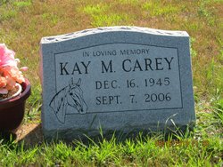
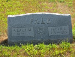
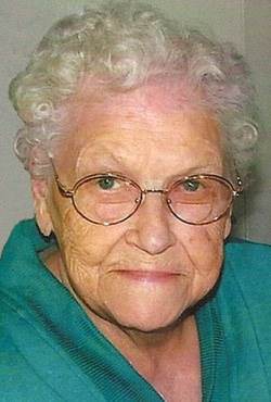
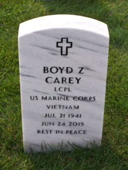
Kay Marie Falk Carey
| Birth | : | 16 Dec 1945 Marietta, Lac qui Parle County, Minnesota, USA |
| Death | : | 7 Sep 2006 Pierre, Hughes County, South Dakota, USA |
| Burial | : | St Michael Churchyard, Kirkham, Fylde Borough, England |
| Coordinate | : | 53.7843570, -2.8709520 |
| Description | : | Kay M Carey, 60, of Pierre, died Thursday, September 7, 2006, Maryhouse, Pierre, SD. Kay Falk was born December 16, 1945 in Marietta, MN to Clarence and Clara (Scotvold) Falk. She graduated from Marietta High School, and attended SDSU for two years. Kay started teaching at a country school near Reliance, and later at St. Joseph's Indian School in Chamberlain. During this time she received her teaching certificate from Dakota Wesleyan in Mitchell. Kay moved to Pierre where she taught at the Pierre Indian Learning Center. Kay loved horses and her family was involved in breeding... Read More |
frequently asked questions (FAQ):
-
Where is Kay Marie Falk Carey's memorial?
Kay Marie Falk Carey's memorial is located at: St Michael Churchyard, Kirkham, Fylde Borough, England.
-
When did Kay Marie Falk Carey death?
Kay Marie Falk Carey death on 7 Sep 2006 in Pierre, Hughes County, South Dakota, USA
-
Where are the coordinates of the Kay Marie Falk Carey's memorial?
Latitude: 53.7843570
Longitude: -2.8709520
Family Members:
Parent
Spouse
Flowers:
Nearby Cemetories:
1. St Michael Churchyard
Kirkham, Fylde Borough, England
Coordinate: 53.7843570, -2.8709520
2. Zion Chapel Cemetery
Kirkham, Fylde Borough, England
Coordinate: 53.7814380, -2.8721260
3. Christ Church Churchyard
Wesham, Fylde Borough, England
Coordinate: 53.7905000, -2.8845600
4. Saint John the Evangelist Churchyard
Kirkham, Fylde Borough, England
Coordinate: 53.7808000, -2.8873870
5. Saint Joseph's Roman Catholic Church
Wesham, Fylde Borough, England
Coordinate: 53.7928600, -2.8871800
6. Quakers Wood Burial Ground
Freckleton, Fylde Borough, England
Coordinate: 53.7652227, -2.8601674
7. Christ Churchyard
Treales, Fylde Borough, England
Coordinate: 53.8045970, -2.8440710
8. St Nicholas Churchyard
Wrea Green, Fylde Borough, England
Coordinate: 53.7772420, -2.9156380
9. Holy Trinity Churchyard
Freckleton, Fylde Borough, England
Coordinate: 53.7543090, -2.8669130
10. St. Anne's Roman Catholic Churchyard
Westby, Fylde Borough, England
Coordinate: 53.7876590, -2.9247000
11. St. John the Evangelist Churchyard
Clifton, Fylde Borough, England
Coordinate: 53.7758600, -2.8158500
12. Parish Church of St. Paul
Warton, Fylde Borough, England
Coordinate: 53.7502621, -2.8932641
13. St Michael Churchyard
Weeton, Fylde Borough, England
Coordinate: 53.7995380, -2.9358020
14. St. Mary's Churchyard
Lea, City of Preston, England
Coordinate: 53.7733810, -2.7942770
15. Elswick Congregational Chapelyard
Elswick, Fylde Borough, England
Coordinate: 53.8378950, -2.8775320
16. Inskip Baptist Churchyard
Inskip with Sowerby, Wyre Borough, England
Coordinate: 53.8353150, -2.8299610
17. Saltcoates Roman Catholic Cemetery
Lytham Saint Annes, Fylde Borough, England
Coordinate: 53.7463000, -2.9448940
18. St. Peters Churchyard
Inskip with Sowerby, Wyre Borough, England
Coordinate: 53.8347100, -2.8175200
19. St Anne Churchyard
Great Eccleston, Wyre Borough, England
Coordinate: 53.8481413, -2.8835925
20. St Anne Churchyard
Singleton, Fylde Borough, England
Coordinate: 53.8379280, -2.9359890
21. St Andrew George Haydock Roman Catholic Churchyard
Cottam, City of Preston, England
Coordinate: 53.7879280, -2.7591570
22. St. Anne's Churchyard
Blackburn, Blackburn with Darwen Unitary Authority, England
Coordinate: 53.8381160, -2.9362870
23. Saint Anne's Church
Woodplumpton, City of Preston, England
Coordinate: 53.8038130, -2.7621940
24. St John the Divine
Lytham Saint Annes, Fylde Borough, England
Coordinate: 53.7367060, -2.9548070


