
| Memorials | : | 6 |
| Location | : | Clifton, Fylde Borough, England |
| Coordinate | : | 53.7758600, -2.8158500 |
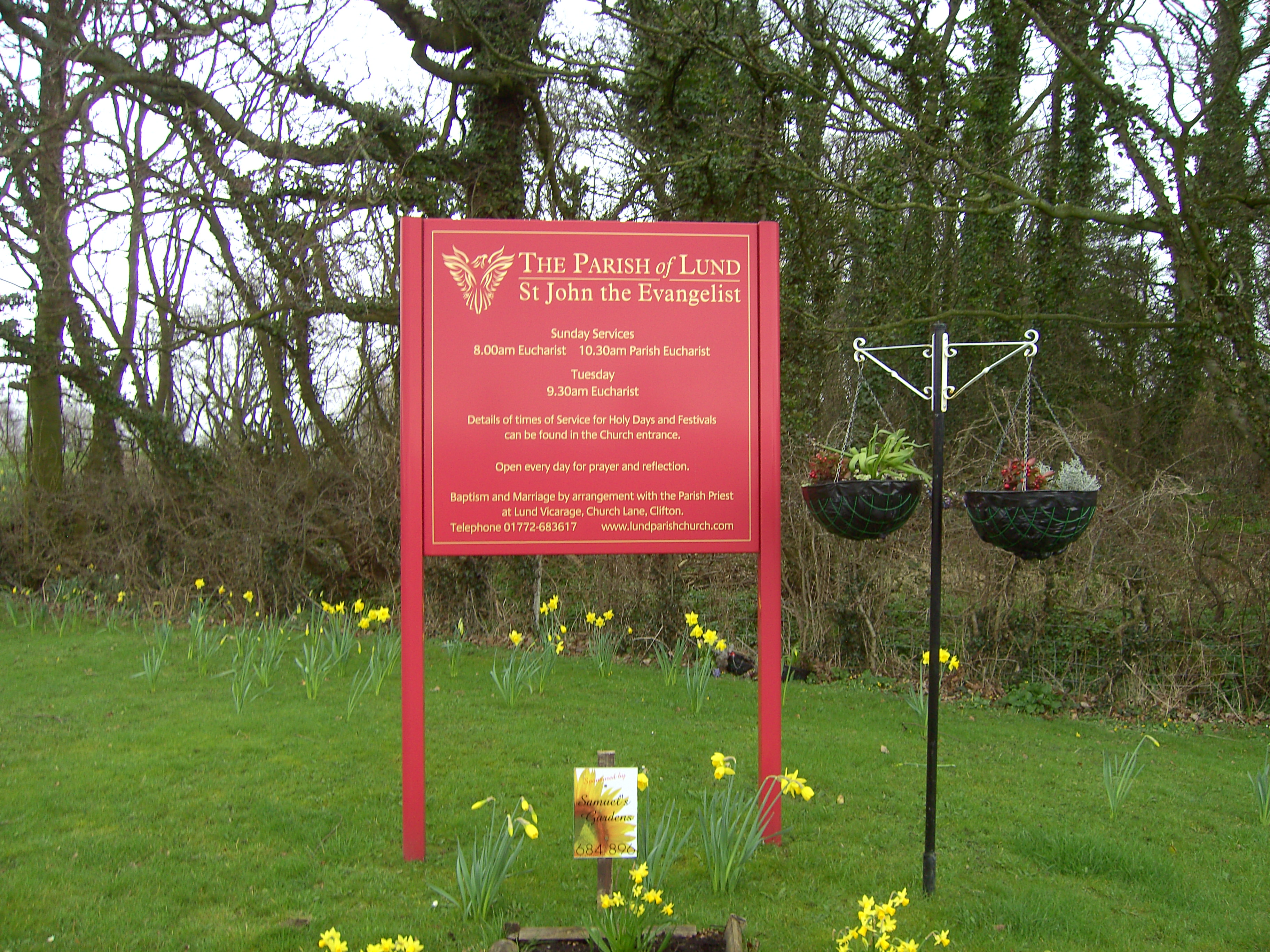
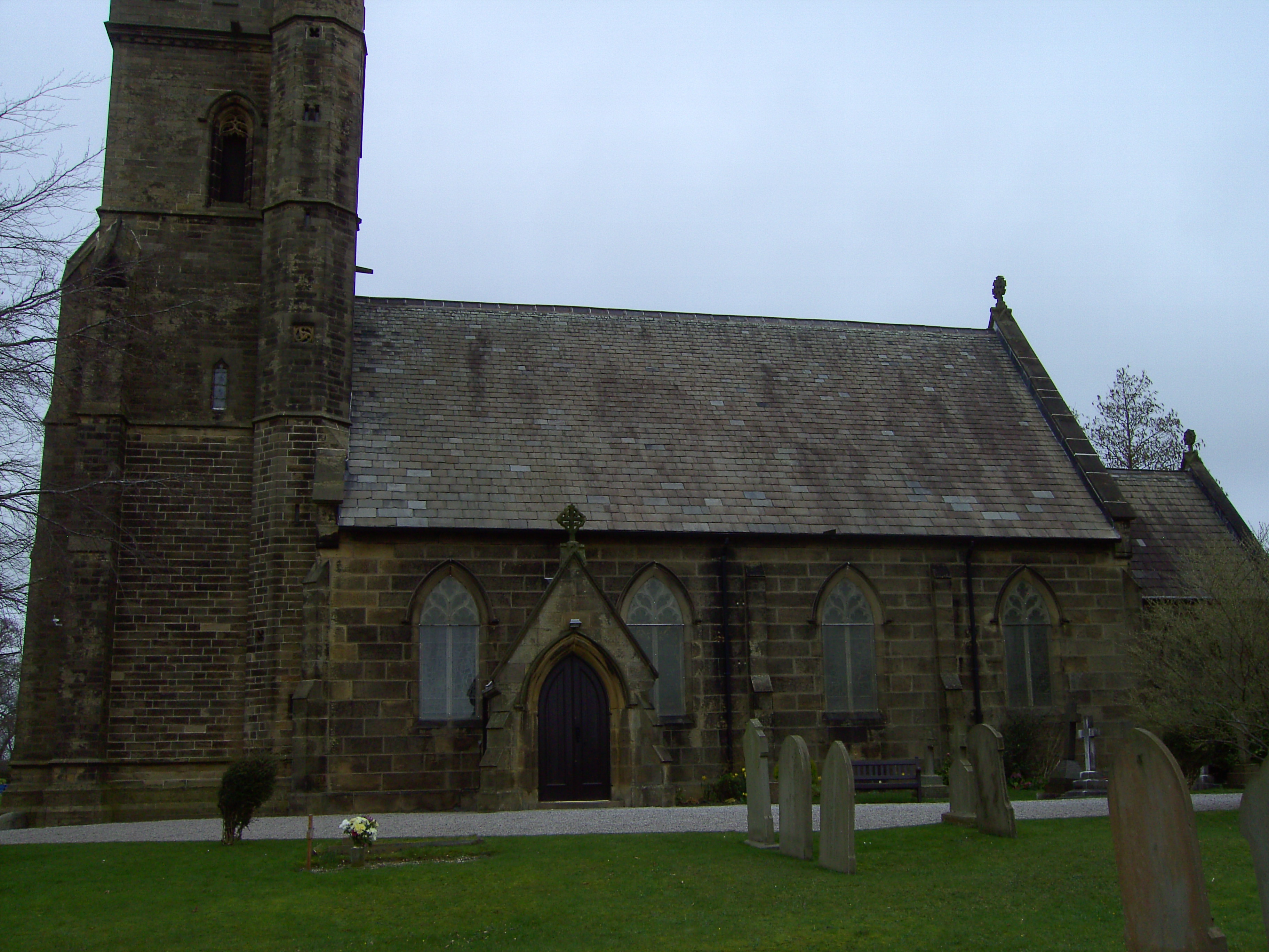
| Description | : | Known as Lund Parish Church The current church, St John the Evangelist, dates from 1824 when the nave was built and It was later extended in 1852 with the addition of a sanctuary, and again in 1873 when the 60 foot high tower was added as a memorial to the first vicar, Revd Richard Moore. It is sited on Church Lane, Clifton 3 miles ESE of Kirkham at the head of the Ribble estuary. [Taken from Lancs opc] |
frequently asked questions (FAQ):
-
Where is St. John the Evangelist Churchyard?
St. John the Evangelist Churchyard is located at Church Lane Clifton, Fylde Borough ,Lancashire , PR4 0ZEEngland.
-
St. John the Evangelist Churchyard cemetery's updated grave count on graveviews.com?
6 memorials
-
Where are the coordinates of the St. John the Evangelist Churchyard?
Latitude: 53.7758600
Longitude: -2.8158500
Nearby Cemetories:
1. St. Mary's Churchyard
Lea, City of Preston, England
Coordinate: 53.7733810, -2.7942770
2. Quakers Wood Burial Ground
Freckleton, Fylde Borough, England
Coordinate: 53.7652227, -2.8601674
3. Christ Churchyard
Treales, Fylde Borough, England
Coordinate: 53.8045970, -2.8440710
4. St Michael Churchyard
Kirkham, Fylde Borough, England
Coordinate: 53.7843570, -2.8709520
5. Zion Chapel Cemetery
Kirkham, Fylde Borough, England
Coordinate: 53.7814380, -2.8721260
6. St Andrew George Haydock Roman Catholic Churchyard
Cottam, City of Preston, England
Coordinate: 53.7879280, -2.7591570
7. Holy Trinity Churchyard
Freckleton, Fylde Borough, England
Coordinate: 53.7543090, -2.8669130
8. Saint Anne's Church
Woodplumpton, City of Preston, England
Coordinate: 53.8038130, -2.7621940
9. Saint John the Evangelist Churchyard
Kirkham, Fylde Borough, England
Coordinate: 53.7808000, -2.8873870
10. Christ Church Churchyard
Wesham, Fylde Borough, England
Coordinate: 53.7905000, -2.8845600
11. Saint Joseph's Roman Catholic Church
Wesham, Fylde Borough, England
Coordinate: 53.7928600, -2.8871800
12. St. Andrew's Churchyard
Ashton-on-Ribble, City of Preston, England
Coordinate: 53.7687030, -2.7359180
13. Parish Church of St. Paul
Warton, Fylde Borough, England
Coordinate: 53.7502621, -2.8932641
14. St. Andrew's Churchyard
Longton, South Ribble Borough, England
Coordinate: 53.7263889, -2.7822222
15. St Mary Churchyard
Penwortham, South Ribble Borough, England
Coordinate: 53.7551800, -2.7234210
16. St. Peters Churchyard
Inskip with Sowerby, Wyre Borough, England
Coordinate: 53.8347100, -2.8175200
17. St Nicholas Churchyard
Wrea Green, Fylde Borough, England
Coordinate: 53.7772420, -2.9156380
18. Inskip Baptist Churchyard
Inskip with Sowerby, Wyre Borough, England
Coordinate: 53.8353150, -2.8299610
19. St Walburge's RC Church
Preston, City of Preston, England
Coordinate: 53.7629690, -2.7149620
20. St Mary's Newhouse
Barton, City of Preston, England
Coordinate: 53.8205240, -2.7406500
21. Penwortham Cemetery
Penwortham, South Ribble Borough, England
Coordinate: 53.7452590, -2.7209190
22. St. John Baptist Churchyard
Broughton-in-Amounderness, City of Preston, England
Coordinate: 53.8033700, -2.7170400
23. Saint Peter Churchyard
Preston, City of Preston, England
Coordinate: 53.7634100, -2.7080700
24. Christ Church Churchyard
Preston, City of Preston, England
Coordinate: 53.7573210, -2.7103080