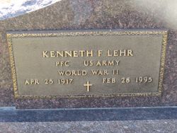
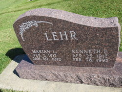
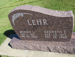
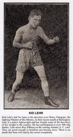
Kenneth Frederick Lehr
| Birth | : | 25 Apr 1917 Waterloo, Black Hawk County, Iowa, USA |
| Death | : | 28 Feb 1995 Waterloo, Black Hawk County, Iowa, USA |
| Burial | : | St. Mary the Virgin Churchyard, Speldhurst, Tunbridge Wells Borough, England |
| Coordinate | : | 51.1510790, 0.2198230 |
| Plot | : | Block 4 Lot 58 |
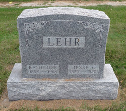
| Description | : | Kenneth F. Lehr, 77, of 1404 Rainbow Drive, died Tuesday, Feb. 28, at Allen Memorial Hospital of cancer. He was born April 25, 1917, in Waterloo, son of Jesse and Katherine Smith Lehr. He married Eleanor Rickhoff in 1939. They were divorced. He married Marian Jensen on Aug. 7, 1943, in Missouri. Mr. Lehr was employed at Rath Packing Co. in the hog kill and maintenance divisions for 44 years, retiring in 1981. He was a U.S. Army veteran of World War II serving in the European Theater. Survived by: his wife; two sons,... Read More |
frequently asked questions (FAQ):
-
Where is Kenneth Frederick Lehr's memorial?
Kenneth Frederick Lehr's memorial is located at: St. Mary the Virgin Churchyard, Speldhurst, Tunbridge Wells Borough, England.
-
When did Kenneth Frederick Lehr death?
Kenneth Frederick Lehr death on 28 Feb 1995 in Waterloo, Black Hawk County, Iowa, USA
-
Where are the coordinates of the Kenneth Frederick Lehr's memorial?
Latitude: 51.1510790
Longitude: 0.2198230
Family Members:
Parent
Spouse
Siblings
Flowers:
Nearby Cemetories:
1. St. Mary the Virgin Churchyard
Speldhurst, Tunbridge Wells Borough, England
Coordinate: 51.1510790, 0.2198230
2. St Paul New Churchyard
Rusthall, Tunbridge Wells Borough, England
Coordinate: 51.1401520, 0.2204420
3. All Souls Churchyard
Poundsbridge, Sevenoaks District, England
Coordinate: 51.1540700, 0.1961470
4. Southborough Cemetery
Southborough, Tunbridge Wells Borough, England
Coordinate: 51.1592860, 0.2420140
5. St. Lawrence Churchyard
Bidborough, Tunbridge Wells Borough, England
Coordinate: 51.1666950, 0.2371870
6. All Saints Churchyard
Langton Green, Tunbridge Wells Borough, England
Coordinate: 51.1309738, 0.2022060
7. St. Paul's Churchyard
Rusthall, Tunbridge Wells Borough, England
Coordinate: 51.1307144, 0.2376710
8. St. Peter's Churchyard
Southborough, Tunbridge Wells Borough, England
Coordinate: 51.1626549, 0.2520690
9. Southborough War Memorial
Southborough, Tunbridge Wells Borough, England
Coordinate: 51.1639214, 0.2528920
10. St. Peter's Churchyard
Fordcombe, Sevenoaks District, England
Coordinate: 51.1422043, 0.1792730
11. St John's Church
Royal Tunbridge Wells, Tunbridge Wells Borough, England
Coordinate: 51.1402330, 0.2608070
12. Woodbury Park Cemetery
Royal Tunbridge Wells, Tunbridge Wells Borough, England
Coordinate: 51.1389847, 0.2637900
13. Hanover Strict Baptist Chapel
Royal Tunbridge Wells, Tunbridge Wells Borough, England
Coordinate: 51.1356700, 0.2625100
14. St. John the Baptist Churchyard
Penshurst, Sevenoaks District, England
Coordinate: 51.1735240, 0.1834540
15. Trinity Churchyard
Royal Tunbridge Wells, Tunbridge Wells Borough, England
Coordinate: 51.1328200, 0.2623600
16. St John the Evangelist Churchyard
Groombridge, Wealden District, England
Coordinate: 51.1179771, 0.1854370
17. St Martin of Tours Churchyard
Ashurst, Tunbridge Wells Borough, England
Coordinate: 51.1306560, 0.1590710
18. St. Mary's Churchyard
Leigh, Sevenoaks District, England
Coordinate: 51.1977660, 0.2151510
19. Kent and Sussex Cemetery and Crematorium
Royal Tunbridge Wells, Tunbridge Wells Borough, England
Coordinate: 51.1173720, 0.2740330
20. St Stephens
Tonbridge, Tonbridge and Malling Borough, England
Coordinate: 51.1893961, 0.2687135
21. All Saints Churchyard
Blackham, Wealden District, England
Coordinate: 51.1411200, 0.1405600
22. Holy Trinity Churchyard
Eridge Green, Wealden District, England
Coordinate: 51.0989300, 0.2232190
23. St Luke Churchyard
Chiddingstone Causeway, Sevenoaks District, England
Coordinate: 51.1974910, 0.1758540
24. Chiddingstone Churchyard Extension
Chiddingstone, Sevenoaks District, England
Coordinate: 51.1861590, 0.1488930

