| Memorials | : | 0 |
| Location | : | Eridge Green, Wealden District, England |
| Coordinate | : | 51.0989300, 0.2232190 |
| Description | : | Eridge is a small village sitting high on a sandstone ridge on the border of East Sussex and Kent. It commands many far-reaching views across the Kent and Sussex countryside. Although the village is in East Sussex, it has a Kent postal address. It is located on the A26 between Tunbridge Wells (Kent) and Crowborough (East Sussex). In 1792 the Henry Nevill, 2nd Earl of Abergavenny converted the old Eridge House into a Gothic castle, which he named Eridge Castle. It was replaced by a Neo-Georgian mansion in the 1930s. The area also contains several follies, including the Saxonbury Tower and... Read More |
frequently asked questions (FAQ):
-
Where is Holy Trinity Churchyard?
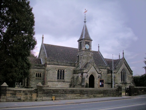
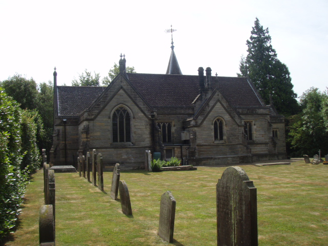
Holy Trinity Churchyard is located at A26 Eridge Green, Wealden District ,East Sussex ,England.
-
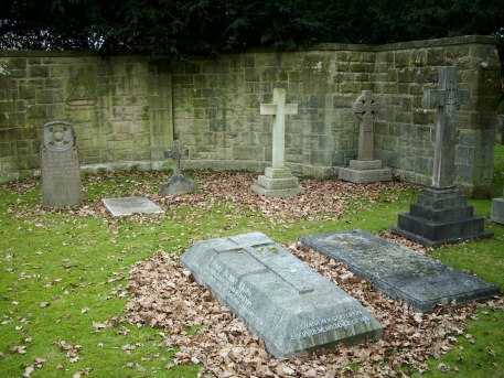
Holy Trinity Churchyard cemetery's updated grave count on graveviews.com?
0 memorials
-
Where are the coordinates of the Holy Trinity Churchyard?
Latitude: 51.0989300
Longitude: 0.2232190
Nearby Cemetories:
1. St. Alban's Churchyard
Frant, Wealden District, England
Coordinate: 51.0980580, 0.2698300
2. St John the Evangelist Churchyard
Groombridge, Wealden District, England
Coordinate: 51.1179771, 0.1854370
3. St. Paul's Churchyard
Rusthall, Tunbridge Wells Borough, England
Coordinate: 51.1307144, 0.2376710
4. All Saints Churchyard
Langton Green, Tunbridge Wells Borough, England
Coordinate: 51.1309738, 0.2022060
5. Kent and Sussex Cemetery and Crematorium
Royal Tunbridge Wells, Tunbridge Wells Borough, England
Coordinate: 51.1173720, 0.2740330
6. St Paul New Churchyard
Rusthall, Tunbridge Wells Borough, England
Coordinate: 51.1401520, 0.2204420
7. Trinity Churchyard
Royal Tunbridge Wells, Tunbridge Wells Borough, England
Coordinate: 51.1328200, 0.2623600
8. Rotherfield Cemetery
Rotherfield, Wealden District, England
Coordinate: 51.0553690, 0.2191294
9. Hanover Strict Baptist Chapel
Royal Tunbridge Wells, Tunbridge Wells Borough, England
Coordinate: 51.1356700, 0.2625100
10. Woodbury Park Cemetery
Royal Tunbridge Wells, Tunbridge Wells Borough, England
Coordinate: 51.1389847, 0.2637900
11. St John's Church
Royal Tunbridge Wells, Tunbridge Wells Borough, England
Coordinate: 51.1402330, 0.2608070
12. St Martin of Tours Churchyard
Ashurst, Tunbridge Wells Borough, England
Coordinate: 51.1306560, 0.1590710
13. St. Peter's Churchyard
Fordcombe, Sevenoaks District, England
Coordinate: 51.1422043, 0.1792730
14. Forest Fold Baptist Chapel
Crowborough, Wealden District, England
Coordinate: 51.0715790, 0.1531650
15. St. Mary the Virgin Churchyard
Speldhurst, Tunbridge Wells Borough, England
Coordinate: 51.1510790, 0.2198230
16. St. Denys Churchyard
Rotherfield, Wealden District, England
Coordinate: 51.0460000, 0.2184000
17. St. Michael and All Angels Churchyard
Withyham, Wealden District, England
Coordinate: 51.0999580, 0.1322440
18. All Saints Churchyard
Crowborough, Wealden District, England
Coordinate: 51.0550461, 0.1649020
19. All Souls Churchyard
Poundsbridge, Sevenoaks District, England
Coordinate: 51.1540700, 0.1961470
20. St. John the Evangelist Churchyard
Crowborough, Wealden District, England
Coordinate: 51.0656784, 0.1441483
21. Southborough Cemetery
Southborough, Tunbridge Wells Borough, England
Coordinate: 51.1592860, 0.2420140
22. Crowborough Cemetery
Crowborough, Wealden District, England
Coordinate: 51.0472660, 0.1648910
23. St. Peter's Churchyard
Southborough, Tunbridge Wells Borough, England
Coordinate: 51.1626549, 0.2520690
24. All Saints Churchyard
Blackham, Wealden District, England
Coordinate: 51.1411200, 0.1405600


