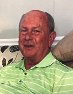
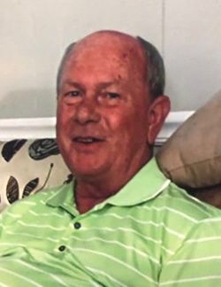
Larry Dale Whitaker
| Birth | : | 14 Jun 1950 Elkin, Surry County, North Carolina, USA |
| Death | : | 4 Jan 2020 White Plains, Surry County, North Carolina, USA |
| Burial | : | New Bethel Baptist Church Cemetery, Mount Airy, Surry County, USA |
| Coordinate | : | 36.5535920, -80.7020960 |
| Description | : | Mr. Larry Dale Whitaker, 69, of Mt. Airy passed away unexpectedly at his home Saturday, January 4, 2020. He was born in Surry County on June 14, 1950, to Junior Whitaker and Ruby Hall Brewer. Mr. Whitaker was a kind and gentle man, always thinking of others. He was a loving father, son, and brother. Mr. Whitaker enjoyed coaching basketball and baseball teams and worked diligently on fundraisers for the teams when needed. He worked in the finance industry for 44 years with various companies. |
frequently asked questions (FAQ):
-
Where is Larry Dale Whitaker's memorial?
Larry Dale Whitaker's memorial is located at: New Bethel Baptist Church Cemetery, Mount Airy, Surry County, USA.
-
When did Larry Dale Whitaker death?
Larry Dale Whitaker death on 4 Jan 2020 in White Plains, Surry County, North Carolina, USA
-
Where are the coordinates of the Larry Dale Whitaker's memorial?
Latitude: 36.5535920
Longitude: -80.7020960
Family Members:
Parent
Siblings
Flowers:
Nearby Cemetories:
1. New Bethel Baptist Church Cemetery
Mount Airy, Surry County, USA
Coordinate: 36.5535920, -80.7020960
2. New Bethel Baptist South
Mount Airy, Surry County, USA
Coordinate: 36.5533870, -80.7018270
3. James Harding Golding Family Cemetery
Mount Airy, Surry County, USA
Coordinate: 36.5539500, -80.7023900
4. Imogene Baptist Church Cemetery
Pine Ridge, Surry County, USA
Coordinate: 36.5521393, -80.7203598
5. Beamer Cemetery
Mount Airy, Surry County, USA
Coordinate: 36.5343060, -80.7012220
6. Snow Cemetery
Mount Airy, Surry County, USA
Coordinate: 36.5422500, -80.7299170
7. Oak Ridge Baptist Church Cemetery
Cana, Carroll County, USA
Coordinate: 36.5718760, -80.6800790
8. Christopher W Jones Cemetery
Cana, Carroll County, USA
Coordinate: 36.5819178, -80.7000292
9. Furbee Cemetery
Wetzel County, USA
Coordinate: 36.5363984, -80.7316687
10. Zion United Methodist Cemetery
Mount Airy, Surry County, USA
Coordinate: 36.5326958, -80.6725845
11. Maple Grove United Methodist Church Cemetery
Pine Ridge, Surry County, USA
Coordinate: 36.5237770, -80.7171402
12. McCraw Family Cemetery
Lambsburg, Carroll County, USA
Coordinate: 36.5814200, -80.7235270
13. Vernon-Leonard Cemetery
Cana, Carroll County, USA
Coordinate: 36.5841200, -80.7217600
14. Johnson Puckett Cemetery
Mount Airy, Surry County, USA
Coordinate: 36.5306740, -80.7362830
15. Booker-Busick-Smith Cemetery
Mount Airy, Surry County, USA
Coordinate: 36.5302400, -80.6638700
16. Surratt Cemetery
Lambsburg, Carroll County, USA
Coordinate: 36.5790920, -80.7396730
17. Gray Cemetery
Cana, Carroll County, USA
Coordinate: 36.5943420, -80.7034040
18. Flower Gap Primitive Baptist Church Cemetery
Cana, Carroll County, USA
Coordinate: 36.5900510, -80.7286500
19. A.L. Jones Family Cemetery
Cana, Carroll County, USA
Coordinate: 36.5754410, -80.6561640
20. Epworth United Methodist Church Cemetery
Cana, Carroll County, USA
Coordinate: 36.5736110, -80.6536110
21. Primitive Baptist Church Of Jesus Christ Cemetery
Cana, Carroll County, USA
Coordinate: 36.5917320, -80.6737210
22. Wisler Cemetery
Cana, Carroll County, USA
Coordinate: 36.5933240, -80.6756550
23. Cedar Lane-Easter Cemetery
Cana, Carroll County, USA
Coordinate: 36.5898610, -80.7356070
24. Easter Family Cemetery
Carroll County, USA
Coordinate: 36.5900270, -80.7354860


