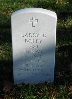
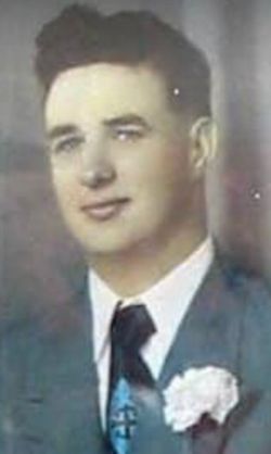
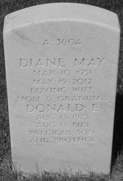
Larry Dean Boley
| Birth | : | 10 Nov 1940 Keokuk, Lee County, Iowa, USA |
| Death | : | 16 Feb 2006 Iowa City, Johnson County, Iowa, USA |
| Burial | : | Melbern-Neihardt Cemetery, Melbern, Williams County, USA |
| Coordinate | : | 41.4633600, -84.6416330 |
| Plot | : | A-0380-A |
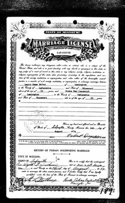
| Description | : | Larry D. Boley, 65, of Revere, Mo. died Thursday, Feb. 16, 2006 at the University of Iowa Hospital. He was born on Nov. 10, 1940 in Keokuk, the son of John and Grace Thompson Boley. He married Diane Pangborn on Aug. 3, 1974. He served in the Navy. He worked at Permar doing security. He was a member of the American Legion in Kahoka, Mo. Survivors include two sons, Larry Harris of Port Orchard, Wash. and Robert Boley of Nevada; four daughters, Tina Miesse of Port Orchard, Cheryl Wardlow of Revere, Jean Boley of Wilmington, N.C., and Joyce Boley of... Read More |
frequently asked questions (FAQ):
-
Where is Larry Dean Boley's memorial?
Larry Dean Boley's memorial is located at: Melbern-Neihardt Cemetery, Melbern, Williams County, USA.
-
When did Larry Dean Boley death?
Larry Dean Boley death on 16 Feb 2006 in Iowa City, Johnson County, Iowa, USA
-
Where are the coordinates of the Larry Dean Boley's memorial?
Latitude: 41.4633600
Longitude: -84.6416330
Family Members:
Parent
Spouse
Siblings
Children
Flowers:
Nearby Cemetories:
1. Melbern-Neihardt Cemetery
Melbern, Williams County, USA
Coordinate: 41.4633600, -84.6416330
2. Yackee Cemetery
Williams County, USA
Coordinate: 41.4707985, -84.6324997
3. Fetters Cemetery
Williams County, USA
Coordinate: 41.4519500, -84.6159900
4. Brown Cemetery
Bryan, Williams County, USA
Coordinate: 41.4822006, -84.5935974
5. Williams Center Cemetery
Williams Center, Williams County, USA
Coordinate: 41.4288902, -84.6125031
6. Thomas Cemetery
Williams County, USA
Coordinate: 41.4769100, -84.6994240
7. Hepker Cemetery
Blakeslee, Williams County, USA
Coordinate: 41.5136620, -84.6707873
8. Lick Creek Cemetery
Bryan, Williams County, USA
Coordinate: 41.5135994, -84.5927963
9. Zion Lutheran Church Cemetery
Defiance County, USA
Coordinate: 41.4261017, -84.7099991
10. West Buffalo Cemetery
Blakeslee, Williams County, USA
Coordinate: 41.5135994, -84.6956024
11. Fountain Grove Cemetery
Bryan, Williams County, USA
Coordinate: 41.4572182, -84.5480576
12. Tamarack Cemetery
Milford Township, Defiance County, USA
Coordinate: 41.4117012, -84.7089005
13. Farmer Cemetery
Farmer, Defiance County, USA
Coordinate: 41.3903008, -84.6410980
14. Union Chapel Cemetery
Montpelier, Williams County, USA
Coordinate: 41.5424995, -84.6568985
15. Upper Lost Creek Cemetery
Farmer, Defiance County, USA
Coordinate: 41.3840000, -84.6700000
16. Maple Grove Cemetery
Edgerton, Williams County, USA
Coordinate: 41.4435997, -84.7521973
17. Lee Family Graveyard
Montpelier, Williams County, USA
Coordinate: 41.5470300, -84.6669400
18. West Bethesda Cemetery
West Jefferson, Williams County, USA
Coordinate: 41.5422700, -84.5941200
19. St. Mary's Cemetery
Edgerton, Williams County, USA
Coordinate: 41.4441120, -84.7542700
20. Saint Joseph Catholic Cemetery
Blakeslee, Williams County, USA
Coordinate: 41.5346985, -84.7300034
21. Kemp Cemetery
Defiance County, USA
Coordinate: 41.3703003, -84.6802979
22. Skelton Cemetery
Edgerton, Williams County, USA
Coordinate: 41.4646380, -84.7728980
23. Mary Bechtol Gravesite
Montpelier, Williams County, USA
Coordinate: 41.5575900, -84.6034900
24. Trinity Lutheran Cemetery
Ney, Defiance County, USA
Coordinate: 41.4016991, -84.5353012

