
| Birth | : | 29 Jul 1912 Allen County, Kansas, USA |
| Death | : | 23 Mar 2005 Topeka, Shawnee County, Kansas, USA |
| Burial | : | Riverside Cemetery, Pierre, Hughes County, USA |
| Coordinate | : | 44.3608017, -100.3071976 |
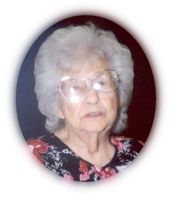
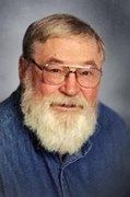
| Description | : | Lawrence L. Crook, 92, Topeka died Wednesday, March 23, 2005, at his home. He was born July 29, 1912, in Allen County, the son of Walter and Bertha Peck Crook. Mr. Crook was co-founder, co-owner and operator of Lawrence Freight Line and BC&R Storage, from which he retired in 1980. He attended Grace Bible Church. Mr. Crook was preceded in death by his parents; his brothers, Claude and Floyd Crook; and a sister, Florence Felicy. He married his childhood sweetheart, Sarah E. Benton, on May 27, 1933, in Topeka. She survives. Other survivors include sons and their wives, Larry and Dolly Crook, Manitou Springs, Colo., Merle... Read More |
frequently asked questions (FAQ):
-
Where is Lawrence Leslie Crook's memorial?
Lawrence Leslie Crook's memorial is located at: Riverside Cemetery, Pierre, Hughes County, USA.
-
When did Lawrence Leslie Crook death?
Lawrence Leslie Crook death on 23 Mar 2005 in Topeka, Shawnee County, Kansas, USA
-
Where are the coordinates of the Lawrence Leslie Crook's memorial?
Latitude: 44.3608017
Longitude: -100.3071976
Family Members:
Parent

Spouse
Siblings
Children
Flowers:


Nearby Cemetories:
1. Riverside Cemetery
Pierre, Hughes County, USA
Coordinate: 44.3608017, -100.3071976
2. South Dakota State Capitol Grounds
Pierre, Hughes County, USA
Coordinate: 44.3660100, -100.3448000
3. Fort Pierre Chouteau Cemetery
Fort Pierre, Stanley County, USA
Coordinate: 44.3908700, -100.3878300
4. Mount Calvary Cemetery
Pierre, Hughes County, USA
Coordinate: 44.4197006, -100.3557968
5. Cedar Hill Cemetery
Fort Pierre, Stanley County, USA
Coordinate: 44.3356018, -100.3964005
6. Scotty Philip Cemetery
Fort Pierre, Stanley County, USA
Coordinate: 44.4019012, -100.4036026
7. Byron Township Cemetery
Blunt, Hughes County, USA
Coordinate: 44.4979200, -100.1904700
8. Canning Cemetery
Hughes County, USA
Coordinate: 44.3986890, -100.0278460
9. Holy Name Episcopal Cemetery
Fort Pierre, Stanley County, USA
Coordinate: 44.2694960, -100.0357300
10. Holy Name Chapel Cemetery
Fort Pierre, Stanley County, USA
Coordinate: 44.2694292, -100.0356989
11. Mathews Family Cemetery
Stanley County, USA
Coordinate: 44.1816040, -100.5581080
12. Pleasant Hill Cemetery
Blunt, Hughes County, USA
Coordinate: 44.5135994, -100.0156021
13. Okobojo Cemetery
Sully County, USA
Coordinate: 44.6568985, -100.3647003
14. Meers Cemetery
Stanley County, USA
Coordinate: 44.4116970, -100.7360760
15. Fort Sully Post Cemetery
Sully County, USA
Coordinate: 44.5866480, -100.6087530
16. Holy Faith Cemetery
Lyman County, USA
Coordinate: 44.1356010, -99.9878006
17. Chapelle Cemetery
Hughes County, USA
Coordinate: 44.3025017, -99.8653030
18. Fort Bennett Post Cemetery
Stanley County, USA
Coordinate: 44.6716500, -100.6404200
19. Onida Cemetery
Onida, Sully County, USA
Coordinate: 44.7147000, -100.0650000
20. Immanuel Lutheran Cemetery
Van Metre, Jones County, USA
Coordinate: 44.0958800, -100.7263300
21. Saint Catherines Cemetery
Harrold, Hughes County, USA
Coordinate: 44.2091100, -99.7868200
22. Ascension Cemetery
Canning, Hughes County, USA
Coordinate: 44.1523700, -99.7927100
23. Medicine Hill Cemetery
Harrold, Hughes County, USA
Coordinate: 44.5116997, -99.7453003
24. Saint John Catholic Cemetery
Harrold, Hughes County, USA
Coordinate: 44.5127983, -99.7335968