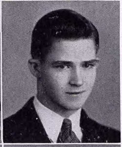
Leah Anna Johnson Shockley
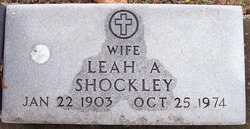
| Birth | : | 22 Jan 1903 Jewell, Hamilton County, Iowa, USA |
| Death | : | 25 Oct 1974 Reno, Washoe County, Nevada, USA |
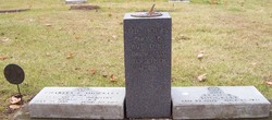
| Burial | : | Pleasant Hill Cemetery, Blunt, Hughes County, USA |
| Coordinate | : | 44.5135994, -100.0156021 |
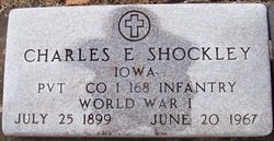
| Description | : | Ames Daily Tribune, Ames, IA, Saturday, Oct 26, 1974, pg 16: "Mrs. Leah Shockley died in Reno, Nev. --- Mrs. Leah Shockley, 71, formerly of 1321 Douglas Ave., died Oct. 25 at Reno, Nev., where she had lived since leaving Ames in 1951. "She and Charles E. (Hans) Shockley were married Jan. 20, 1930. He died June 20, 1967. "Survivors include two sons, Charles Shockley, 1707 Coolidge Drive and Kenneth E. Shockley, Reno; three daughters, Mrs. Orla Burgoon of Boone, Mrs. Alice Seymore, Red Oak and Mrs. Mary Martin, Los Angeles, Calif.; two sisters, Mrs. Mary Young,... Read More |
frequently asked questions (FAQ):
-
Where is Leah Anna Johnson Shockley's memorial?
Leah Anna Johnson Shockley's memorial is located at: Pleasant Hill Cemetery, Blunt, Hughes County, USA.
-
When did Leah Anna Johnson Shockley death?
Leah Anna Johnson Shockley death on 25 Oct 1974 in Reno, Washoe County, Nevada, USA
-
Where are the coordinates of the Leah Anna Johnson Shockley's memorial?
Latitude: 44.5135994
Longitude: -100.0156021
Family Members:
Parent
Spouse
Siblings
Children
Flowers:
Nearby Cemetories:
1. Pleasant Hill Cemetery
Blunt, Hughes County, USA
Coordinate: 44.5135994, -100.0156021
2. Canning Cemetery
Hughes County, USA
Coordinate: 44.3986890, -100.0278460
3. Byron Township Cemetery
Blunt, Hughes County, USA
Coordinate: 44.4979200, -100.1904700
4. Medicine Hill Cemetery
Harrold, Hughes County, USA
Coordinate: 44.5116997, -99.7453003
5. Saint John Catholic Cemetery
Harrold, Hughes County, USA
Coordinate: 44.5127983, -99.7335968
6. Onida Cemetery
Onida, Sully County, USA
Coordinate: 44.7147000, -100.0650000
7. Chapelle Cemetery
Hughes County, USA
Coordinate: 44.3025017, -99.8653030
8. Holy Name Episcopal Cemetery
Fort Pierre, Stanley County, USA
Coordinate: 44.2694960, -100.0357300
9. Holy Name Chapel Cemetery
Fort Pierre, Stanley County, USA
Coordinate: 44.2694292, -100.0356989
10. Pleasant Cemetery
Sully County, USA
Coordinate: 44.6927986, -99.7568970
11. Riverside Cemetery
Pierre, Hughes County, USA
Coordinate: 44.3608017, -100.3071976
12. Mount Calvary Cemetery
Pierre, Hughes County, USA
Coordinate: 44.4197006, -100.3557968
13. South Dakota State Capitol Grounds
Pierre, Hughes County, USA
Coordinate: 44.3660100, -100.3448000
14. Okobojo Cemetery
Sully County, USA
Coordinate: 44.6568985, -100.3647003
15. Fort Pierre Chouteau Cemetery
Fort Pierre, Stanley County, USA
Coordinate: 44.3908700, -100.3878300
16. Scotty Philip Cemetery
Fort Pierre, Stanley County, USA
Coordinate: 44.4019012, -100.4036026
17. Cedar Hill Cemetery
Fort Pierre, Stanley County, USA
Coordinate: 44.3356018, -100.3964005
18. Holy Rosary Cemetery
Agar, Sully County, USA
Coordinate: 44.8380000, -100.0616000
19. Saint Catherines Cemetery
Harrold, Hughes County, USA
Coordinate: 44.2091100, -99.7868200
20. Schreiber Cemetery
Agar, Sully County, USA
Coordinate: 44.8821983, -100.1196976
21. Holy Faith Cemetery
Lyman County, USA
Coordinate: 44.1356010, -99.9878006
22. Ascension Cemetery
Canning, Hughes County, USA
Coordinate: 44.1523700, -99.7927100
23. Blair Cemetery
Sully County, USA
Coordinate: 44.8027992, -100.4199982
24. Saint Marys Catholic Cemetery
Highmore, Hyde County, USA
Coordinate: 44.5063800, -99.4214900

