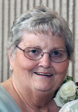
Lela Joann Wetzel Holder
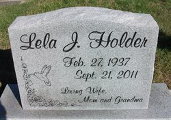
| Birth | : | 27 Feb 1937 Eureka, Lincoln County, Montana, USA |
| Death | : | 22 Sep 2011 Kalispell, Flathead County, Montana, USA |
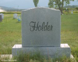
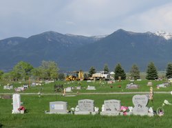
| Burial | : | Tobacco Valley Cemetery, Eureka, Lincoln County, USA |
| Coordinate | : | 48.9052600, -115.1003850 |
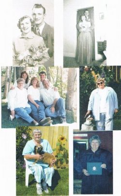
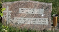
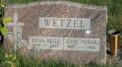
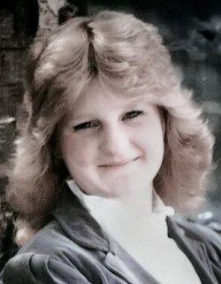
| Description | : | Lela Holder passed away suddenly and peacefully from a heart attack on Sept. 22, 2011. Lela Holder was born Feb. 27, 1937, to Jess and Emma Wetzel in Eureka. As the baby of the family, she adored her brothers and sisters growing up in the Tobacco Valley. It was there that she met the love of her life, Gale E. Holder, and married him on Dec. 26, 1953, in Eureka. Gale and Lela lived in Eureka for their 40 years of marriage, raising their own children, Mike, Gail Jean, Rock and Lynn Ann. Lela loved to quilt, knit and crochet and was often... Read More |
frequently asked questions (FAQ):
-
Where is Lela Joann Wetzel Holder's memorial?
Lela Joann Wetzel Holder's memorial is located at: Tobacco Valley Cemetery, Eureka, Lincoln County, USA.
-
When did Lela Joann Wetzel Holder death?
Lela Joann Wetzel Holder death on 22 Sep 2011 in Kalispell, Flathead County, Montana, USA
-
Where are the coordinates of the Lela Joann Wetzel Holder's memorial?
Latitude: 48.9052600
Longitude: -115.1003850
Family Members:
Parent
Spouse
Siblings
Children
Flowers:
Nearby Cemetories:
1. Tobacco Valley Cemetery
Eureka, Lincoln County, USA
Coordinate: 48.9052600, -115.1003850
2. Roosville Cemetery
Roosville, East Kootenay Regional District, Canada
Coordinate: 49.0034200, -115.0523000
3. Pine Ridge Memorial Park and Cemetery
Fortine, Lincoln County, USA
Coordinate: 48.7395840, -115.0119910
4. Fortine Cemetery
Fortine, Lincoln County, USA
Coordinate: 48.7670550, -114.8930050
5. Boyd Cemetery
Libby, Lincoln County, USA
Coordinate: 48.9543991, -115.6046982
6. Baynes Lake Cemetery
Baynes Lake, East Kootenay Regional District, Canada
Coordinate: 49.2369900, -115.2106000
7. Frank Day home burial location
Trego, Lincoln County, USA
Coordinate: 48.5841340, -114.9115700
8. Elko Cemetery
Elko, East Kootenay Regional District, Canada
Coordinate: 49.2978200, -115.1353500
9. Sand Creek Cemetery
Jaffray, East Kootenay Regional District, Canada
Coordinate: 49.3362250, -115.2909390
10. Hannah Robinson Gravesite
Morrissey, East Kootenay Regional District, Canada
Coordinate: 49.3725000, -114.9913800
11. Morrissey Cemetery
Morrissey, East Kootenay Regional District, Canada
Coordinate: 49.3751030, -114.9941990
12. Sylvanite Cemetery
Lincoln County, USA
Coordinate: 48.7210000, -115.8745000
13. Saint Margaret's Cemetery
Fernie, East Kootenay Regional District, Canada
Coordinate: 49.4989900, -115.0550900
14. Fernie Cemetery
Fernie, East Kootenay Regional District, Canada
Coordinate: 49.5002240, -115.0579050
15. East Fernie Cemetery
Fernie, East Kootenay Regional District, Canada
Coordinate: 49.5018590, -115.0566640
16. Libby Cemetery
Libby, Lincoln County, USA
Coordinate: 48.3893540, -115.5646380
17. Moyie Cemetery
Moyie, East Kootenay Regional District, Canada
Coordinate: 49.2743920, -115.8350350
18. Yahk Cemetery
Yahk, Central Kootenay Regional District, Canada
Coordinate: 49.0885510, -116.0776230
19. Winn Family Cemetery
Lincoln County, USA
Coordinate: 48.5488590, -115.9644710
20. Corbin Cemetery
Corbin, East Kootenay Regional District, Canada
Coordinate: 49.5217700, -114.6785500
21. Troy Cemetery
Troy, Lincoln County, USA
Coordinate: 48.4752330, -115.8992710
22. Milnor Lake Cemetery
Troy, Lincoln County, USA
Coordinate: 48.4181150, -115.8259500
23. Larchwood Cemetery
Lincoln County, USA
Coordinate: 48.4178009, -115.8257980
24. Hosmer Cemetery
Hosmer, East Kootenay Regional District, Canada
Coordinate: 49.5863580, -114.9565980

